
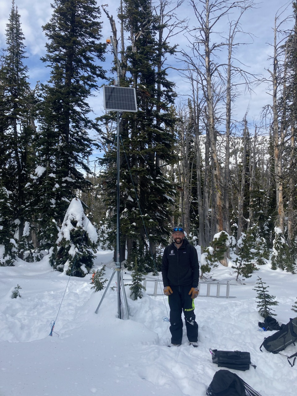
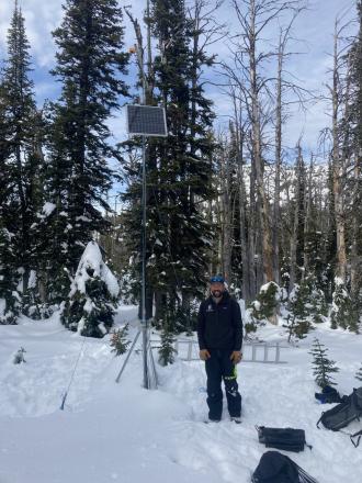
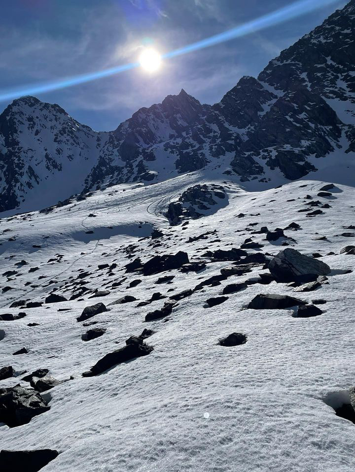
Went to do maintenance on the Sawtelle Snowfall weather station at 8800 ft just off the Sawtelle Mountain Road. Continuous snowcover starts around 8000 ft. At 8800 ft there is ~20" of snow with a mix of hard crusts and weak facets. These weak layers near the ground will be something to watch once snows again. Photo: GNFAC
Trip Planning for Island Park

Primary Problem: Wet Snow
Bottom Line: Daily forecasts are done for the season, but avalanches will continue. Remain diligent with your snowpack assessments and route-finding, and adapt your decision-making to changing conditions. On Monday and Tuesday, wet snow avalanches are likely. The snow is unstable on a spectrum, from when the upper few inches of the snowpack are wet and slushy to the entire snowpack being unsupportable. Avoid steep slopes and runout zones where these scenarios are present. Beginning Tuesday night, as snow returns to the area, watch for signs of instability within the new and wind-drifted snow, such as shooting cracks, and dig down until you find a supportable crust to test for instability above this level. Avoid steep slopes where you find instability.Past 5 Days
Thu Apr 11

Considerable
Considerable
Fri Apr 12
Considerable
Considerable
Sat Apr 13
Considerable
Considerable
Sun Apr 14
Considerable
Considerable
Mon Apr 15

None
None
Relevant Avalanche Activity
Southern Madison
Quake Lake
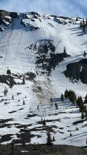
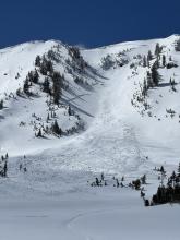
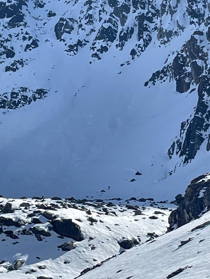
Wet Slab Avalanche Above Quake Lake
Quake Lake
WS-N-R2-D2-G
Coordinates: 44.8524, -111.3920
Caught: 0 ; Buried: 0
More Avalanche Details
WS-N-R2-D2-G
Coordinates: 44.8524, -111.3920
Caught: 0 ; Buried: 0
From IG: Wet slide to the ground above Quake Lake.
More Avalanche Details
Island Park
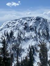
Arange Peak
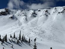
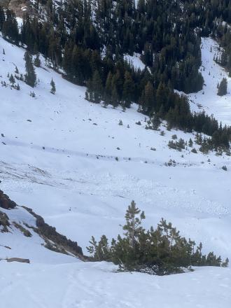
Wet avalanches in Island Park
Arange Peak
WL-N
Coordinates: 44.5263, -111.4650
Caught: 0 ; Buried: 0
More Avalanche Details
WL-N
Coordinates: 44.5263, -111.4650
Caught: 0 ; Buried: 0
From IG mesasge (4/6): "Some wet action at arange peak near Sawtell yesterday. From slope Dave and I did our first pit on Monday. Lots of release in that new old interface but didn’t see anything releasing down deeper."
More Avalanche Details
Island Park
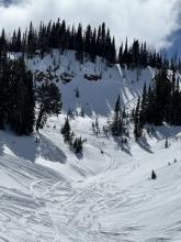
CENTENNIAL RANGE
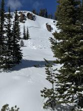
Recent instability in the new and wind drifted snow
CENTENNIAL RANGE
SS-N-R2-D2-I
Coordinates: 44.5489, -111.7310
Caught: 0 ; Buried: 0
More Avalanche Details
SS-N-R2-D2-I
Coordinates: 44.5489, -111.7310
Caught: 0 ; Buried: 0
Two rider-triggered avalanches near Reas Peak on north aspects that broke within or just below the new storm snow (D1s)
Natural avalanche broke near Yale Creek on a southern aspect that broke below new snow (D1)
Two natural avalanches that broke within the wind drifted snow in Jefferson Bowl (D2s)
More Avalanche Details
Relevant Photos
Displaying 41 - 45
-
-

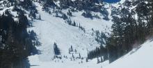
From IG: “Pine creek today, some small wind slabs and a full depth wet slide off black mountain”
-
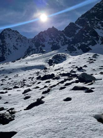
From IG: “Pine creek today (10/21), some small wind slabs and a full depth wet slide off black mountain”
-
From obs. "Was out alpine climbing today and observed the north face of Blackmore had slid already."
-

Get your tickets and online bid for items HERE!


Videos- Island Park


Weather Stations- Island Park
Weather Forecast Island Park
Extended Forecast for10 Miles ESE Lakeview MT
-
Tonight

Partly Cloudy
Low: 12 °F
-
Friday

Sunny
High: 32 °F
-
Friday
Night
Mostly Clear
Low: 12 °F
-
Saturday
Sunny
High: 42 °F
-
Saturday
NightPartly Cloudy
Low: 28 °F
-
Sunday
Slight Chance
Rain/Snow
then Chance
Rain and
BreezyHigh: 46 °F
-
Sunday
NightChance
Rain/Snow and
Breezy then
Partly CloudyLow: 23 °F
-
Monday

Slight Chance
SnowHigh: 40 °F
-
Monday
NightPartly Cloudy
Low: 23 °F
The Last Word
We began our daily forecasts on December 7. 130 daily forecasts and 464 reported avalanches later, we wrapped up our daily forecasting season on April 14th. While avalanches remain a concern until the snow is in the rivers, read our SEASON SUMMARY to look back at the heart of the 2023-24 avalanche year.
Additionally, please join us in congratulating Doug Chabot on his retirement from the GNFAC after 29 years of forecasting and 25 years as the center’s director. Thank you for everything, Doug!