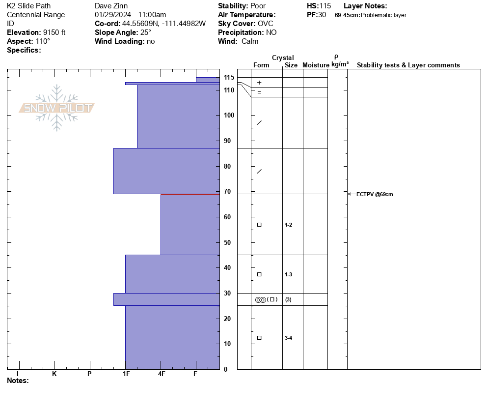
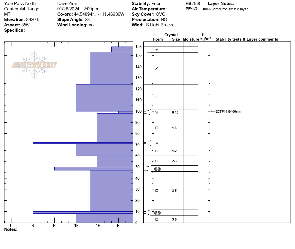
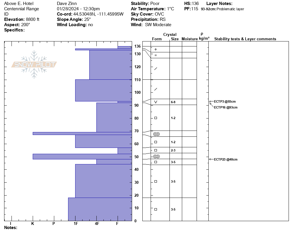
Snow Observations List
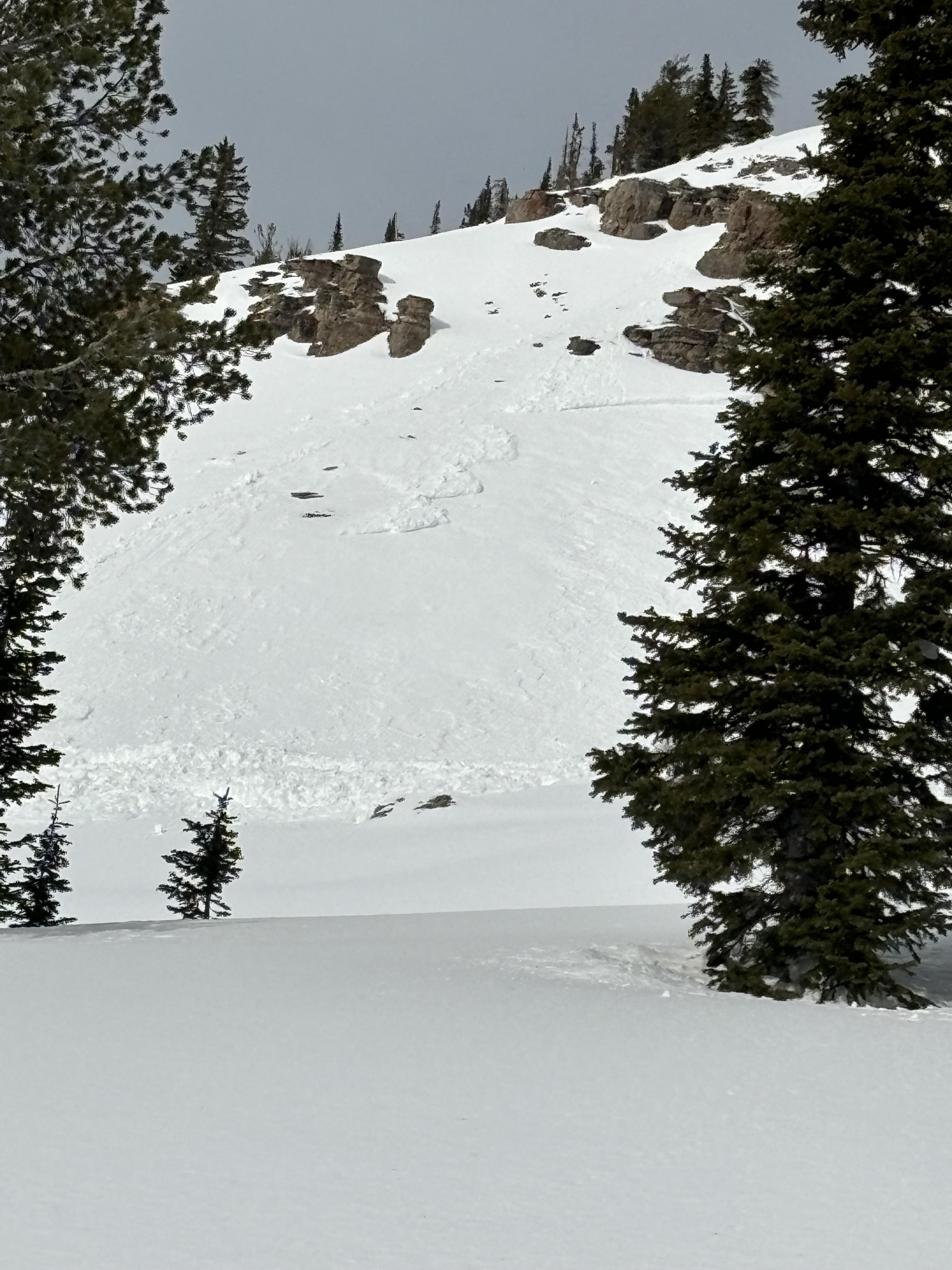
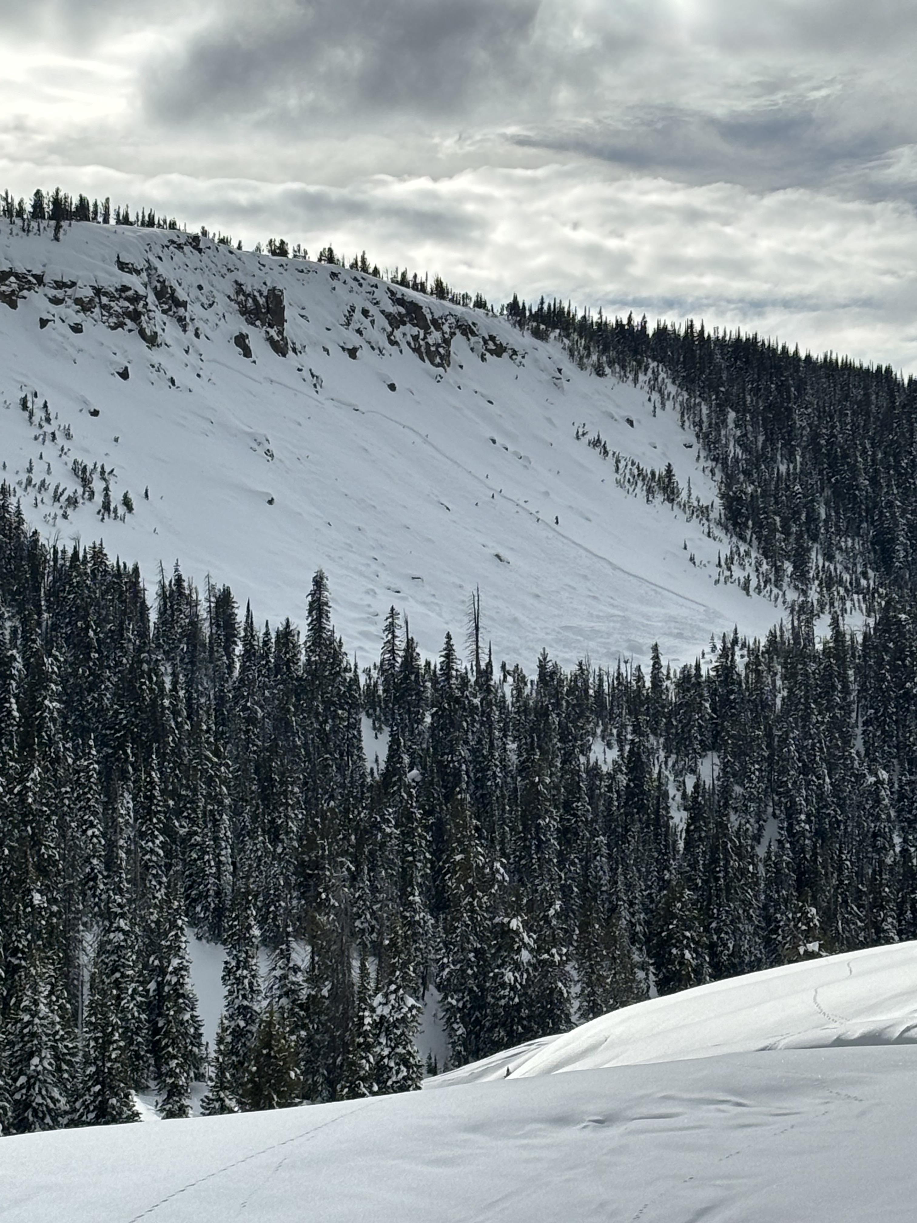
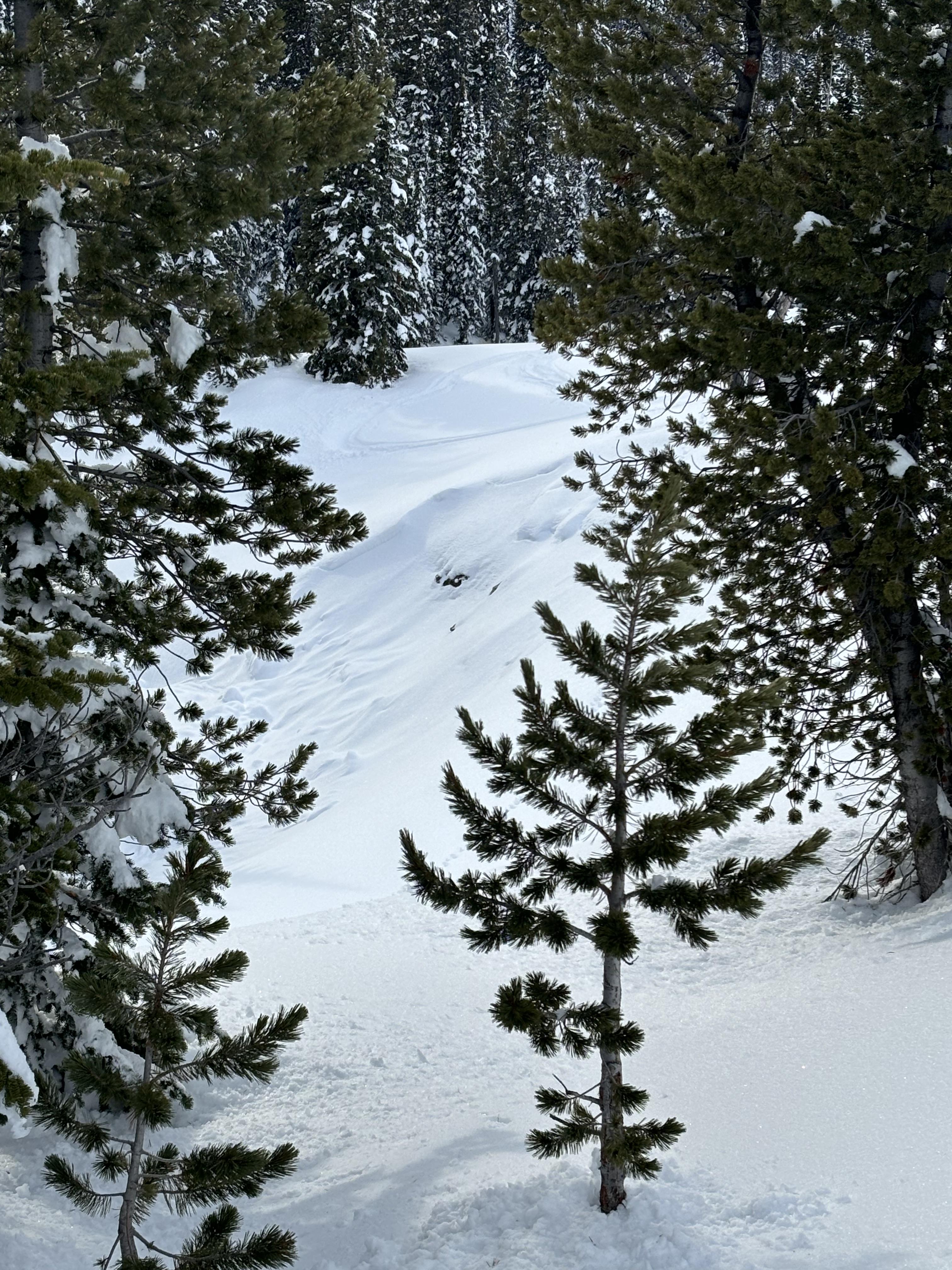
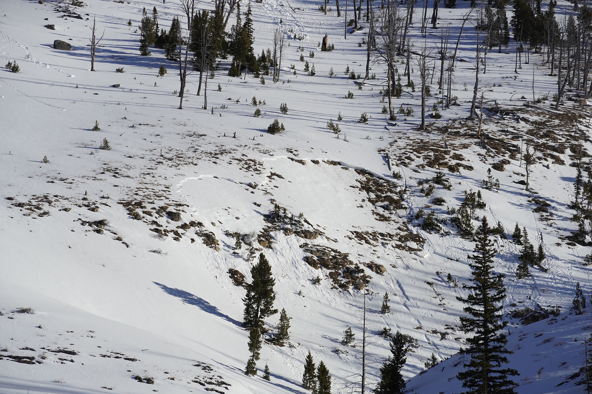
We rode into Taylor Fork today towards the Beaver Creek wilderness boundary. We saw multiple natural avalanches that happened during the last week, some newer than others and ranging in size (some in gullies others 50-75' wide). Many of these avalanches were old enough to be unrelated to the recent warming. However, at the wilderness boundary on an east-facing slope, we saw one natural wet slab avalanche and several smaller wet loose avalanches that likely happened yesterday during the warm sunny weather.
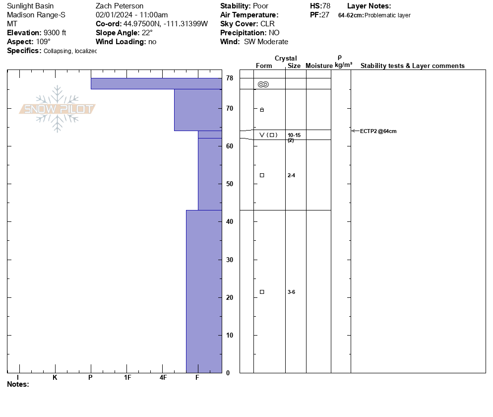
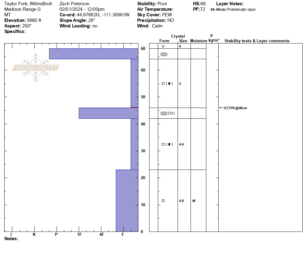
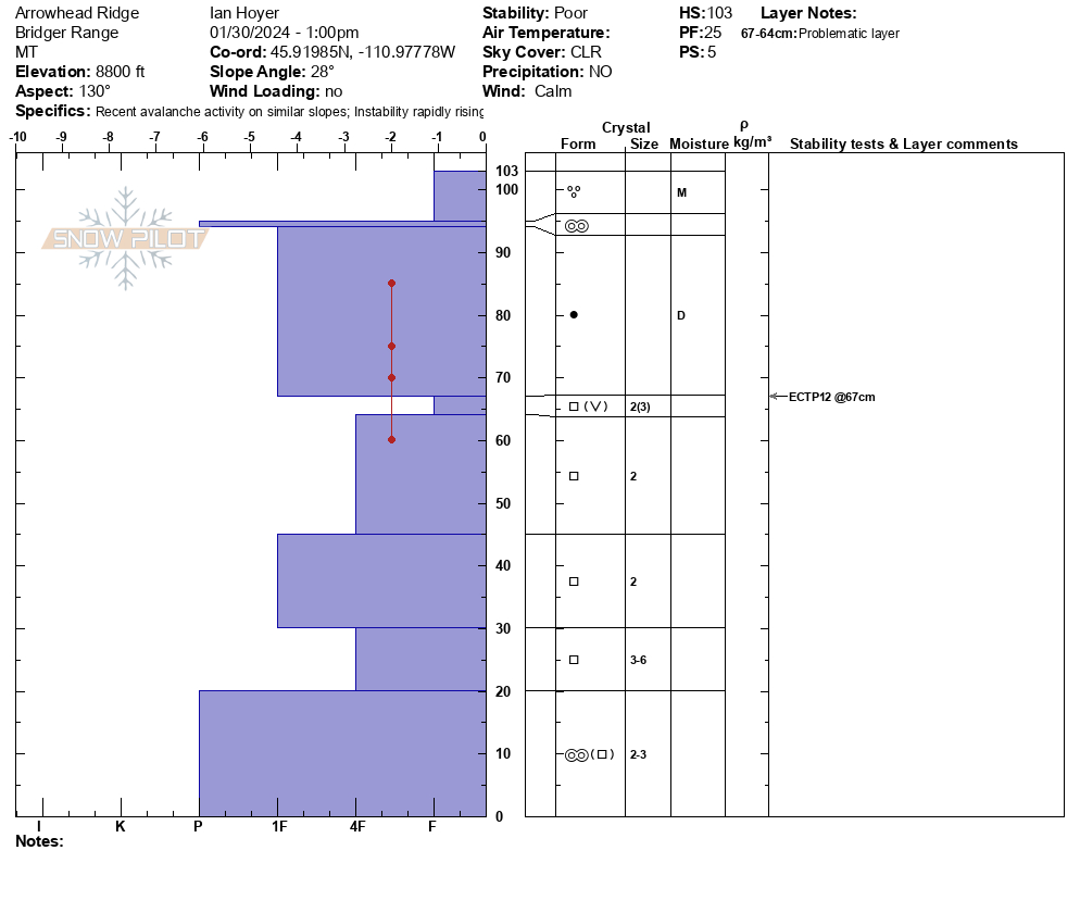
We felt a large collapse while approaching our snowpit location on an east-facing slope at 9300'. The pit was mostly faceted snow capped by a small cohesive slab and crust. We got an ECTP2, which is a very unstable result. We continued riding and after parking felt another collapse just 20' from our snowmobiles. We dug on a southwest-facing slope at 8800' and again had poor stability test results of ECTP6. Facets near the ground were moist but our stability tests were failing on dry facets above.
Clouds began rolling in around 11 AM, and a strong southwest wind remained throughout the day. Almost all slopes had a crust on them and temperatures remained cold enough that they did not soften.
Full Snow Observation ReportThe road is rideable but just barely. New snow will solve some access issues but the main problem is the whoops are very big.

Lots of collapsing and whomping in the snow, 3 avalanches seen in hell roaring creek and performed a few snow pit tests with an ECTP21 with 2 failures at 25 cm and 70 cm.
Full Snow Observation Report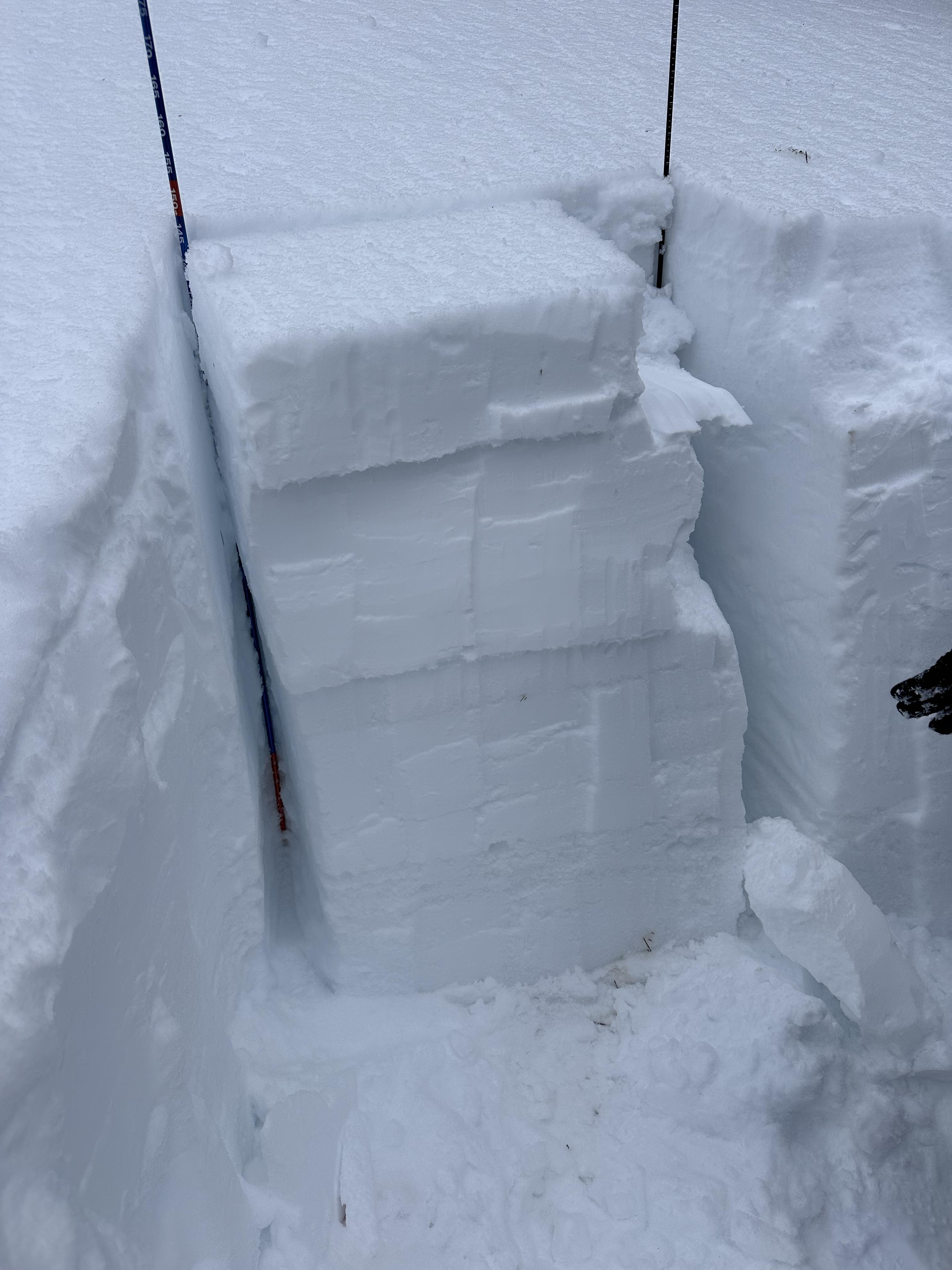
From email: "Some natural wet loose and PWL avalanches that happened yesterday, 01/30/2024, in Sheep Creek (observed today). Less collapsing today also."
Full Snow Observation Report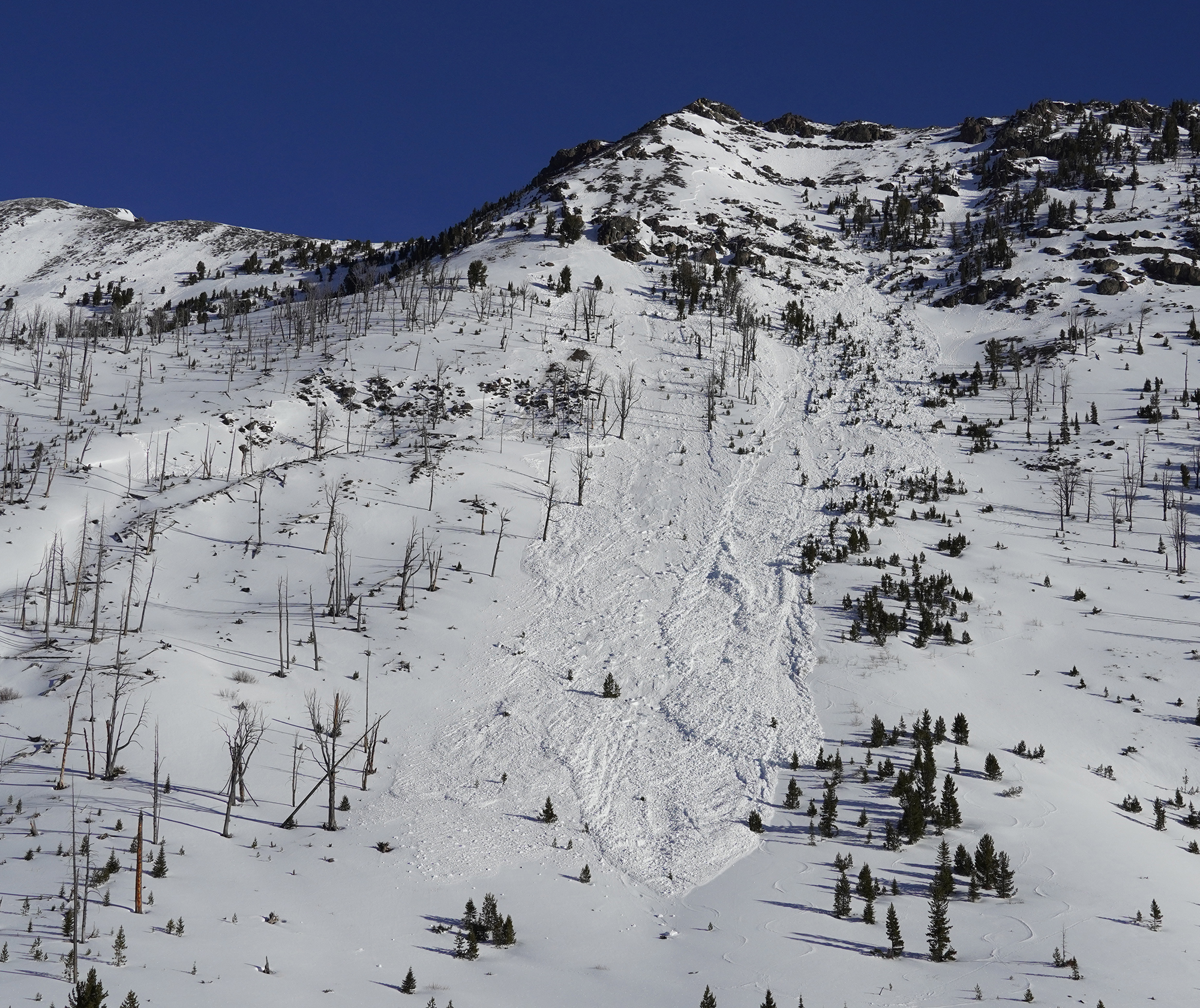
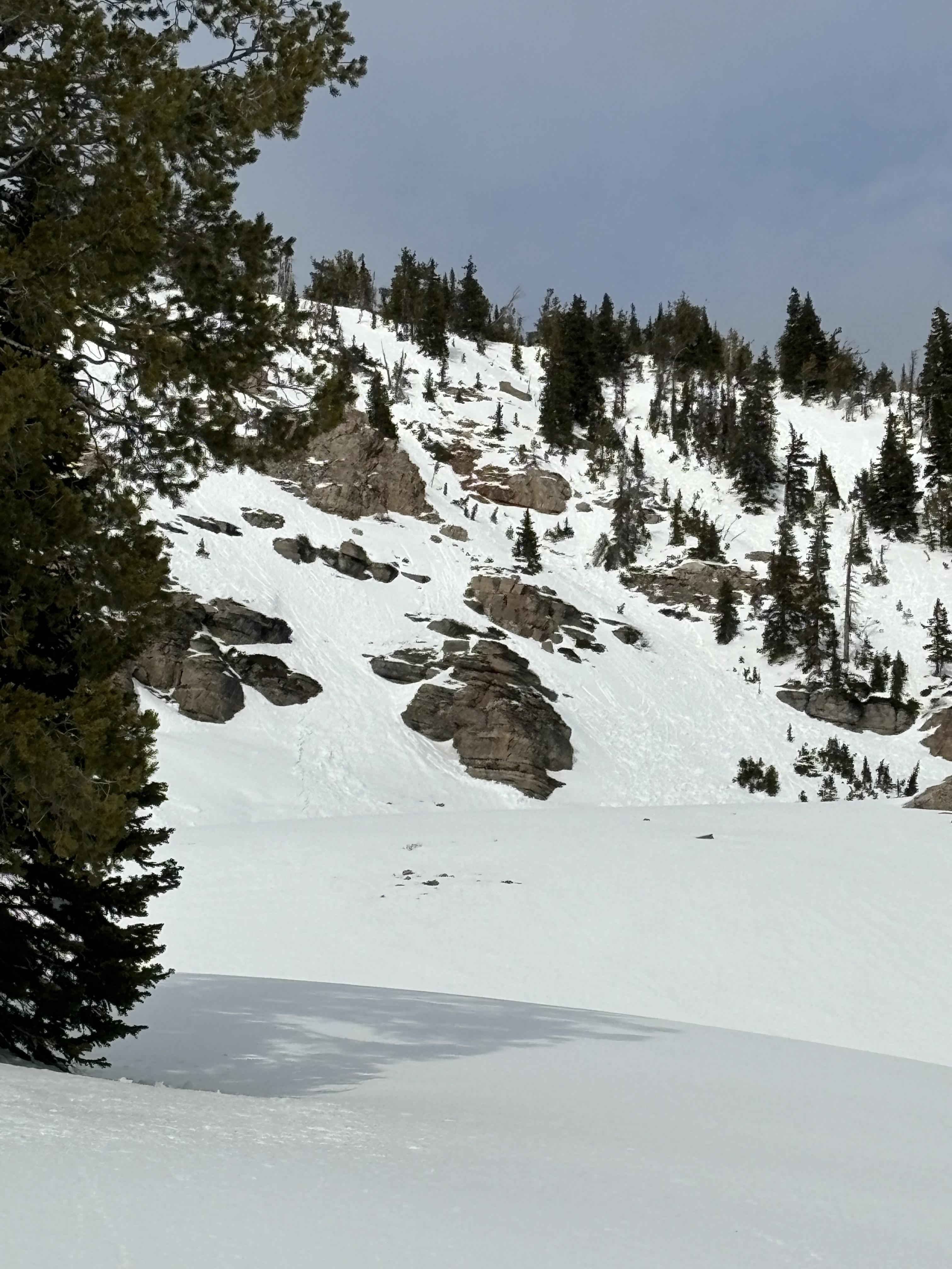
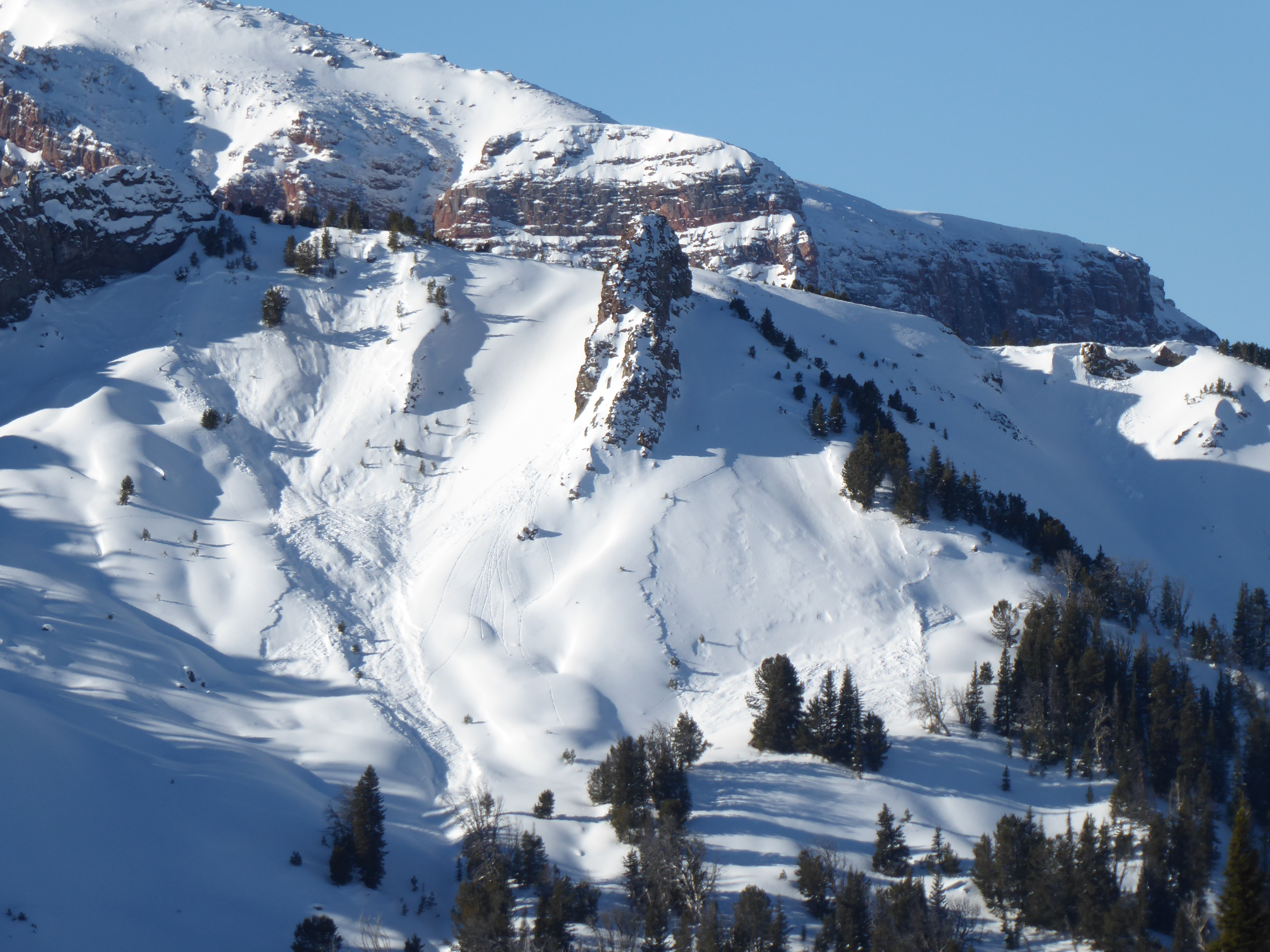
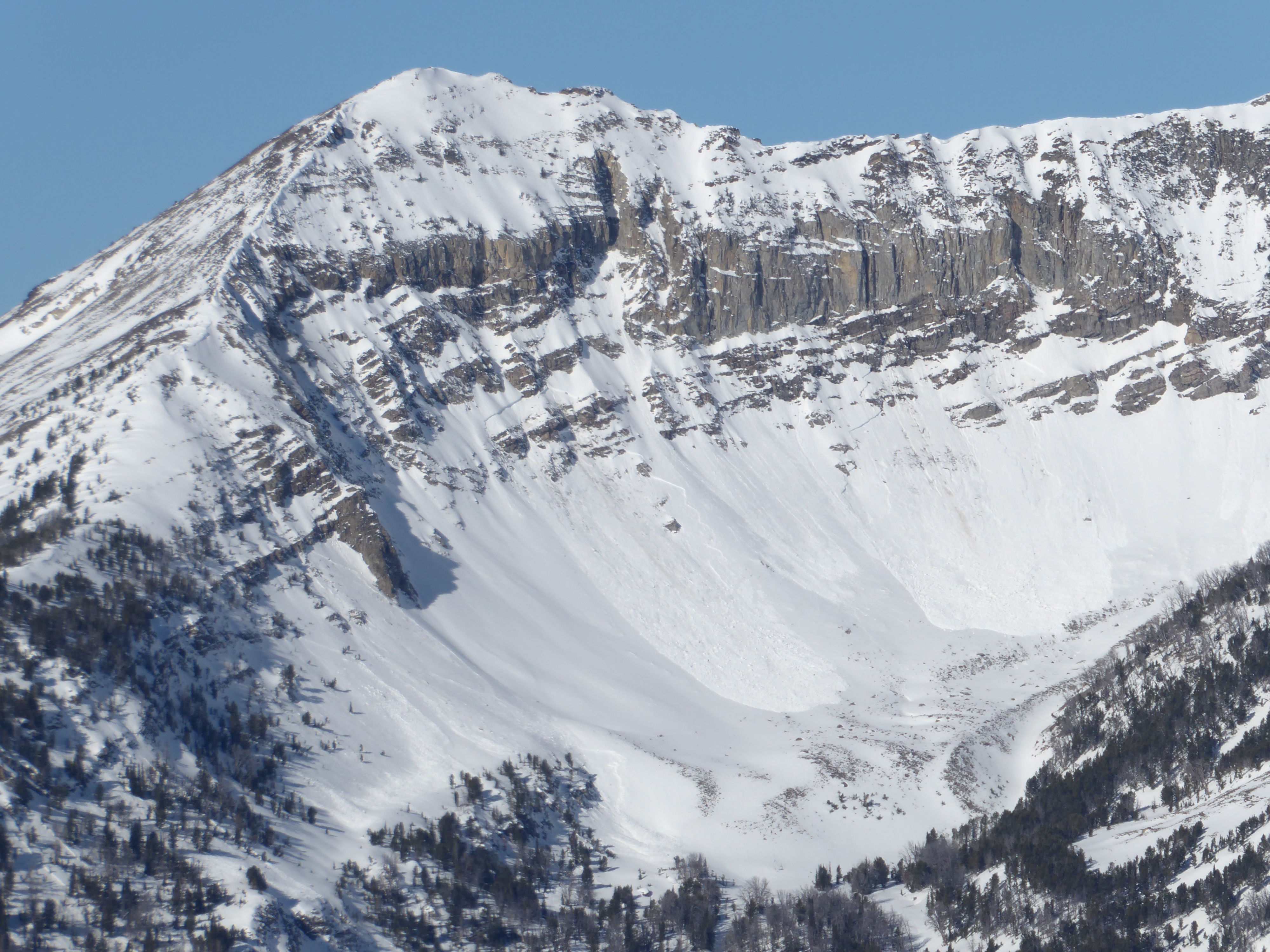
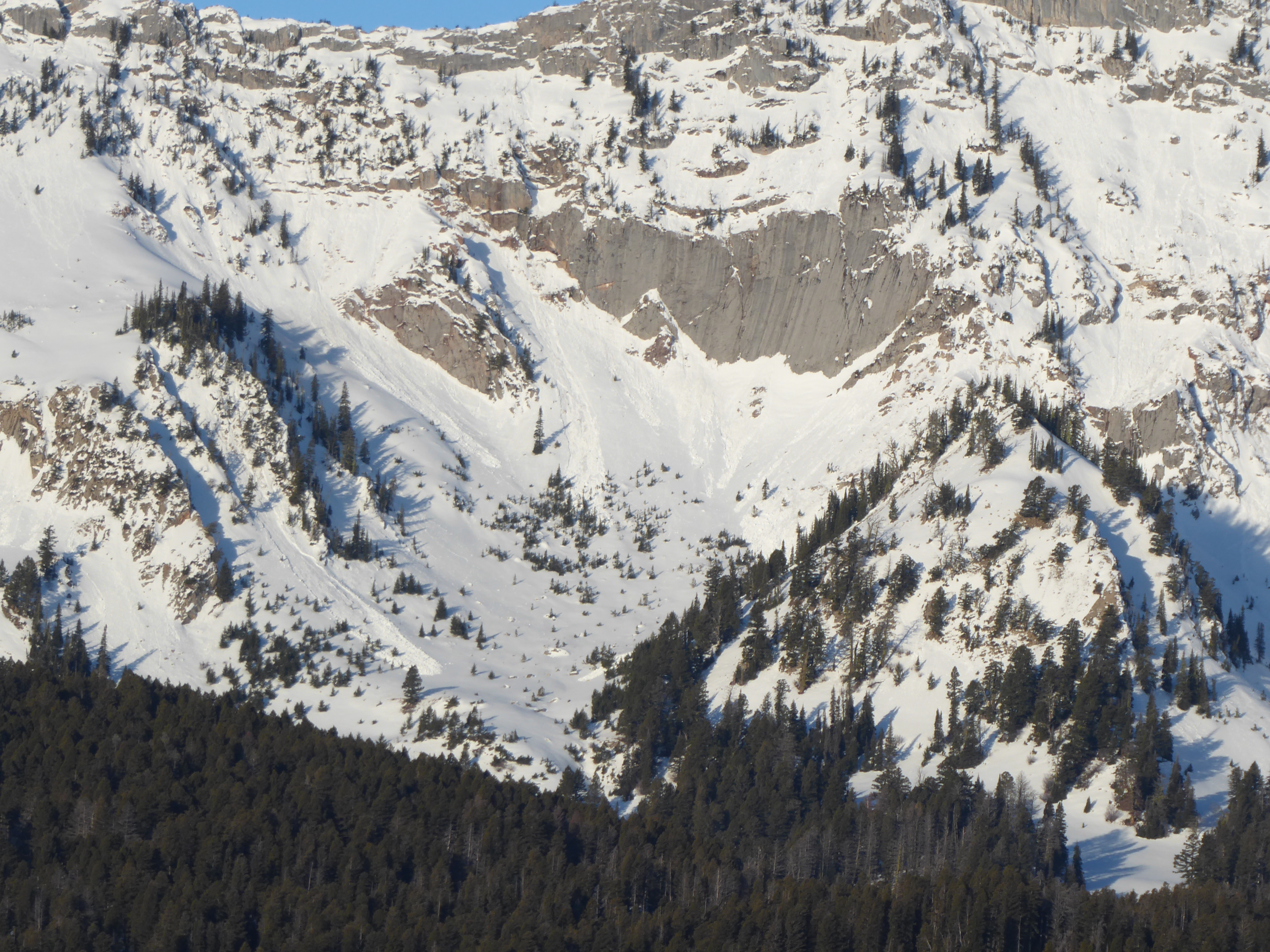
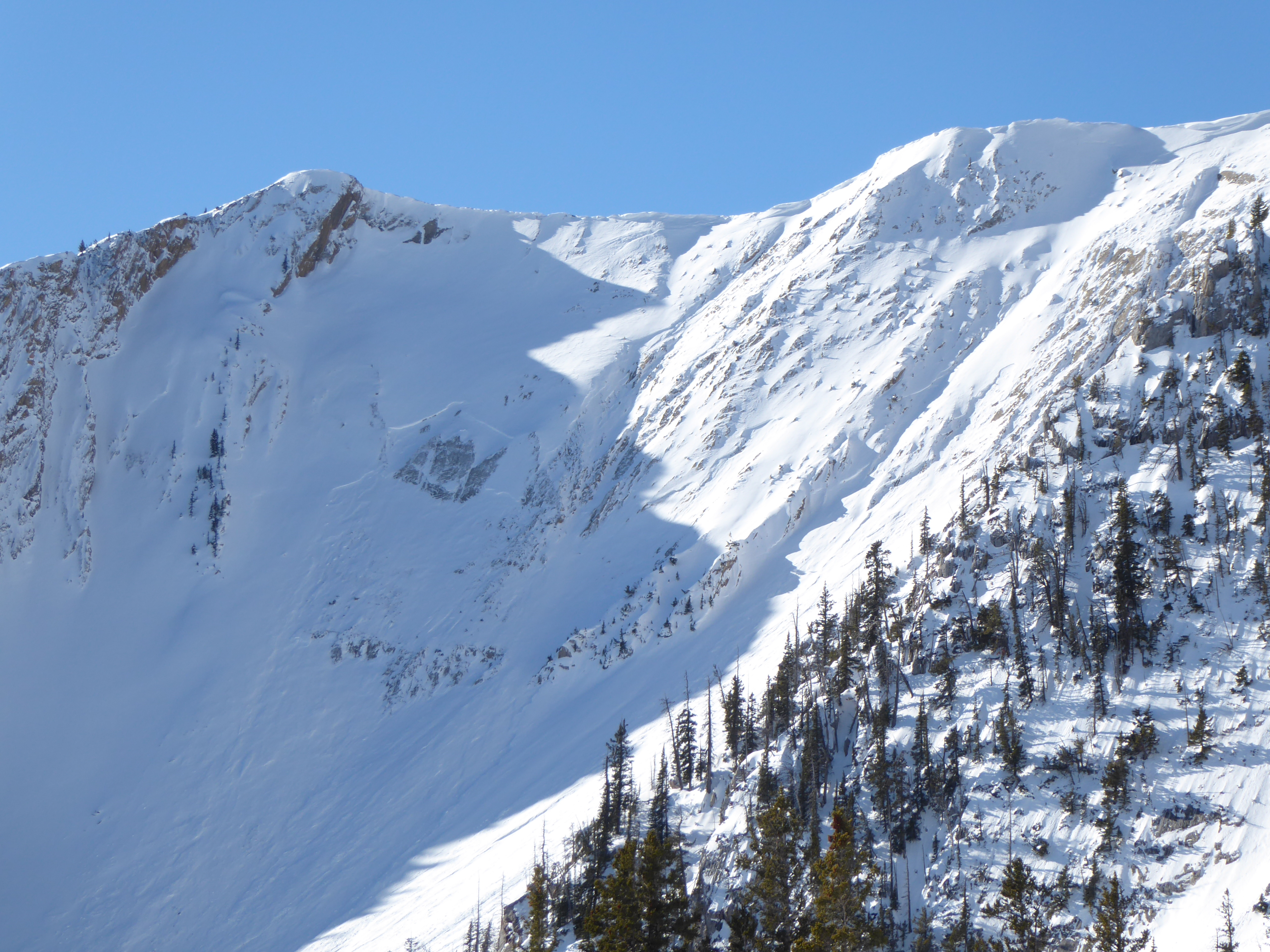
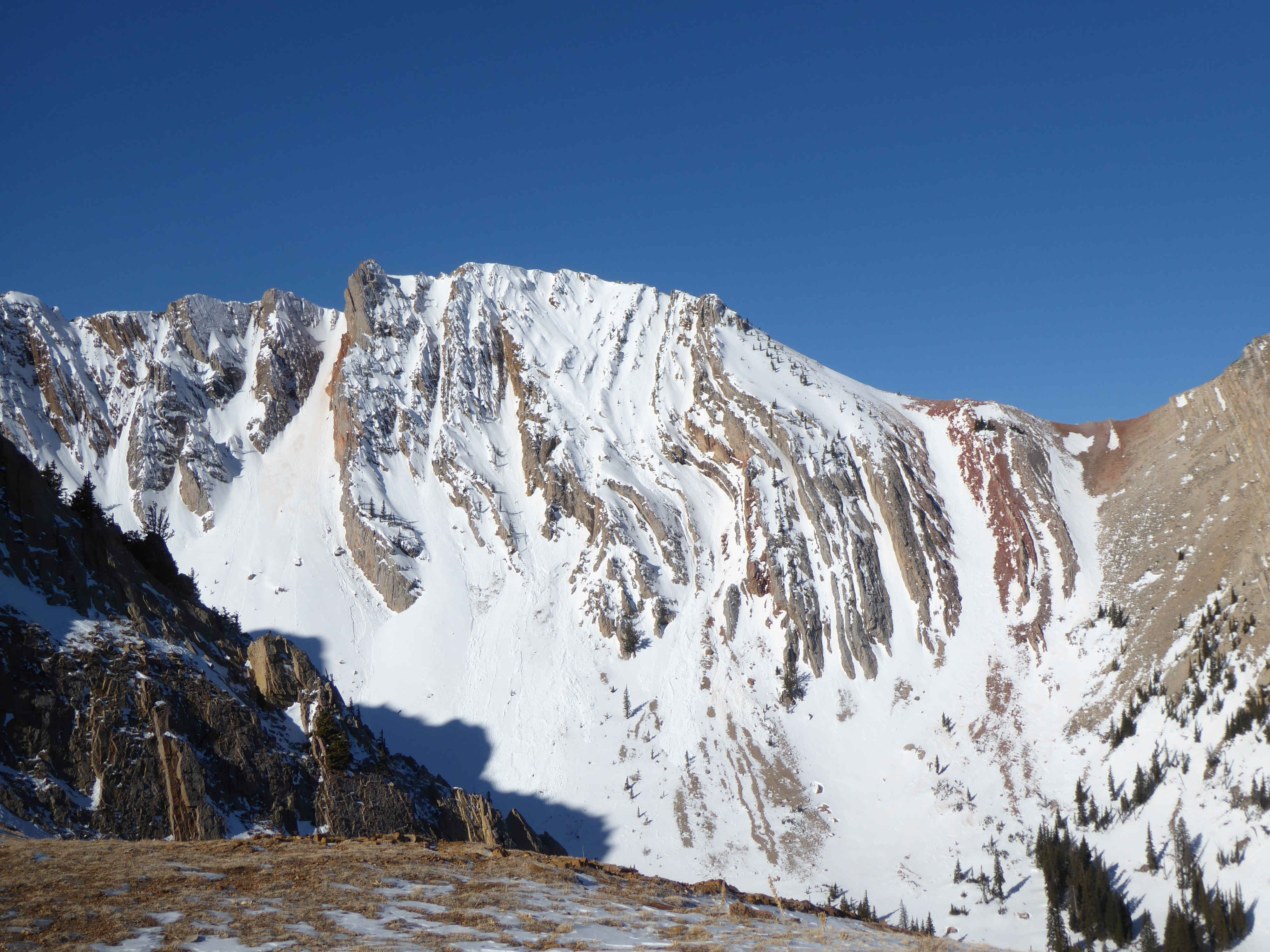
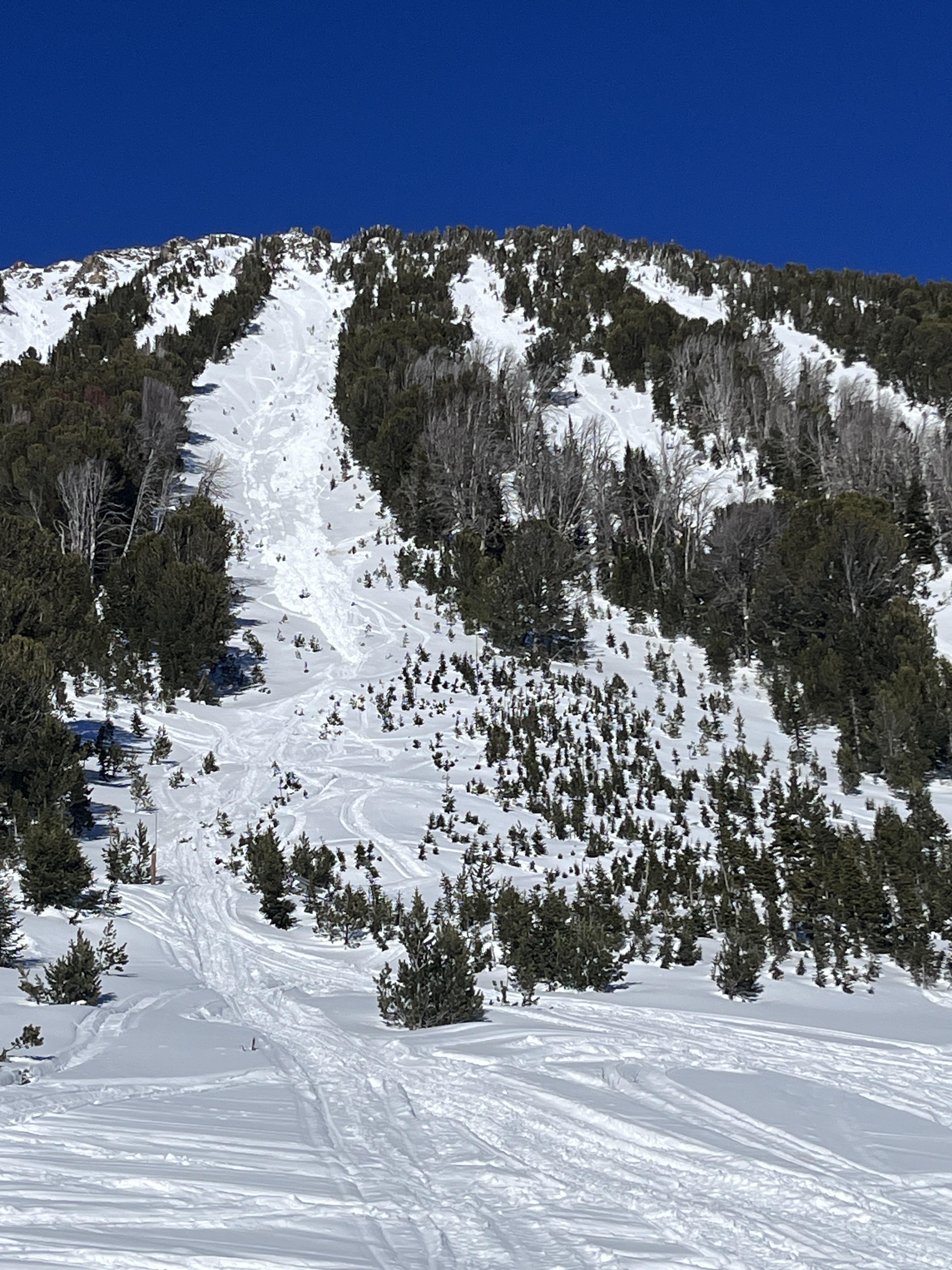
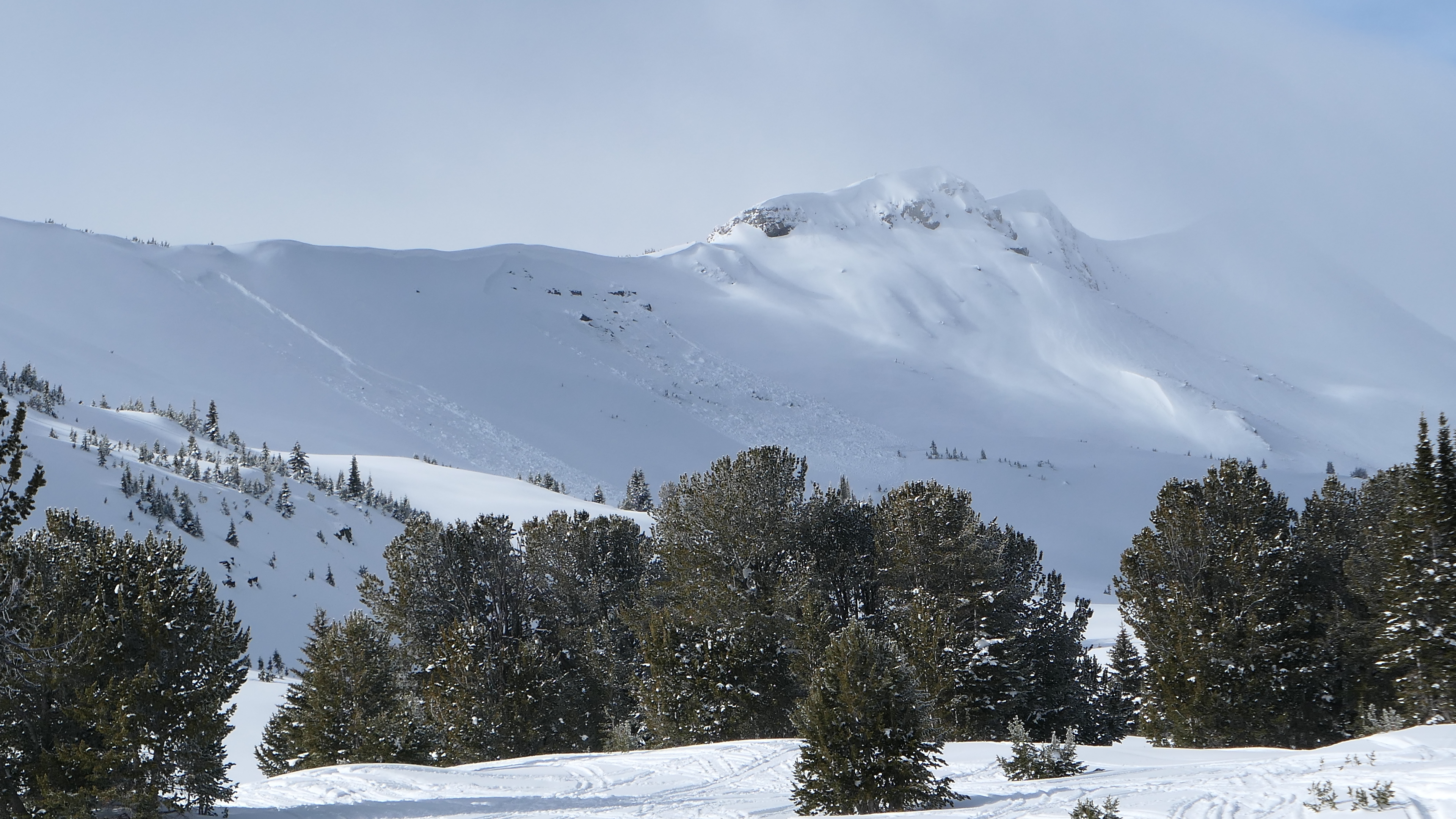
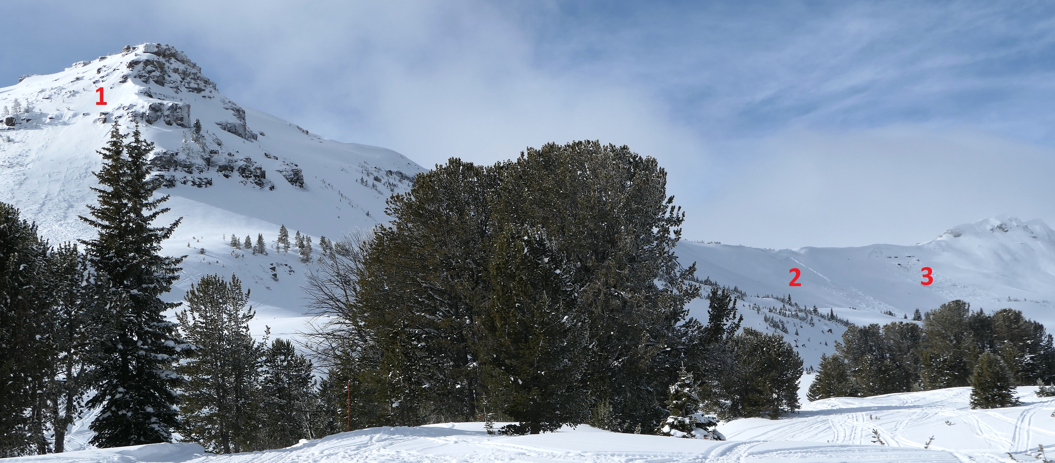
Today we rode along Buck Ridge through 1st, 2nd, and 3rd Yellowmule, McAtee Basin and into the head of Bear Creek. We saw numerous dry slab avalanches that broke over the last 10 days. Some of these slides were on small gully walls and some broke a hundreds of feet wide and ran a couple hundred vertical feet.
We also saw a number of natural wet slab avalanches that broke yesterday or the day before. There were at least five of these slides on Cedar Mtn and one in Third Yellowmule. There were also many recent wet loose avalanches.
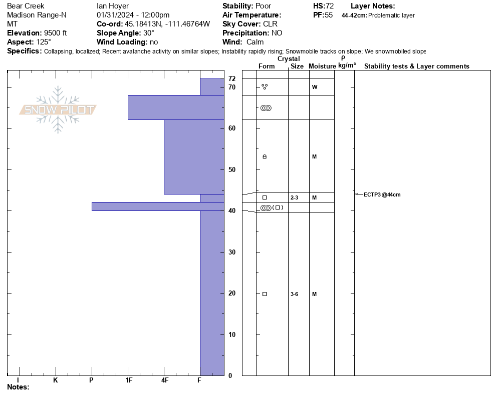
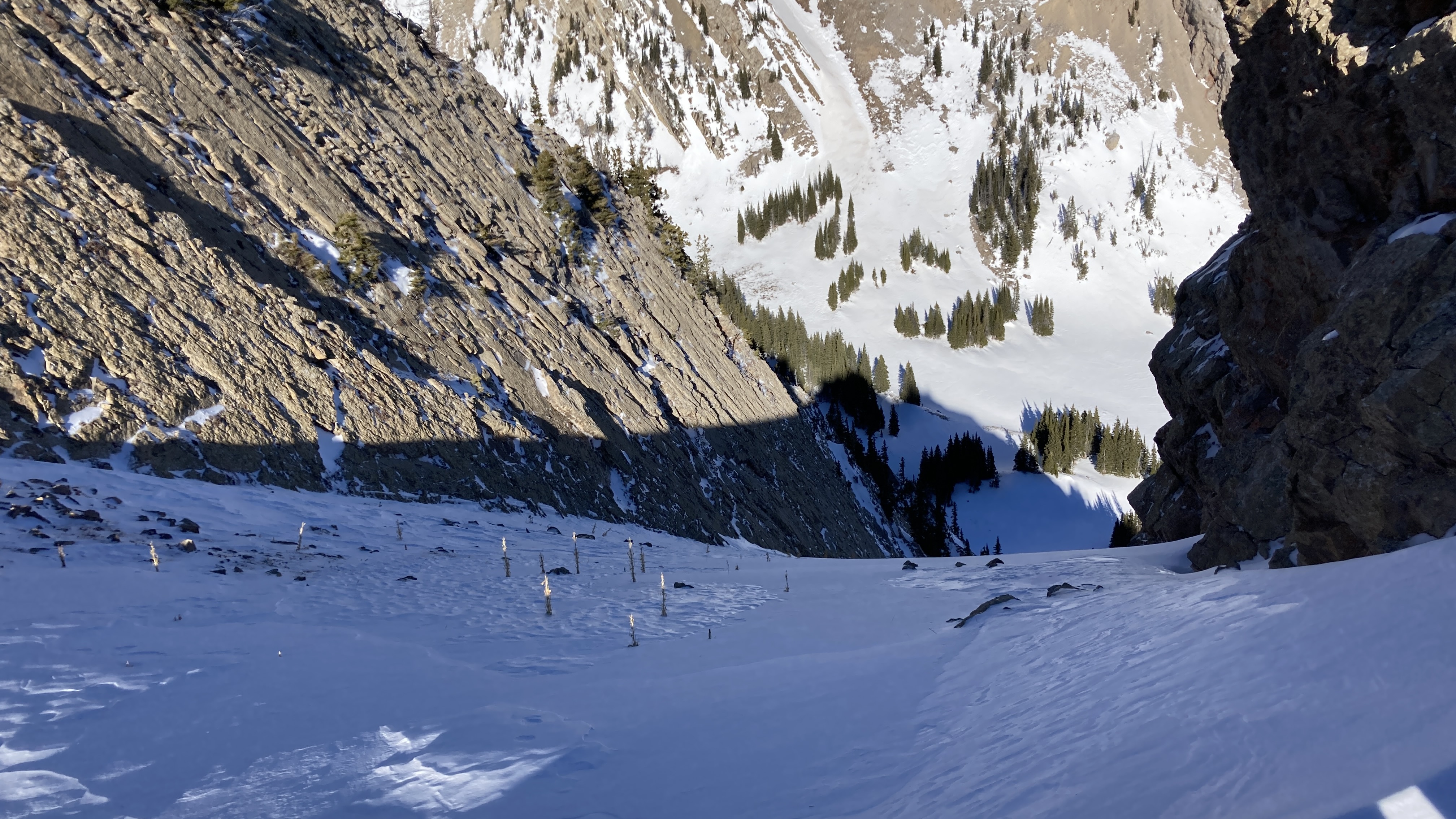
We dug a snowpit on a SE facing slope at 9500 ft near the head of Bear Creek. The snowpack was only two feet thick here. 1/2 slab - 1/2 facets. At noon, the top 3" were wet and it was moist to the ground. We got ECTP3 and ECTPV test results on the top of the facets. These are very unstable results. As we were leaving our snowpit we got the whole slope to collapse, at least 50 feet out. This shows that we were already primed for wet slabs and there were still many more hours of sunshine and heat to deteriorate conditions as the afternoon went on.
Full Snow Observation Report

Toured up to the south side of Bell Lake near treeline. Found sugary facets with the smallest sun crust on top, but generally less heat impact than in other areas. The snow above treeline was cold and preserved into a large slab.
I heard two large whumpfs once I got into a clearing around the treeline.
Three large old naturals were spotted on east faces.
Dug a pit on a NE facing slope at around 9,207ft. The surface did not appear to be loaded relative to the rest of the area, but wind impact was noted, 140cm deep snowpack. CT11Q2 50 cm up, ECTP19 60 cm up. The structure was condescended basal ice with a layer of depth hoar that increased in softness as the distance from the bottom increased. Between 40-50cm was a reactive layer of fist facets, and between 50-55cm was a pencil/knife crust, with another layer of fist facets above. The slab was a 1F hard slab that was consistent in structure from 60cm to the top of the snowpack. The slab seemed to be formed by multiple wind events as there where multiple slabs stacked up with no weak layer in between.
Full Snow Observation ReportThis avalanche occurred between noon and 4pm on Tuesday, 30 January. It was likely snowmobile trifggered. An adjacent path went naturally on Friday, 26 January.
Full Snow Observation Report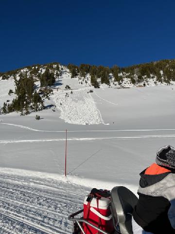
Driving up Bridger Canyon we saw wet loose avalanche across the whole range that ran yesterday afternoon (1/29). Some of these slides appear to have gouged down to the ground, entraining the whole season's snowpack.
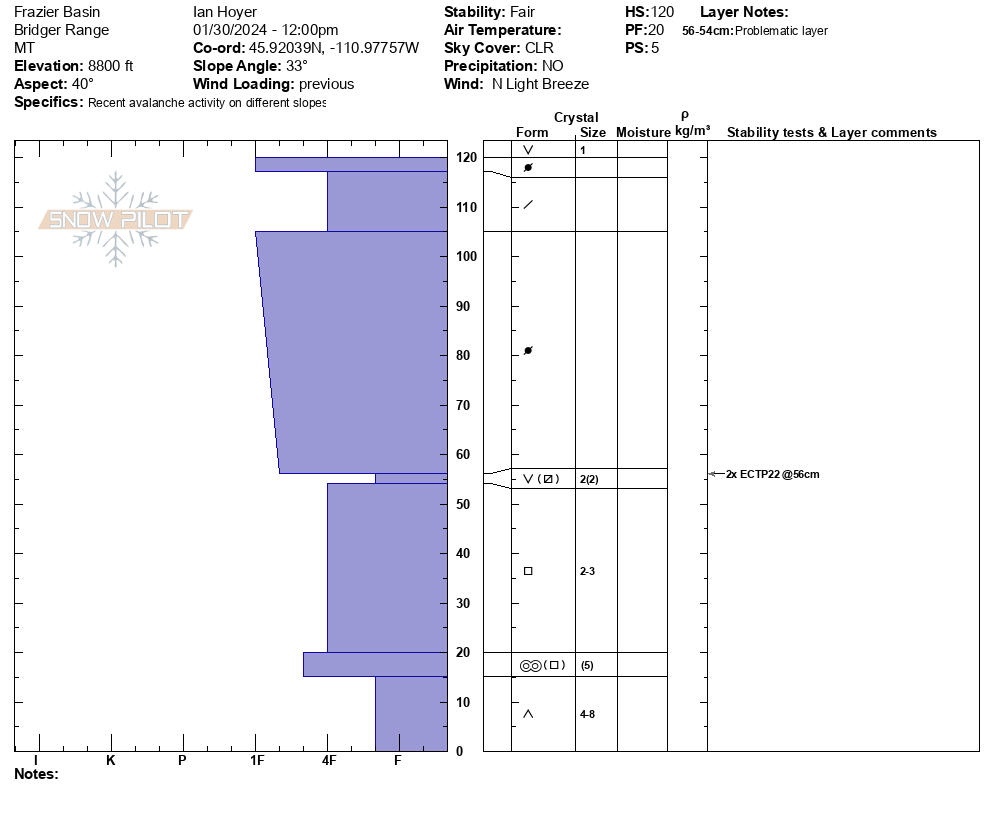
We sledded into Fairy Lake, parked, and skinned up to the ridgeline overlooking Frazier Basin. An older, previously reported slide that broke widely was still visible in October Bowl. There were numerous wet loose avalanches on the south facing wall of Frazier, many of which appear to have pulled out dry slabs lower in the path as they ran yesterday afternoon.
There was a firm refreeze on all slopes this morning. We dug on a NE and SE aspect at 8800 ft and got unstable test results on both aspects (ECTP22 and ECTP12) breaking 1-2 ft deep on the surface hoar/facets from December. The snowpack was 100% dry on the shady slope and only the top 3" was wet on the sunny slope at 1 pm. Was able to push the top couple inches of wet snow downhill on steep rollovers as we descended.
It was ~60 degrees when we returned to the parking lot at 2:30 pm.
Full Snow Observation ReportGreat call on HIGH today. Wet loose were pulling out slabs yesterday. I think the weak layers were still dry, but either way, it felt like we were/are close to a real wet cycle. Wouldn't be surprised if it happened later this afternoon, or if not, tomorrow.
The road ride in was brutal, lots of bare patches and a lot of overheating.
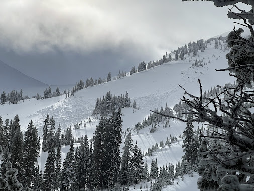
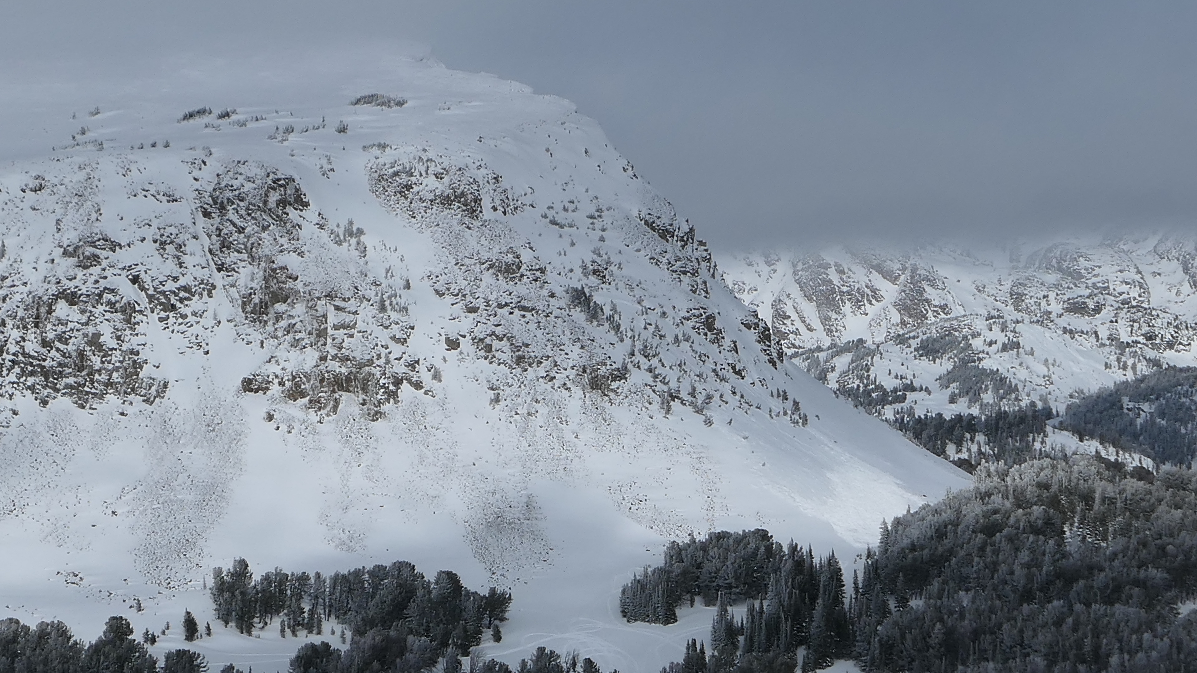
Good views today of upper elevation alpine terrain north of Cooke City. Snow remained cold on all aspects will late in the day above 9500'. The exception was steep west and south-facing terrain that had many small point releases. These were multiple loose wet avalanches on the west side of Scotch Bonnet, each of the Rasta Chutes had debris in them and looked recent, probably this afternoon. Just north of the Rastas, we saw a crown of an avalanche, whether that was recent or not was difficult to tell.
Full Snow Observation Report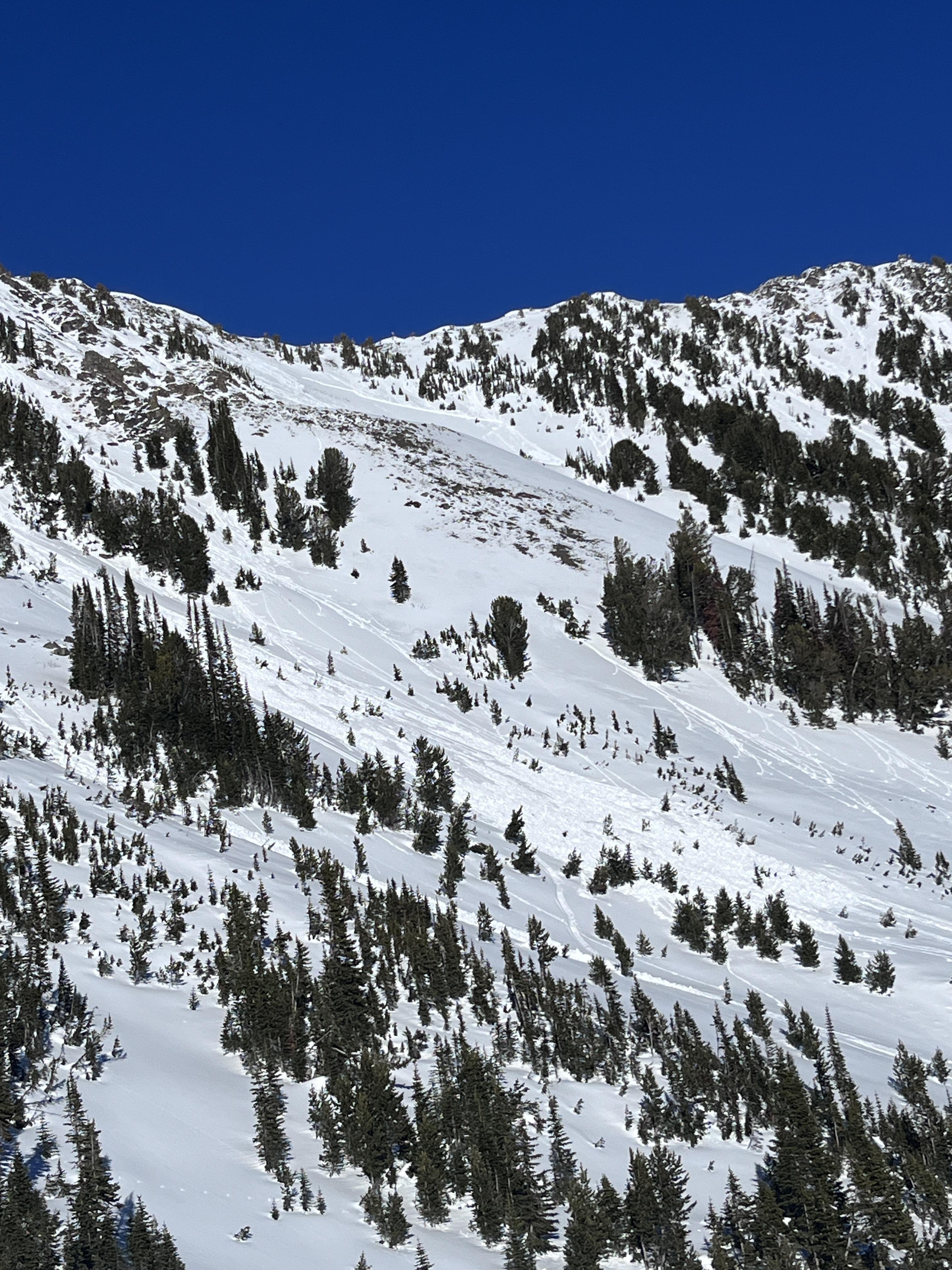
Over 15 slides spotted on our ride today. Both large and small. Mostly south facing slopes with a large one on a north facing slope. Several hills with visible cracking and ready to let loose.
Full Snow Observation Report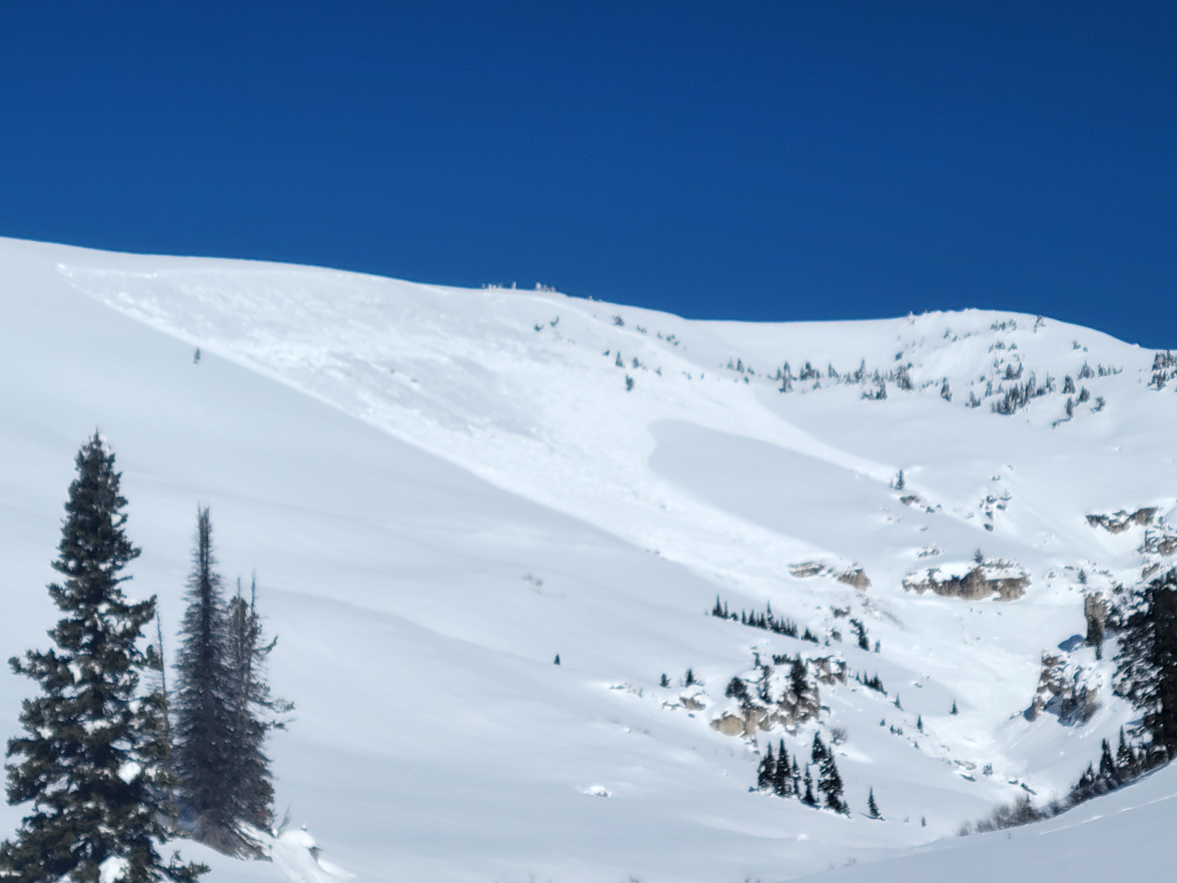
Spotted a recent natural avalanche on a south-southeast aspect on Mineral Mountain from Cooke City. I assume this was a wet slab avalanche. I can see roller balls and possible small wet loose slides on similar aspects with binoculars.
Full Snow Observation Report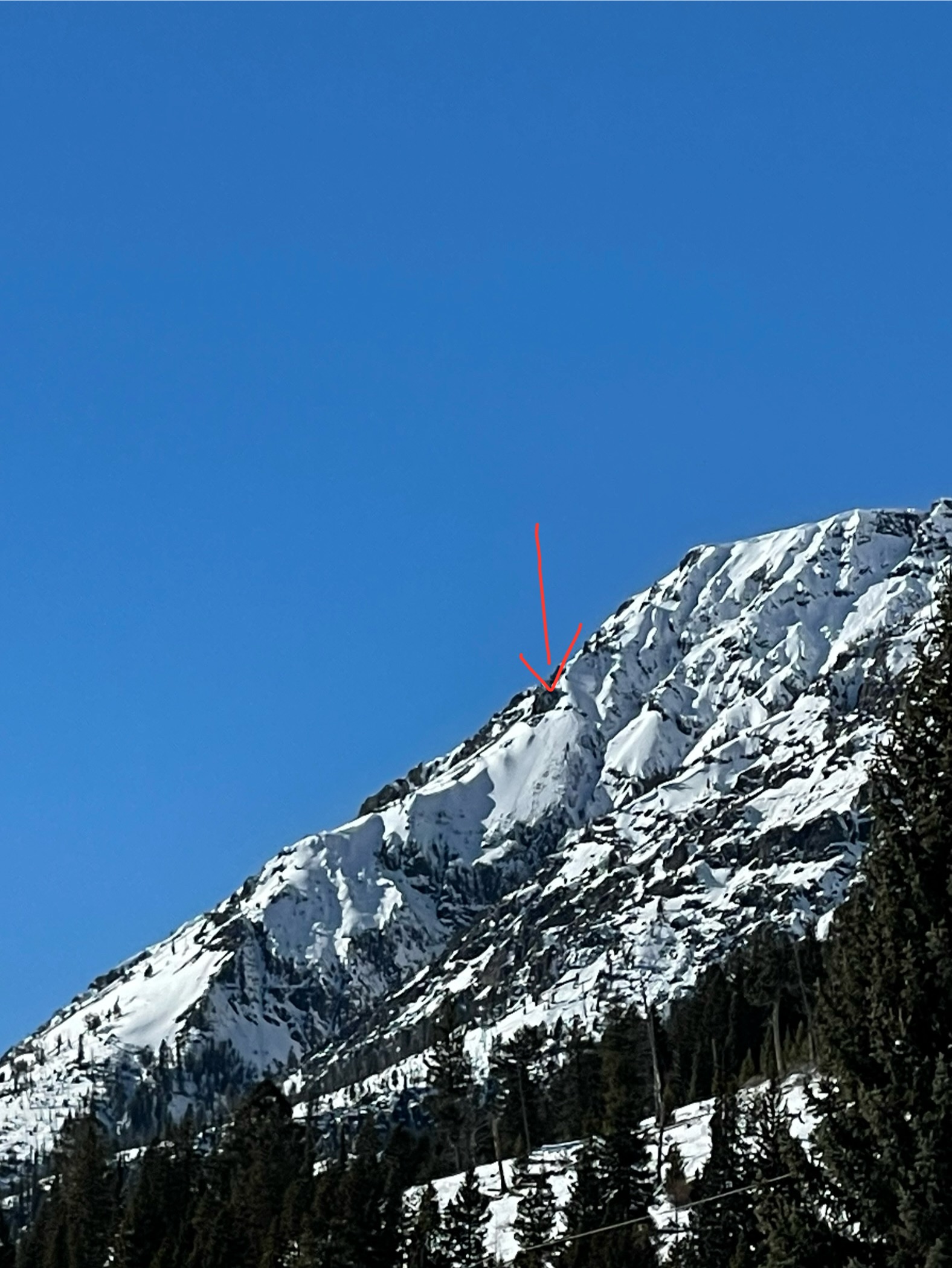
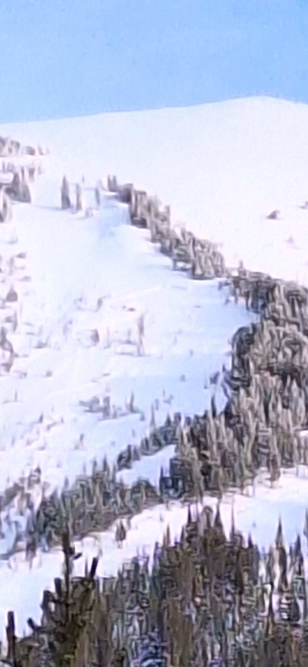
Observed quite a few avalanches at the head of Republic Valley today. D1-D2. Range. Looked to be 2-3 days old on various aspects. primarily North-Northwest facing.
attached a few photos. Did not get a good shot of The headwall off Republic peak but that had also slid
Full Snow Observation Report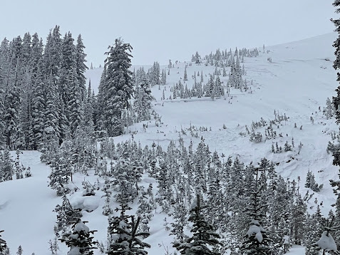
We spent the last two days riding in the Centennial Mountains. We had limited visibility for spotting avalanches but we did catch sight of one slide on a steep slope above Yale Creek.
There were fewer in-your-face signs of instability, such as the avalanches, shooting cracks, and collapsing, which were a staple of conditions last week. However, when we dug deeper (get it), we found the ingredients for a human-triggered avalanche in every snowpit we explored. All failed and propagated on the surface hoar or near surface facets buried 1-2 feet deep, with results varying from ECTV to ECTP21 indicating human-triggered avalanches are likely.
I told my riding partners that, in some ways, I am more worried about people triggering avalanches this week than last because last week, incredibly obvious signs of instability and avalanche warnings largely kept people out of avalanche terrain. This week, the feedback is not as clear, and folks may get tempted by steeper slopes. Our recommendation is to play the long game. Persistent weak layers demand persistent patience. Our best tool to have safe and enjoyable days in the mountains remains conservative terrain selection and sticking to slopes less than 30 degrees.
Full Snow Observation ReportThe stripes of surface hoar we found in the Centennials do not seem quite as prominent or reactive as those in the Lionhead area. I was disappointed that we did not get the visibility windows we needed to really go avalanche hunting, but the weak layers told a story that is largely consistent with the surrounding areas.
The riding is getting really good. The snow is supportable with excellent traction.
The danger was CONSIDERABLE but from what I was able to see, it seemed like it was moving to the lower end of CONS. Not totally convinced.

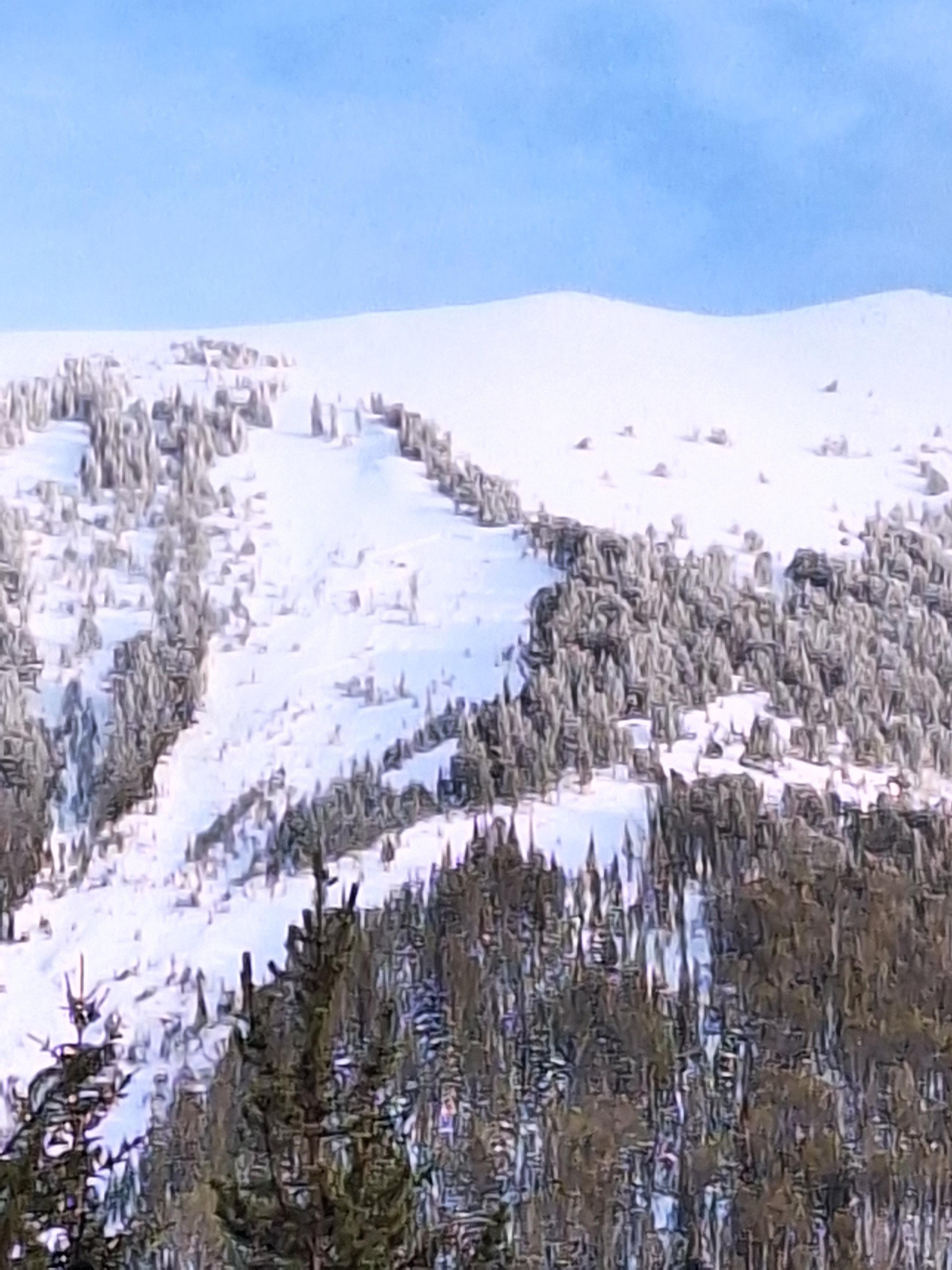
West facing slope 9600' on Woody Ridge, North of the "Ozarks." Appeared to be new 1/29. Observed numerous older crowns and avalanches on all aspects throughout the day. Lots of whoomphing and collapsing, enough to shake small trees. Sorry the images arent great.
Full Snow Observation ReportAccidentally deleted by ZP re-entered on 01/30/2024
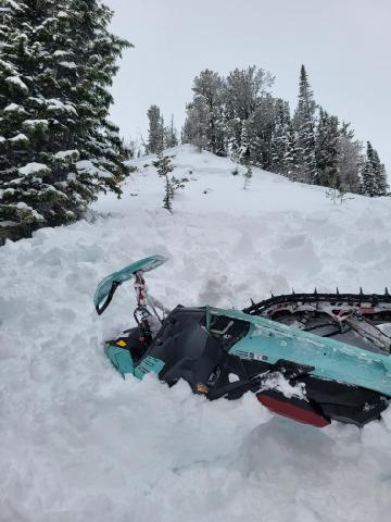
A rider from MN triggered an avalanche immediately north of Round Lake. He was caught, pulled his airbag and was buried with his head out, under his sled. He attributes this to his airbag. His partners dug him out and he was uninjured.
Full Snow Observation ReportWesley (218) 382-0065

Not much snow but I thought it may be worth noting that I saw alot of ice shedding off climbs at unnamed wall today and have heard reports of wet slides coming over climbs in the last couple days
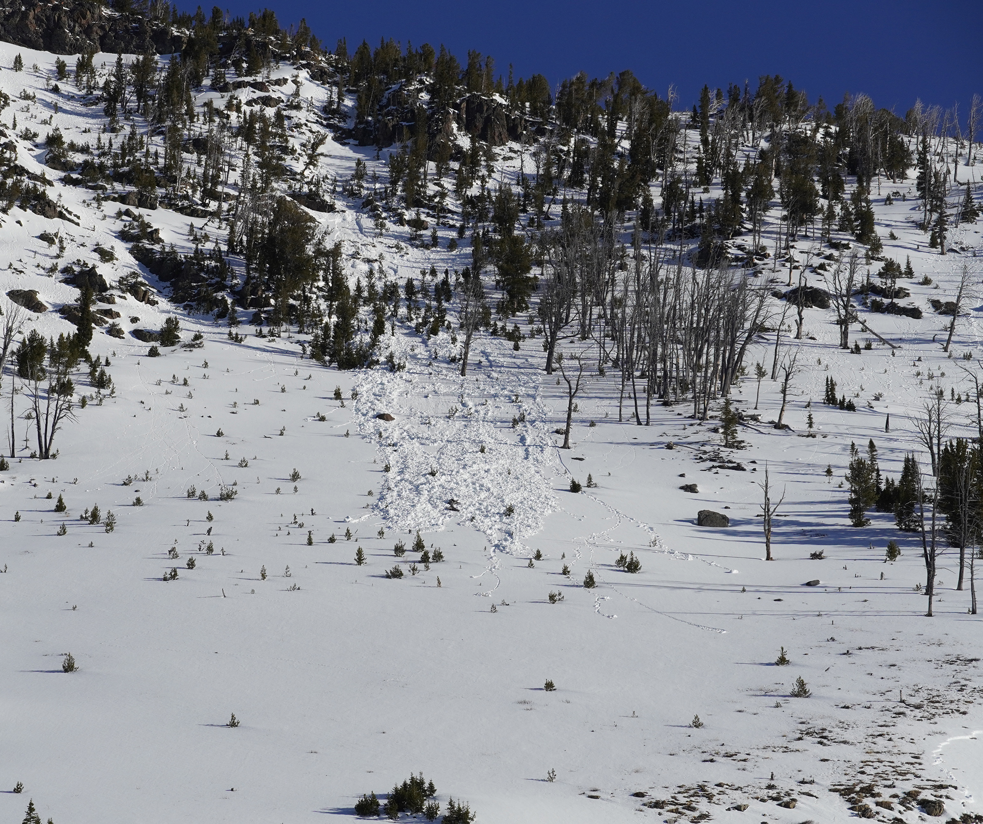
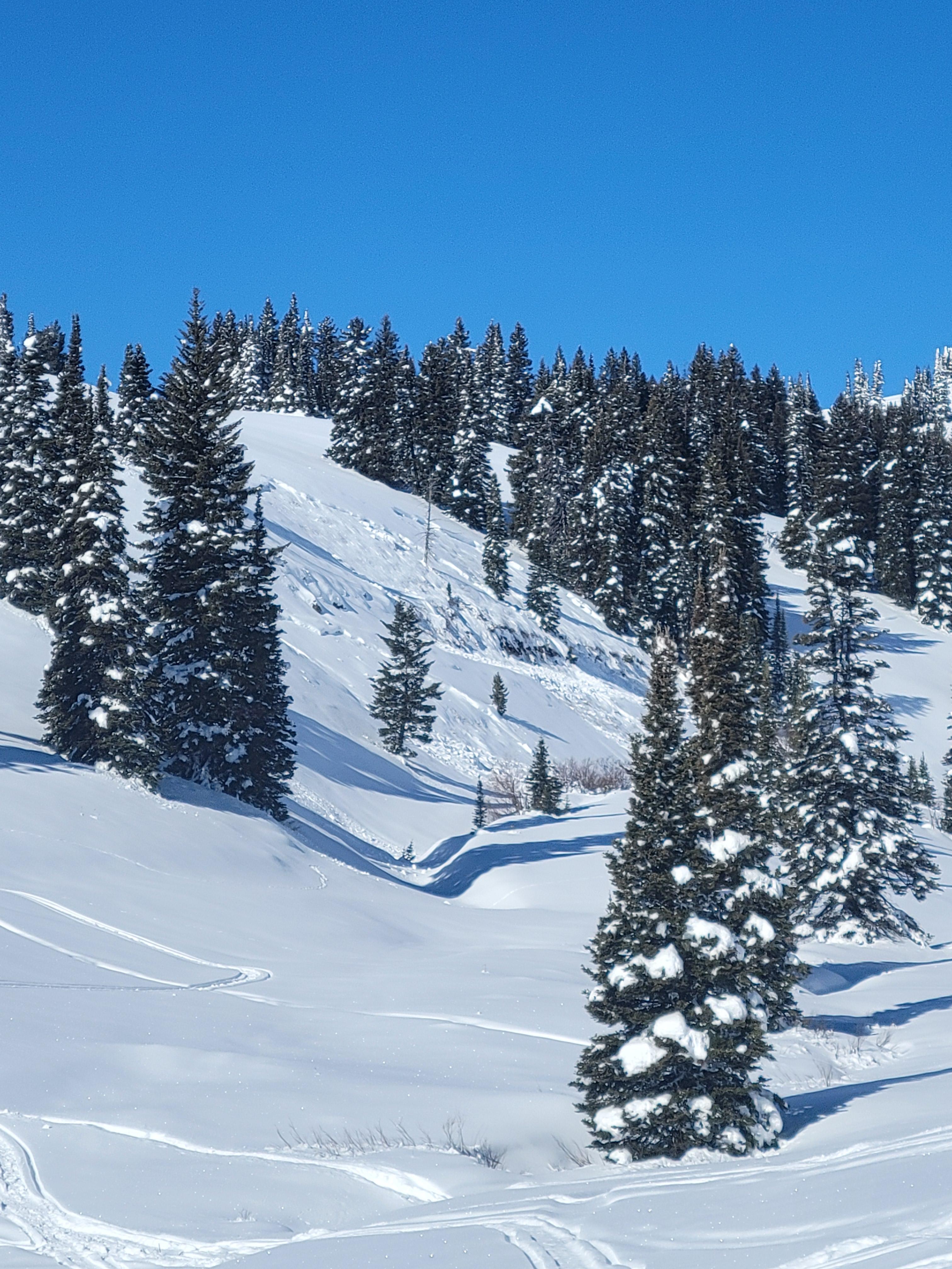
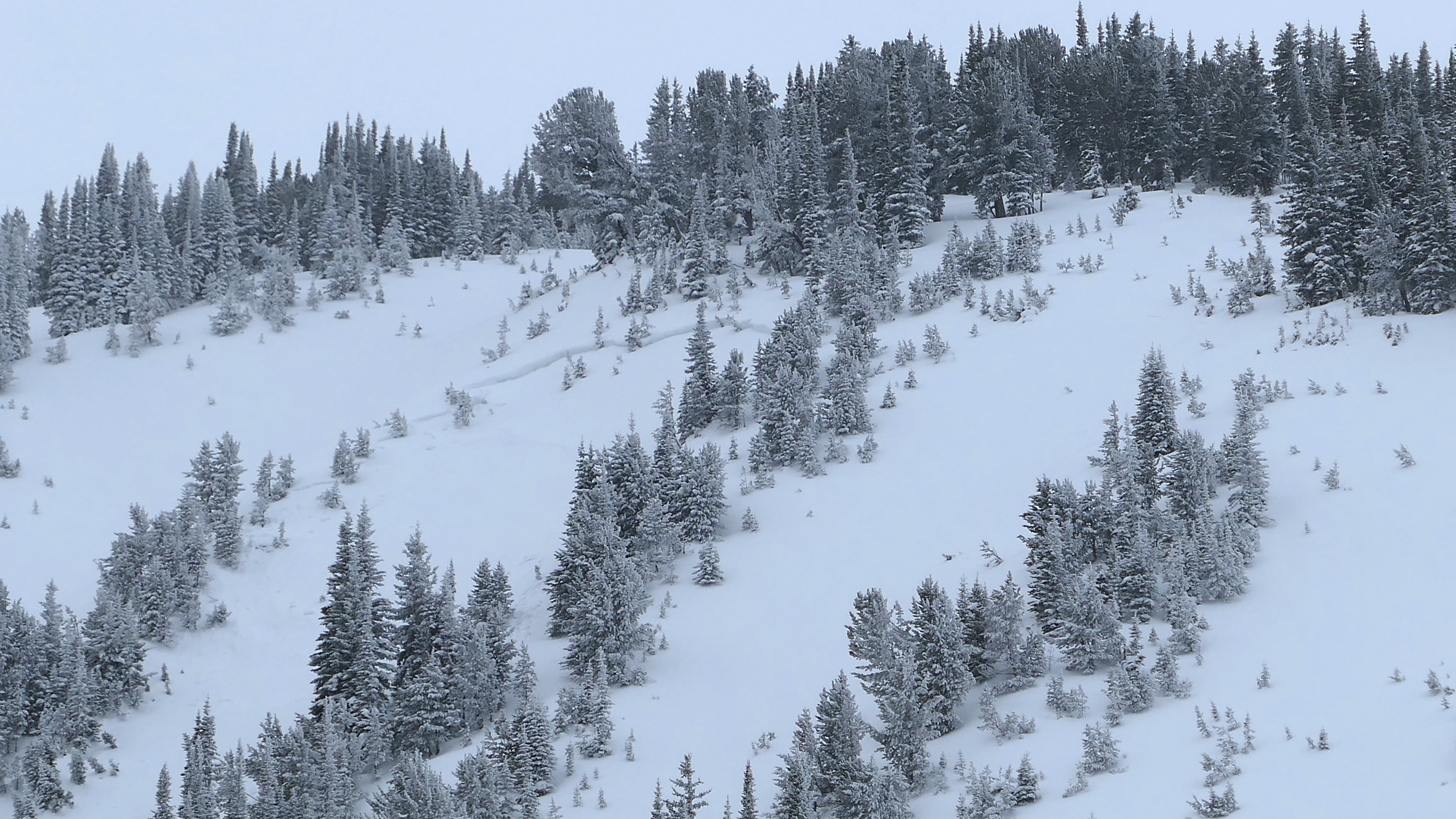
Full Snow Observation ReportWe rode to the cabins in Fisher Creek and skied up Wades World. A slide from last week was visible and we dug a few hundred feet above it. A 70 cm wind slab broke on the facets in our stability test and also in the avalanche. We got 2 large collapses as we approached the crown of the slide and another an hour later near Henderson Mtn. On Henderson Bench we could see 2 new avalanches that looked fresh, possibly cornice triggered. It was not windy, so windloading was not the trigger. Regardless, it was disconcerting. Across the Fisher Creek valley we could see a slide on the nose of Sheep Mountain on the same slope that killed a snowmobiler in 2015.
Whumpfs yesterday and today, recent slides, and a poor snow structure is worrisome.
Full Snow Observation ReportI started the day surprised I did not get collapses, but after I made my video I got 3 collapses and the clouds lifted and I saw 2 slides on Henderson Ridge. Beau noted them too. I learned a lesson about making my video too early in the day!
I was with an AP reporter today which was a bit of a pain in the ass, but that was expected.

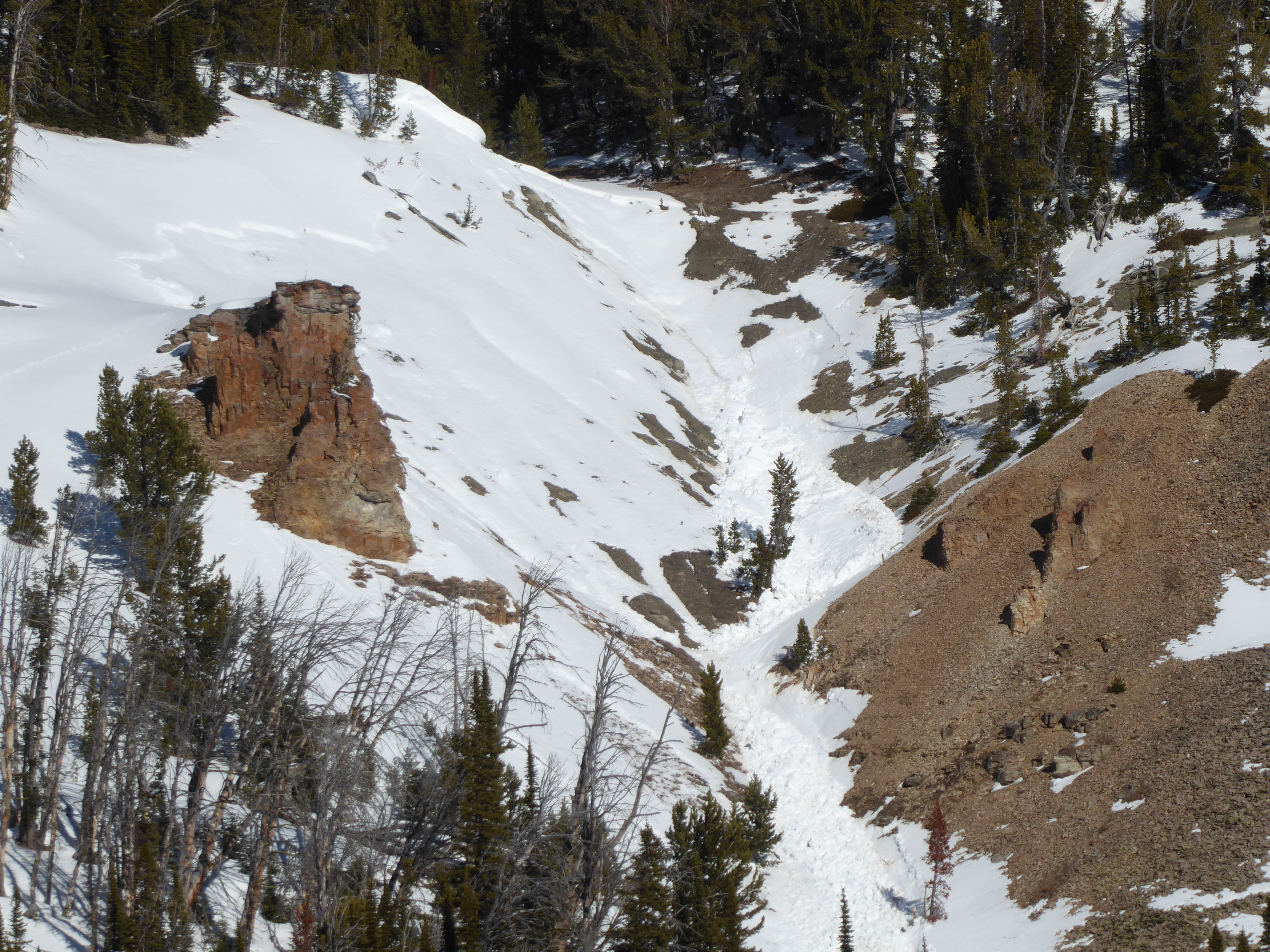
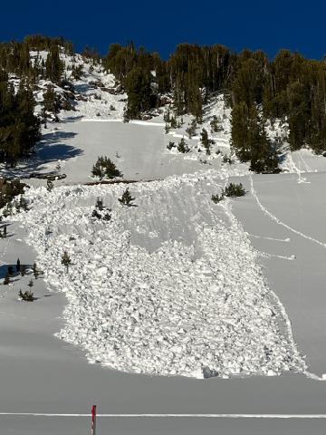
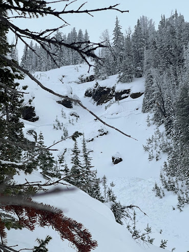
Natural Avalanches on Cedar Mtn. SE bowl. Occurred sometime between the 4pm on 1/28- 9am on 1/29.
Full Snow Observation Report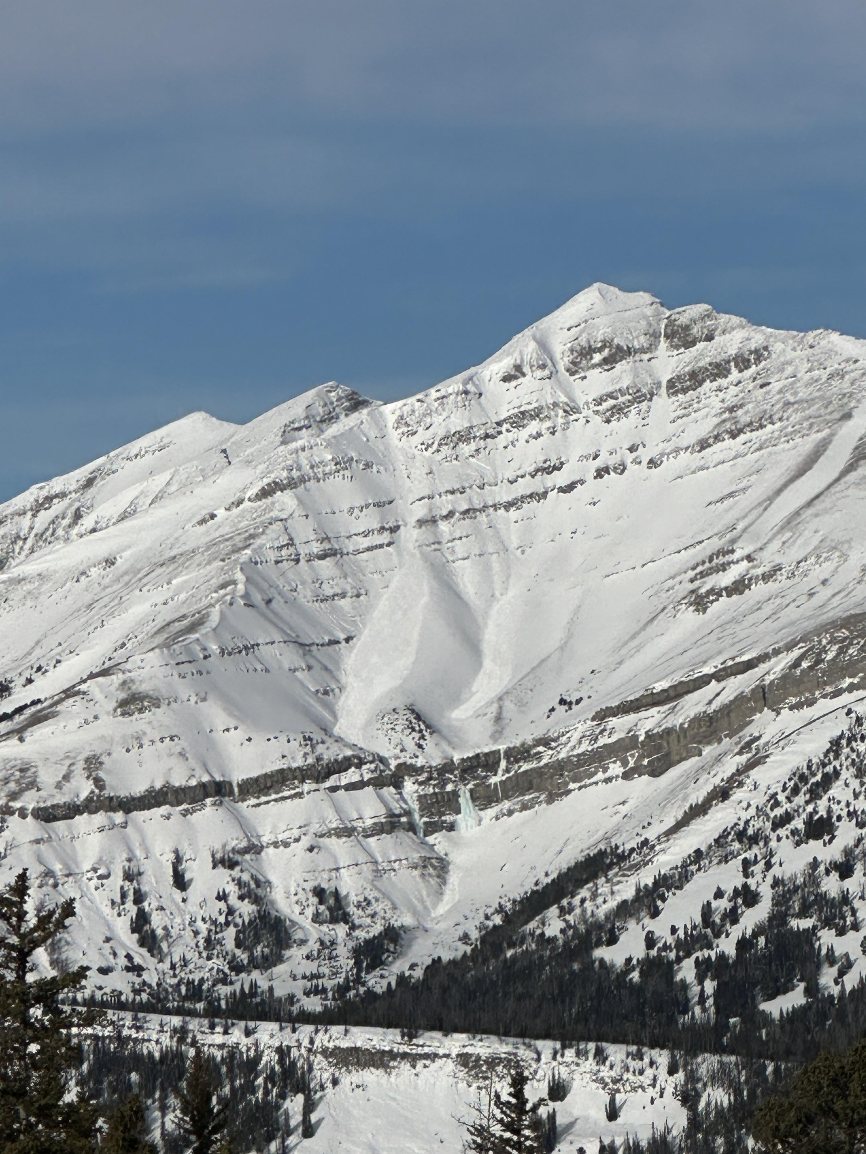
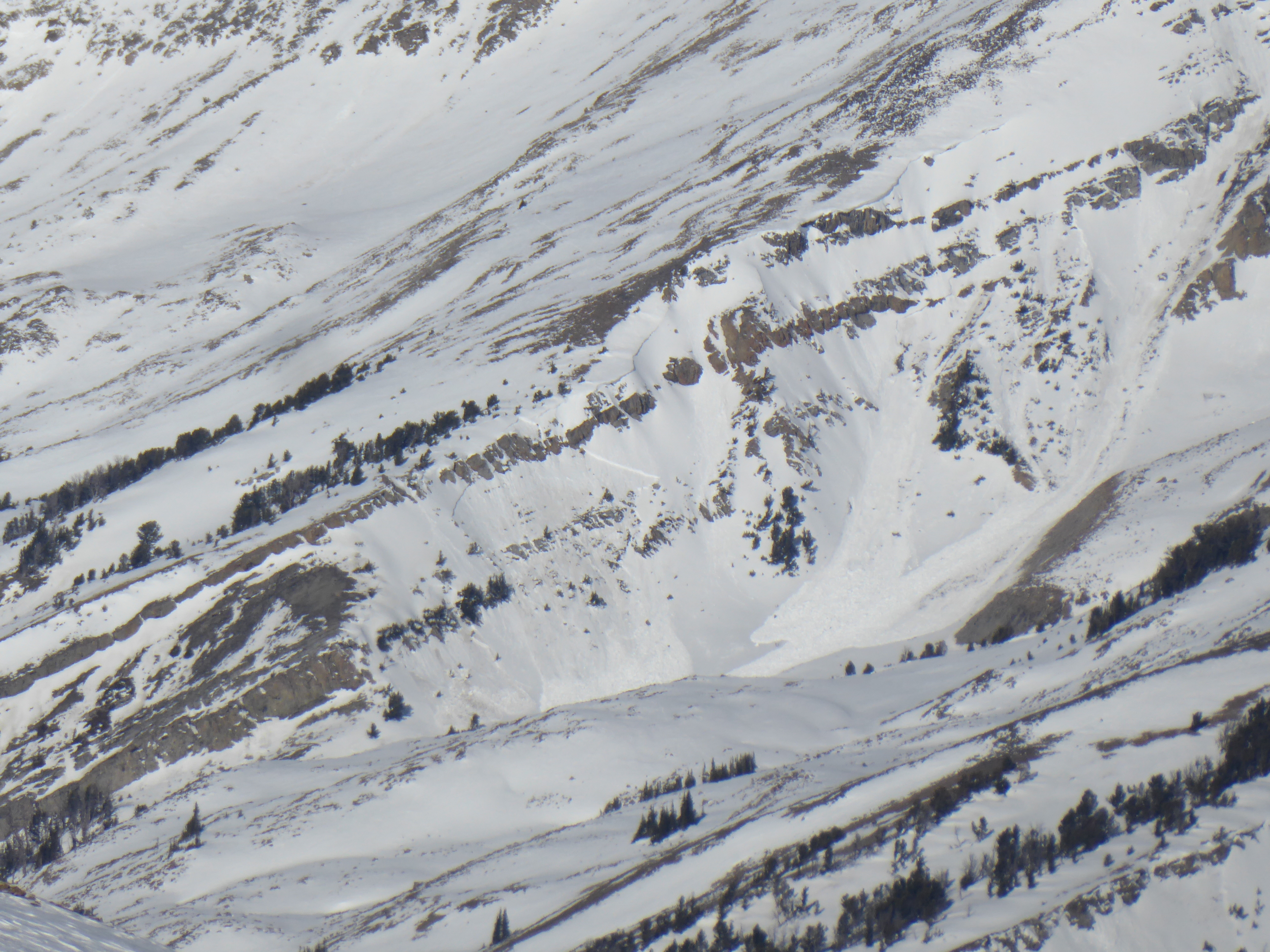
This avalanche released naturally on 1/29/2024. It was seen from the Miller Creek road and looks similar to all the other avalanches in the area.
Full Snow Observation Report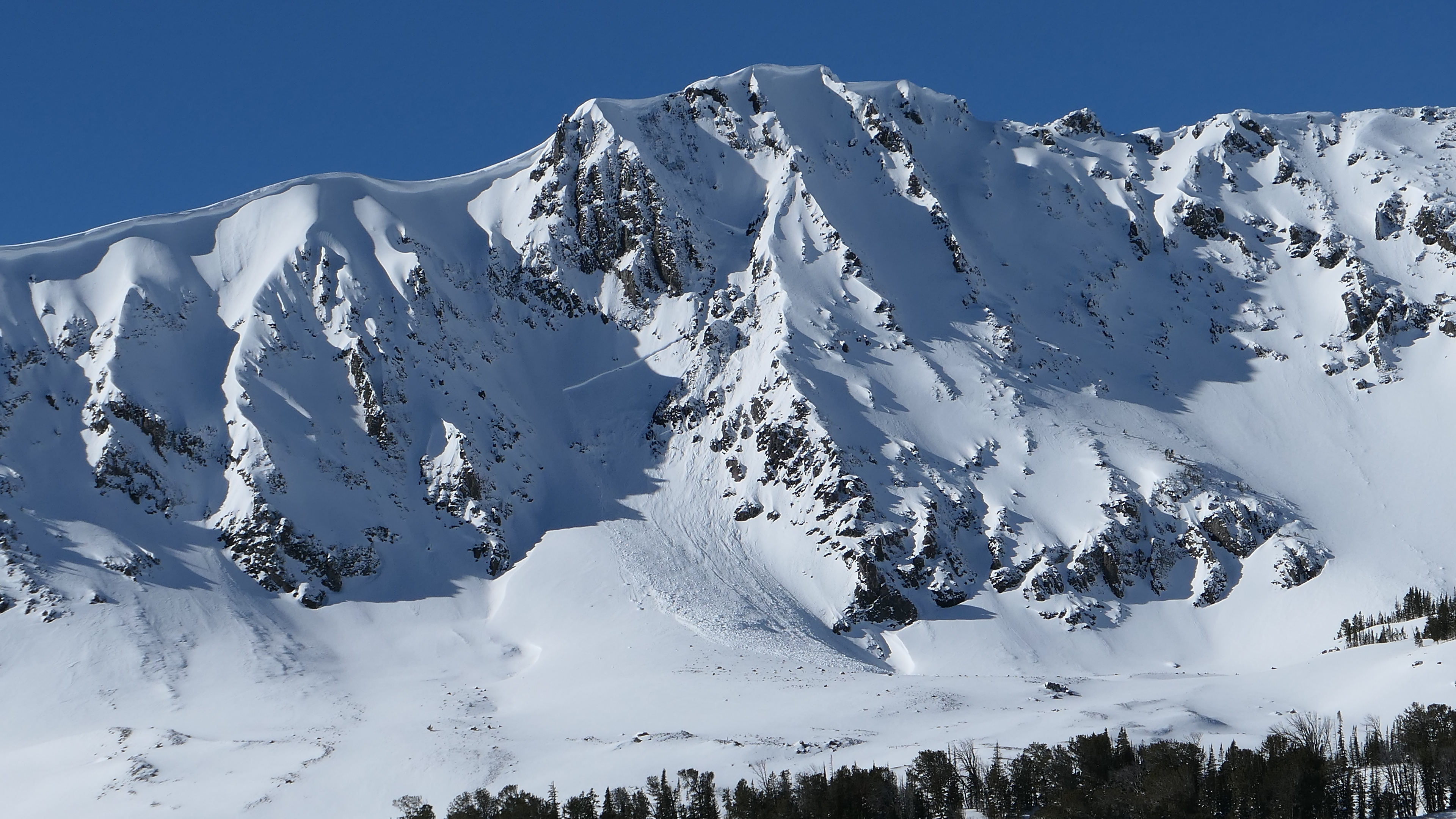
Numerous collapses in any terrain with a non-wind effected snowpack over 70 cm. Recent warm weather leading to settlement of the upper pack and a much denser slab. 3x natural size 1 natural wet loose off palace butte in steep rocky terrain, which happened before noon. Below 8000 feet the snowpack was moist to the ground in the pm.
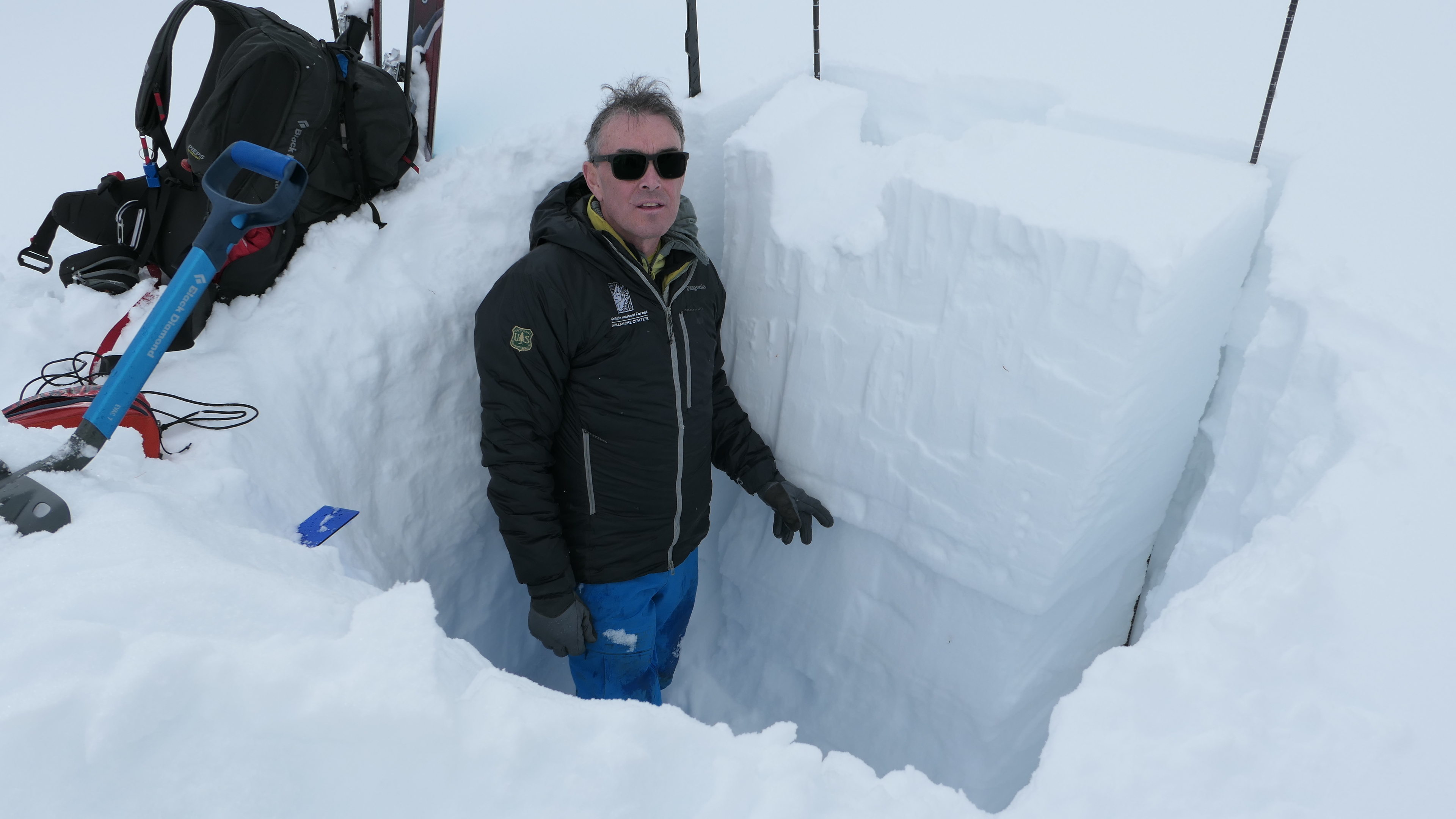
Full Snow Observation ReportSkied and dug in the trees W of Bradley Meadows at 7690’. Ski quality was terrible as the upper 20cm was becoming very heavy and wet, even on this NW aspect, in the trees. It was 48 degrees air temp at 2pm.
Dug two pits, each with slightly different aspects, and got mixed results just 25’ away:
NW: ECTP25 down 55 on 2mm facets, ECTX x 1, HS of 85.
W: ECTP26 down 67 on 2mm facets, ECTX x 2, HS of 97.
No other signs of instability, and there were quite a few skiers out, none of whom mentioned anything other than the poor ski quality.
Full Snow Observation Report