Good morning. This is Doug Chabot with the Gallatin National Forest Avalanche Forecast on Thursday, December 1st at 7:00 a.m. This information is sponsored by Advanced Innovation, Cooke City Motorsports and Upper Yellowstone Snowmobile Club. This forecast does not apply to operating ski areas.
*Note: Bridger Bowl Ski Area is closed and there are no avalanche control or ski patrol services. Backcountry conditions exist. Please don’t ski over hoses and power cords, stay off chairlifts, and give snowcats and snowmobiles plenty of room.
By 6 a.m. the mountains around Bozeman had 1” of new snow, 8” at Big Sky, 3-6” south of Big Sky to West Yellowstone and Island Park, and a whopping 17” outside Cooke City. Temperatures are in the teens F and wind is blowing south to west at 15-25 mph with gusts of 50 mph. Today will remain windy and gusty. By tomorrow morning the southern mountains are poised to get 15-20” of new snow with 5-10” everywhere else. About half the snowfall amounts will fall today and half tonight.
We are on the cusp of issuing an Avalanche Warning (a HIGH danger on all slopes) for the mountains around Cooke City, West Yellowstone and Island Park.

Once again, Cooke City is a catcher’s mitt. A strong storm from the southwest has dropped 17” of new snow (1” of snow water equivalent or SWE) with strong south to southwest wind (gusts of 46 mph). More snow and wind will continue to build drifts whose thickness will be measured in feet, not inches. Before this storm is over the snowpack depth could double. Most avalanches happen during a storm and large storms can produce large avalanches. Today is a day to be cautious and stay out of avalanche terrain and away from the flats at the bottom of big slopes (aka. runout zones). For today the avalanche danger is rated CONSIDERABLE but could become HIGH by midday if snowfall intensity and amount are more than expected.
The mountains south of Big Sky to West Yellowstone picked up 3-6” (.3-.5” of SWE). Southwest wind is gusting to 50 mph. Wind blown snow will likely crack and potentially avalanche, especially around West Yellowstone, where Dave found a buried weak layer of feathery surface hoar crystals collapsing under his weight (video and observation). Because today’s storm is impacting this weak layer, it’s a good idea to stay clear of avalanche terrain. Natural avalanches are possible on wind-drifted slopes and a skier or sledder could likely trigger a slide, potentially from afar. The danger today will start out as CONSIDERABLE, but may ramp up to HIGH.

Big Sky Ski Resort received at least 8” of new snow while the Bridger Range and northern Gallatin Range got 1”. Yesterday ice climbers up Hyalite reported drifting snow at low elevations. Deep drifts were not cracking or collapsing, but at higher elevations in the starting zones a climber or skier could possibly trigger an avalanche (Beehive Basin video). Winds blew southwest to west with gusts of 50 mph. Gullies will be loaded with drifts and caution should be used crossing them. Near the ridgetops shooting cracks in wind blown snow are a clear sign of instability. For today, the avalanche danger is rated MODERATE on all slopes.
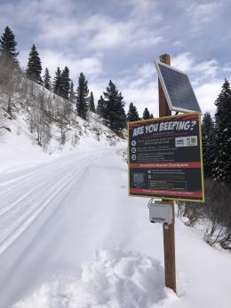
If you get out, please share avalanche, snowpack or weather observations via our website, email (mtavalanche@gmail.com), phone (406-587-6984), or Instagram (#gnfacobs).

The Island Park area picked up 3 inches of snow with strong wind. More will fall today. Wind blown snow will likely crack and potentially avalanche, especially if there is a buried weak layer of feathery surface hoar crystals 12-18” under the surface. Because today’s storm is impacting this weak layer, it’s a good idea to stay clear of avalanche terrain. Natural avalanches are possible on wind-drifted slopes and a skier or sledder could likely trigger a slide, potentially from afar.
Upcoming Avalanche Education and Events
Our education calendar is full of awareness lectures and field courses. Check it out: Events and Education Calendar.
Monday, December 5, 6:30-7:30 p.m. @MAP Brewing in Bozeman, Know Before You Go avalanche awareness presentation.
Tuesday, December 6, 9 a.m. - 3:00 p.m. West Yellowstone Avalanche Fundamentals w/ Snowmobile Field Session. Pre-register HERE.
Thursday, December 8, 6 - 7:30 p.m., Free Snow & Avalanche Safety Workshop: Belgrade Community. This workshop will cover the basics of snow and avalanche equipment. Belgrade Community Library. A raffle and pizza will be included!
Monday, December 12, 5-8 p.m. @MAP Brewing, Movie Night.
Tuesday, December 13, 6 p.m., Avalanche Awareness + Beacons at Story Mill Park. Free.
The Friends of the Avalanche Center are hosting the Powder Blast Fundraiser. Your donations support free and low-cost avalanche education, beacon checkers at trailheads, beacon parks, weather stations, and GNFAC programs! The Friends of GNFAC launched an online GoFundMe campaign. Please consider a donation, and we look forward to having an in-person event again in the future.