Good morning. This is Alex Marienthal with the Gallatin National Forest Avalanche Forecast on Sunday, January 21st at 7:00 a.m. Today’s forecast is dedicated to Tyler Stetson. Tyler was killed in an avalanche in Beehive Basin sixteen years ago yesterday. This forecast does not apply to operating ski areas.
Since yesterday morning the mountains got 2-5” of new snow, except Hyalite was left out with zero. Temperatures are high 20s to low 30s F this morning. Wind has been from the southwest-west at 15-25 mph with gusts of 35-45 mph and up to 78 mph near Island Park. Today temperatures will reach low to mid-30s F and wind will be from the southwest-west at 10-15 mph with gusts to 25 mph. Light snow showers later today favor Island Park where 2-4” are possible, and 1-2” are possible elsewhere.
Avalanche conditions are very dangerous. Large avalanches are easy for a person to trigger, and almost certain on wind-loaded slopes. Steady moderate winds are drifting new and recent snow into thicker slabs on top of a snowpack that has been collapsing and avalanching for the past two weeks (weather and avalanche log, Cooke City video, Lionhead photos, Taylor Fork photos). Yesterday, skiers near Cooke City described widespread instability with multiple large, loud 100’ wide collapses (observation), and one group triggered an avalanche from relatively flat terrain when they stepped off the skintrack (photos). In the southern Madison Range, riders saw natural and rider triggered slides (observation and photos), and skiers reported large collapses.
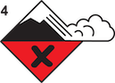
Avalanches have been triggered from flat terrain connected to steep slopes, breaking on weak layers of surface hoar and facets, 1-2 feet deep and up to hundreds of feet wide. Find safe terrain that is less than 30 degrees steep and not connected to steeper terrain above. The avalanche danger is HIGH on wind-loaded slopes and CONSIDERABLE on all other slopes in the mountains near Cooke City, West Yellowstone and Island Park.

Near Big Sky and in the Bridger Range human-triggered avalanches are likely on wind-loaded slopes. Since yesterday these mountains received 2-5” of new snow (0.3”-0.5” snow water equivalent), and moderate winds drifted this snow into thicker slabs on top of a very weak snowpack. Yesterday, in Beehive Basin skiers triggered a large cornice and hard slab avalanche from a flat ridge above (photos), and in the Bridger Range I found unstable hard wind slabs on small wind-loaded terrain (photos). Even just a few inches of snow and moderate wind will make avalanches more likely today. A remarkably wide avalanche on Buck Ridge (video) last Thursday is another example of what you could trigger today. Choose terrain carefully, and evaluate the snowpack for fresh wind-loading and older hard wind-slabs sitting on weak, sugary snow. Avalanche danger is CONSIDERABLE on wind-loaded slopes and MODERATE on other slopes.

In the northern Gallatin Range large avalanches are possible to trigger. It has become less likely to trigger a large slide without as much recent loading from new snow and wind as other areas, but the potential consequences of an avalanche require careful route-finding and snowpack evaluation. On Thursday skiers triggered slides from 150 ft away in Hyalite, and on Friday a skier triggered an avalanche on a windloaded slope just below the ridgeline on the E face of Mt. Blackmore (observation). Yesterday, skiers reported a recent natural avalanche on the same slope (photos). These are examples of the dangerous avalanches that you can trigger today. Carefully assess the snowpack for unstable slabs and recent wind-loading, and seek non-wind-loaded terrain or avoid steep slopes altogether. The avalanche danger is MODERATE in Hyalite.
If you venture out, please fill an observation form. It does not need to be technical. Did you see any avalanches? How much snow is on the ground? Was the wind moving snow? Simple observations are incredibly valuable. You can also contact us via email (mtavalanche@gmail.com), phone (406-587-6984), or Instagram (#gnfacobs).
Upcoming Avalanche Education and Events
Our education calendar is full of awareness lectures and field courses. Check it out: Events and Education Calendar.
Every weekend in Cooke City: Friday at The Antlers at 7 p.m., Free Avalanche Awareness and Current Conditions talk, and Saturday from 10 a.m.-2 p.m. at Round Lake Warming Hut, Free Rescue Practice.
We offer Avalanche Fundamentals with Field Session courses targeted towards non-motorized travelers in January and one geared towards motorized users. Sign up early before they fill up.
King & Queen 2024, 3 February 2024. Form a team or sign up individually to hike laps on the Bridger Bowl ridge to fundraise for the Friends of the Avalanche Center.
Loss in the Outdoors is a support group for those affected by loss and grief related to outdoor pursuits. Check out the link for more information.
KING AND QUEEN OF THE RIDGE, FEBRUARY 3rd
Do you like to hike? Do you like to ski? Then the King & Queen of the Ridge is for you. Hike, ski and raise money for the Friends of the Avalanche Center in their 2nd biggest fundraiser of the year. Join the effort to promote and support avalanche safety and awareness! Fundraising prizes for the top 5 individuals who raise over $500. No racing is necessary to compete for the fundraising prizes. Info is HERE. Race participants for the February 4th event must register separately with Bridger Bowl HERE.
Over the last 10 days, there have been three avalanche fatalities. A skier was killed in an avalanche in the Salt River Range, Wyoming, a skier died in avalanches near Lookout Pass in Idaho, and a skier died in an avalanche at Palisades Tahoe in California). Be good out there.