Good morning. This is Doug Chabot with the Gallatin National Forest Avalanche Forecast on Wednesday, January 24th at 7:00 a.m. Today’s forecast is sponsored by Alpine Yamaha in Livingston and Highline Partners. This forecast does not apply to operating ski areas.
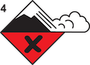
AVALANCHE WARNING
The Gallatin National Forest Avalanche Center is issuing a Backcountry Avalanche Warning for the Centennial Mountains in Island Park. New snow is overloading an exceptionally weak snowpack, creating very dangerous avalanche conditions. Human-triggered avalanches are very likely. Avoid avalanche terrain and avalanche runout zones. The avalanche danger is rated HIGH on all slopes. Contact the Gallatin National Forest Avalanche Center for more detailed information.
This warning will expire or be updated by 6:00 a.m. on Thursday, January 25th.
Yesterday 1-2” fell in Cooke City, West Yellowstone and Island Park. West wind is light with gusts to 25 mph and mountain temperatures in the low 20s F. Today will be partly cloudy in the north and mostly cloudy in the south. In the mountains, 1-2” is expected in the next 24 hours around Cooke City, West Yellowstone and Island Park.
Avalanche Warning
We issued an Avalanche Warning for the second day in a row in Island Park because it keeps snowing. Although the daily amounts are measured in inches, they add up. Since Saturday, 1.4” of snow water equivalent fell, measuring over a foot of snow. Avalanches will be easily triggered and getting caught could be deadly, especially if you are trapped in a gully with snow piling on top of you. Our advice is simple: don’t get into or underneath any avalanche terrain today. Avalanches can be triggered from hundreds of feet away. The avalanche danger is rated HIGH on all slopes.
In the southern mountains, slopes that have more snow (more weight) are the most worrisome. We find this on slopes that were previously wind-loaded. Typically, wind-loads stabilize quickly, but the snowpack is not typical, it is wickedly fragile. Even though the wind has been calm, wind drifts formed over the weekend should not be touched and can be found at ridgelines and in gullies.
Incremental loading, an inch or two every day, is also not typically a problem, except this year. Collapsing, cracking and triggering slides from far away is as likely today as it was yesterday. Take a peek at the avalanche activity log to see how a small amount of snow can produce avalanches. On Sunday, Dave and Alex triggered a slide at Lionhead (video) and similar avalanches could occur today. Reports of folks tip-toeing around Cooke City amongst a sea of collapses and cracks makes my palms sweat.
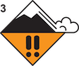
The bottom 2 feet of the snowpack is garbage: sugary facets and a couple layers of surface hoar. I recommend staying off slopes steeper than 30 degrees and be extra careful traveling under slopes. The avalanche danger is HIGH on previously wind-loaded slopes and CONSIDERABLE on all others.
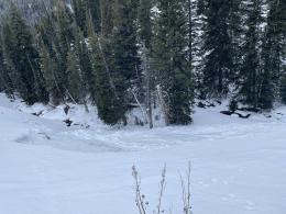
Yesterday, Dave and I went into the Throne in the northern Bridger Range. The conditions we found were expected and also similar to the northern mountain ranges: weak and unstable. We did not need to do a stability test because the collapses were numerous and loud and indicated that we could trigger a slide from hundreds of feet away (aka remote trigger). In the last few days, skiers remotely triggered Flanders Mountain, Hyalite Peak, and Dave remotely triggered a slide from 750 feet away (video) on his snowmobile at Buck Ridge. Not far from the Throne, a lone skier triggered a large avalanche on Saddle Peak on Sunday (details and photos). Collapsing, cracking, a small slide on the Throne triggered Sunday by a few wet snowballs, and nervousness about triggering the slope above us made our decision to retreat an easy one (video). Further south in Beehive Basin, students in an avalanche class were able to take advantage of the unstable conditions and intentionally triggered a small test slope (observation and pics).
If you go into avalanche terrain it’s likely you’ll trigger a slide today. Consequently, the avalanche danger is rated CONSIDERABLE.
If you venture out, please fill an observation form. It does not need to be technical. Did you see any avalanches? How much snow is on the ground? Was the wind moving snow? Simple observations are incredibly valuable. You can also contact us via email (mtavalanche@gmail.com), phone (406-587-6984), or Instagram (#gnfacobs).
Upcoming Avalanche Education and Events
Our education calendar is full of awareness lectures and field courses. Check it out: Events and Education Calendar.
Every weekend in Cooke City: Friday at The Antlers at 7 p.m., Free Avalanche Awareness and Current Conditions talk, and Saturday from 10 a.m.-2 p.m. at Round Lake Warming Hut, Free Rescue Practice.
We offer Avalanche Fundamentals with Field Session courses targeted towards non-motorized travelers in January and one geared towards motorized users. Sign up early before they fill up.
King & Queen 2024, 3 February 2024. Form a team or sign up individually to hike laps on the Bridger Bowl ridge to fundraise for the Friends of the Avalanche Center.
Loss in the Outdoors is a support group for those affected by loss and grief related to outdoor pursuits. Check out the link for more information.
KING AND QUEEN OF THE RIDGE, FEBRUARY 3rd
Do you like to hike? Do you like to ski? Then the King & Queen of the Ridge is for you. Hike, ski and raise money for the Friends of the Avalanche Center in their 2nd biggest fundraiser of the year. Join the effort to promote and support avalanche safety and awareness! Fundraising prizes for the top 5 individuals who raise over $500. No racing is necessary to compete for the fundraising prizes. Info is HERE. Race participants for the February 4th event must register separately with Bridger Bowl HERE.
Since January 10th there have been four avalanche fatalities in the US. A snowboarder died outside Ophir, CO, a skier was killed in an avalanche in the Salt River Range, Wyoming, a skier died in avalanches near Lookout Pass in Idaho, and a skier died in an avalanche inbounds at Palisades Tahoe in California. Don’t let your guard down.