Snow Observations List
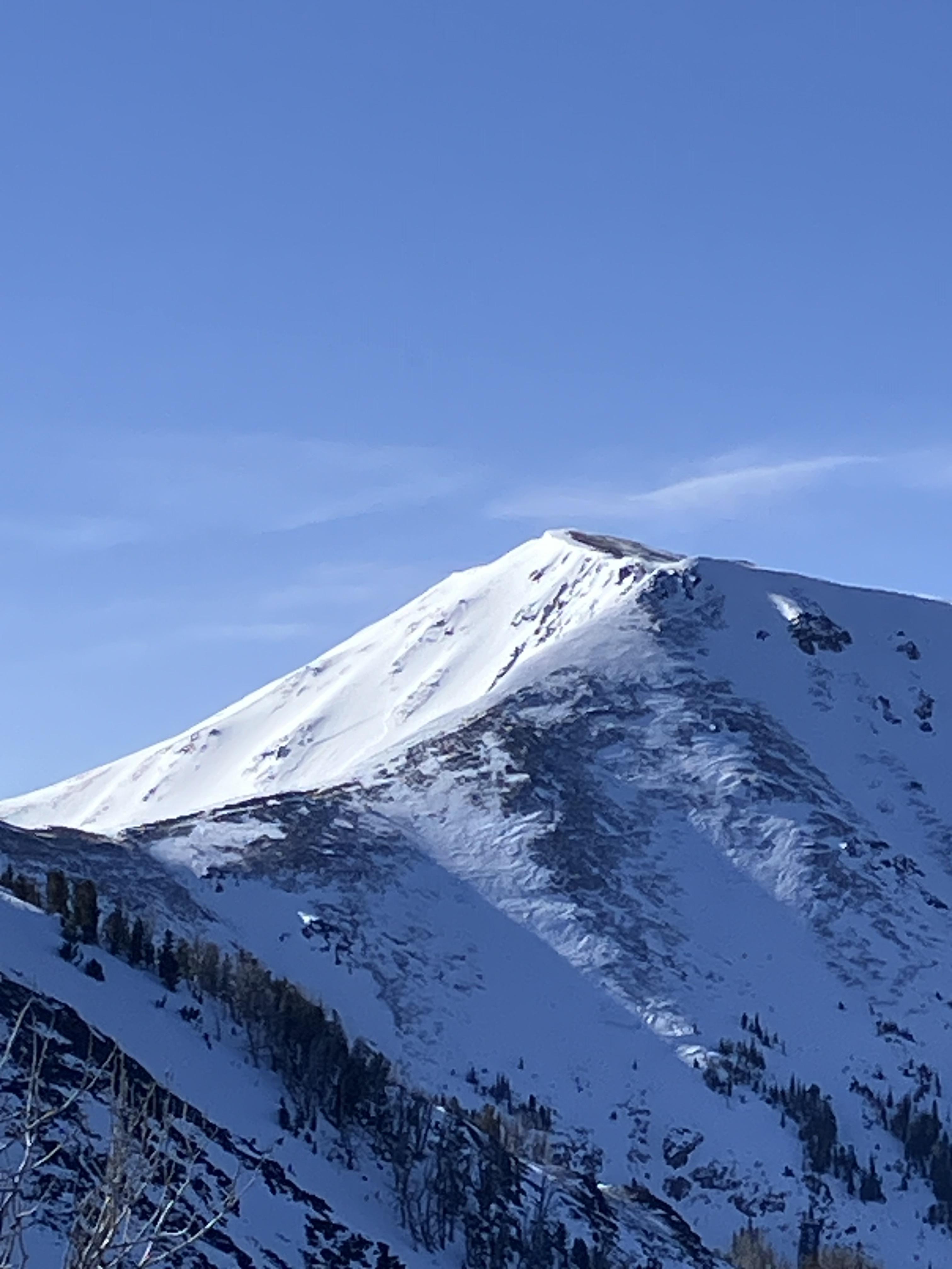
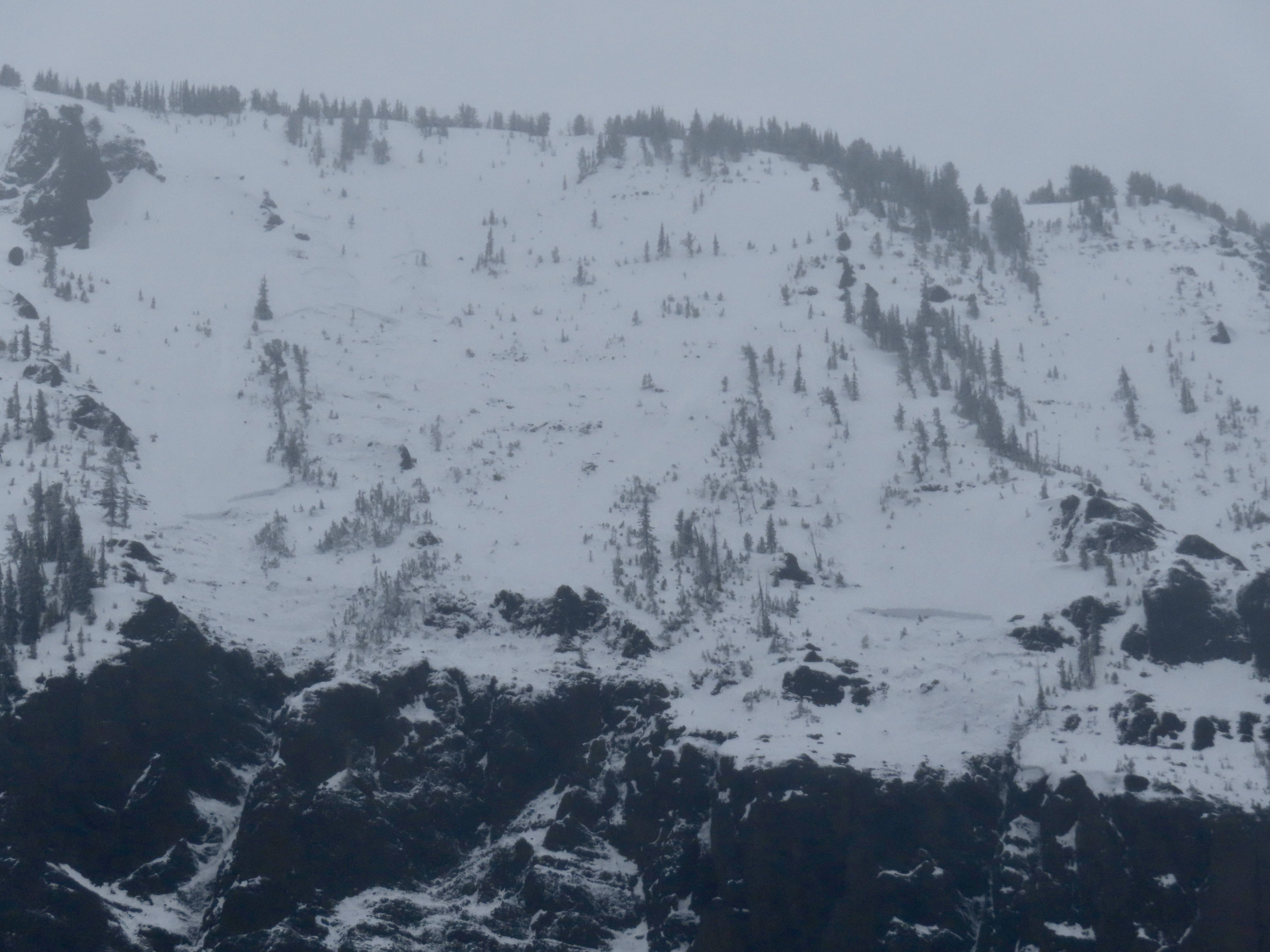
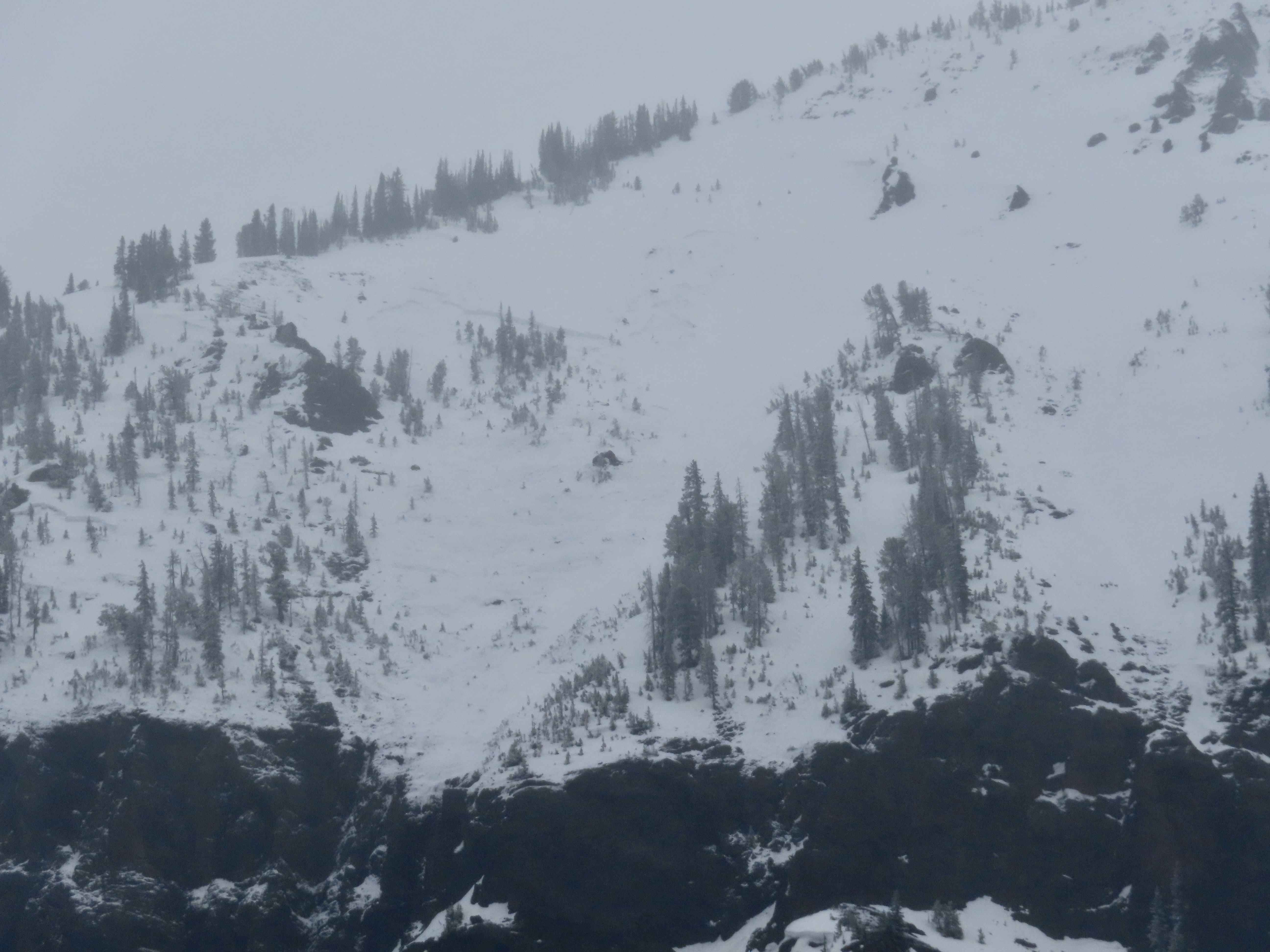
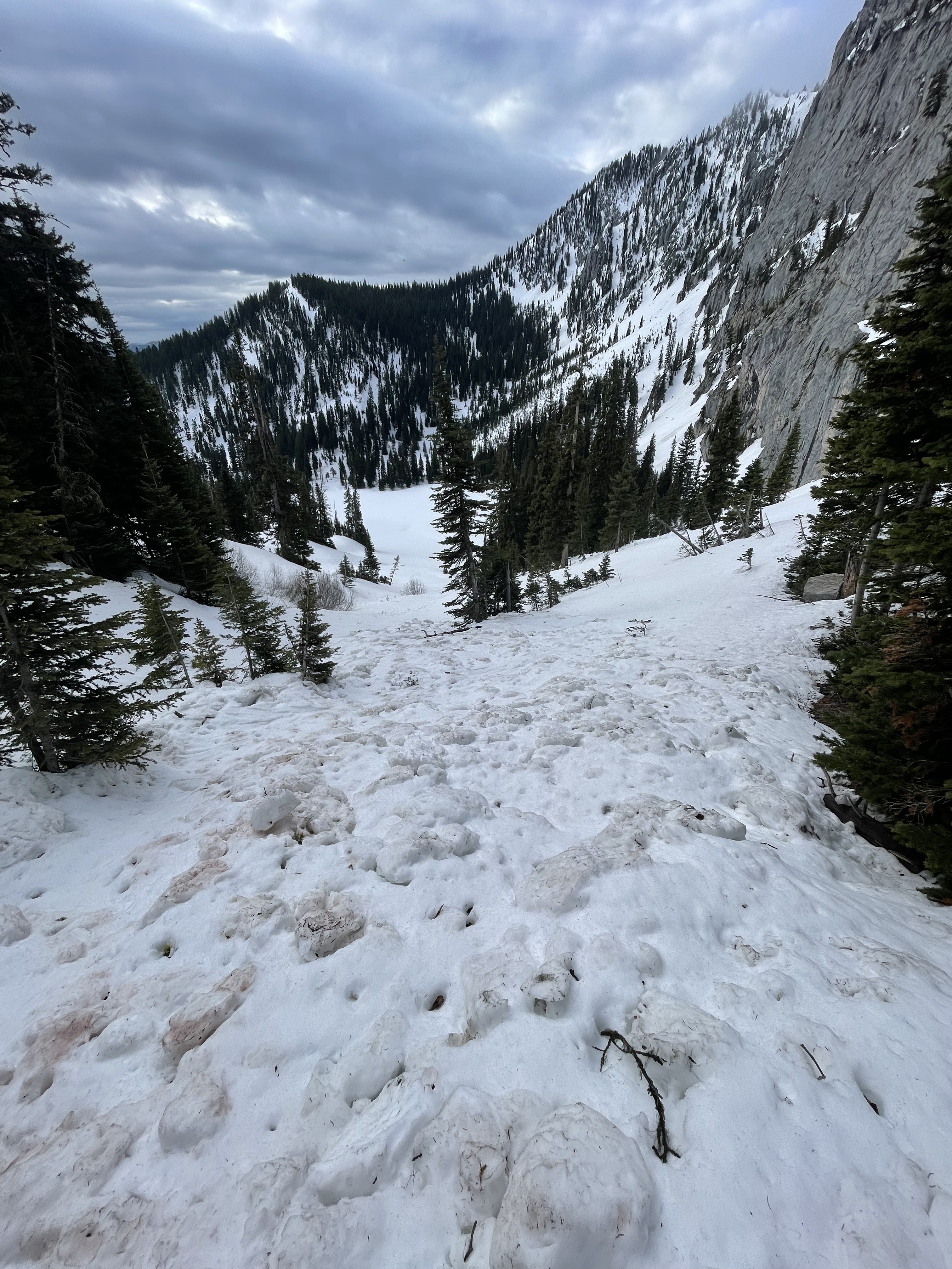
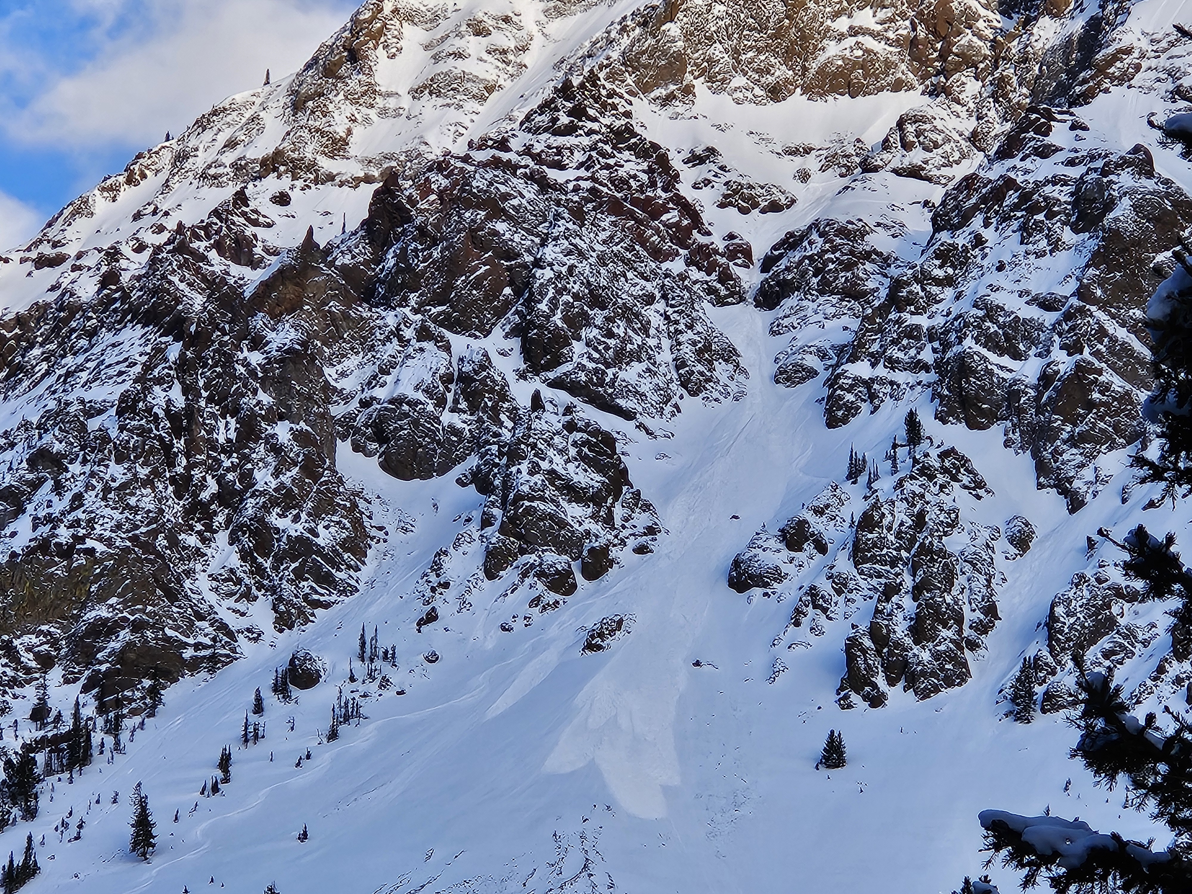
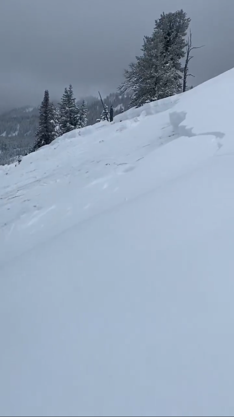
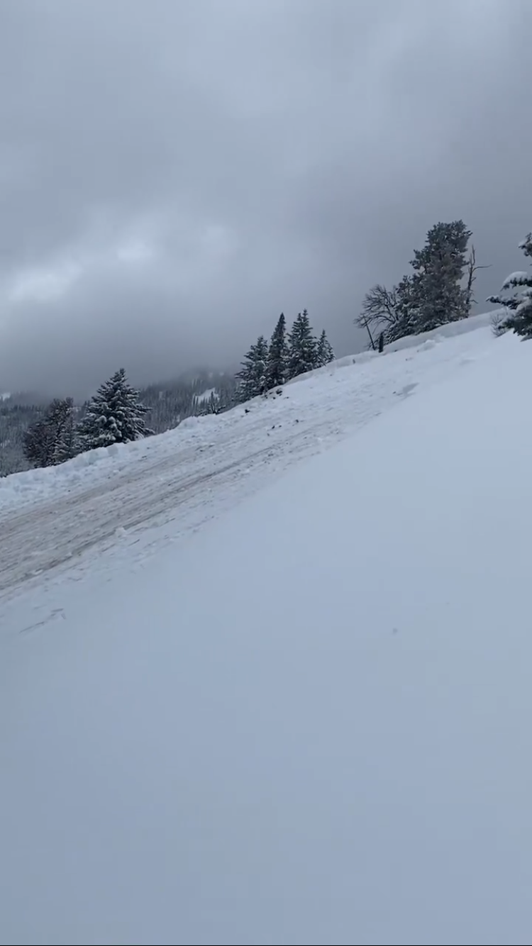
We toured to Elephanthead Mountain today (4/27/24). Most of the couloirs emptying into Mission Creek (e.g. Das Ist Ice, Pitchfork Couloirs) showed signs of recent, large scale wet slides. Higher on the mountain, we observed fairly recent avalanche debris and crowns of 4-5 feet. On our descent of Mission Creek, we crossed large, wet slide debris fields that buried our earlier skin track (see pic). Our decision was to stick to low angle terrain and to steer clear of runout zones of any couloirs.
Full Snow Observation Report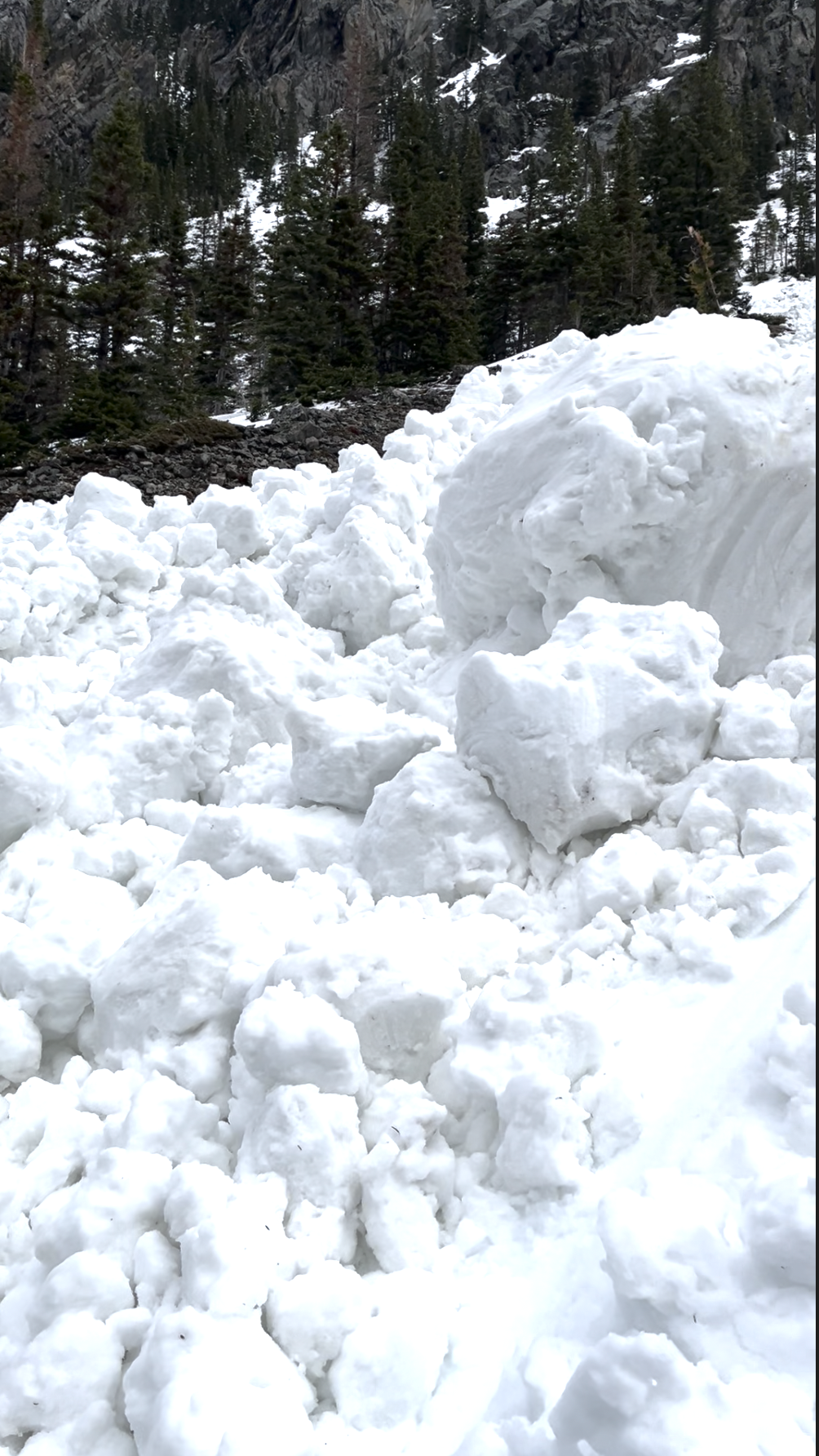
We toured into beehive today starting at around 7:30 AM. We found about 2-4" of fresh wet and heavy snow. Lightly snowing all day until we left around 12 when the snow picked up a bit. Passing fog in and out all day. Around 9400' we dug a pit to the ground (east facing). ~95cm deep. We found about 5" of thick snow from the last two days, on top of a thin layer of graupel and ~4" of very wet snow that had not refrozen from the previous warm-up. The rest of the snowpack was also wet to the ground, but not to the same extent that the upper couple of inches were. Near the ground was definitely a weaker structure, but was also now saturated and closer to "corn snow" than anything. Also noted an ice layer about half way though the snow pack.
In our pit we got cracking in the new snow (ECTN9) and in the top (8-9" down) of the saturated snow pack (ECTN18), but no propagation. A shovel shear test revealed our two layers being about 8-9" down at the bottom of the very wet layer, and at the interface with the ice layer halfway down. No collapses were observed. No avalanches were observed. We got some sluff while we were skiing, but only when skiing/hop turning aggressively. We chose to ski some steep and short couloirs.
The skin track had decent coverage besides a few spots in the trees. It was rain mixed with snow in the parking lot around 12:45, which quickly turned to rain as we drove towards big sky.
Full Snow Observation Report
On 4/26/24 large natural wet slabs were seen running on Wall Mountain near Silver Gate. An observer from Beartooth Powder Guides sent us a video of them happening at 3pm while it was 43 degrees F. I also noted a similar large crown on the north side of Republic Mtn. that probably also happened this afternoon.
Full Snow Observation Report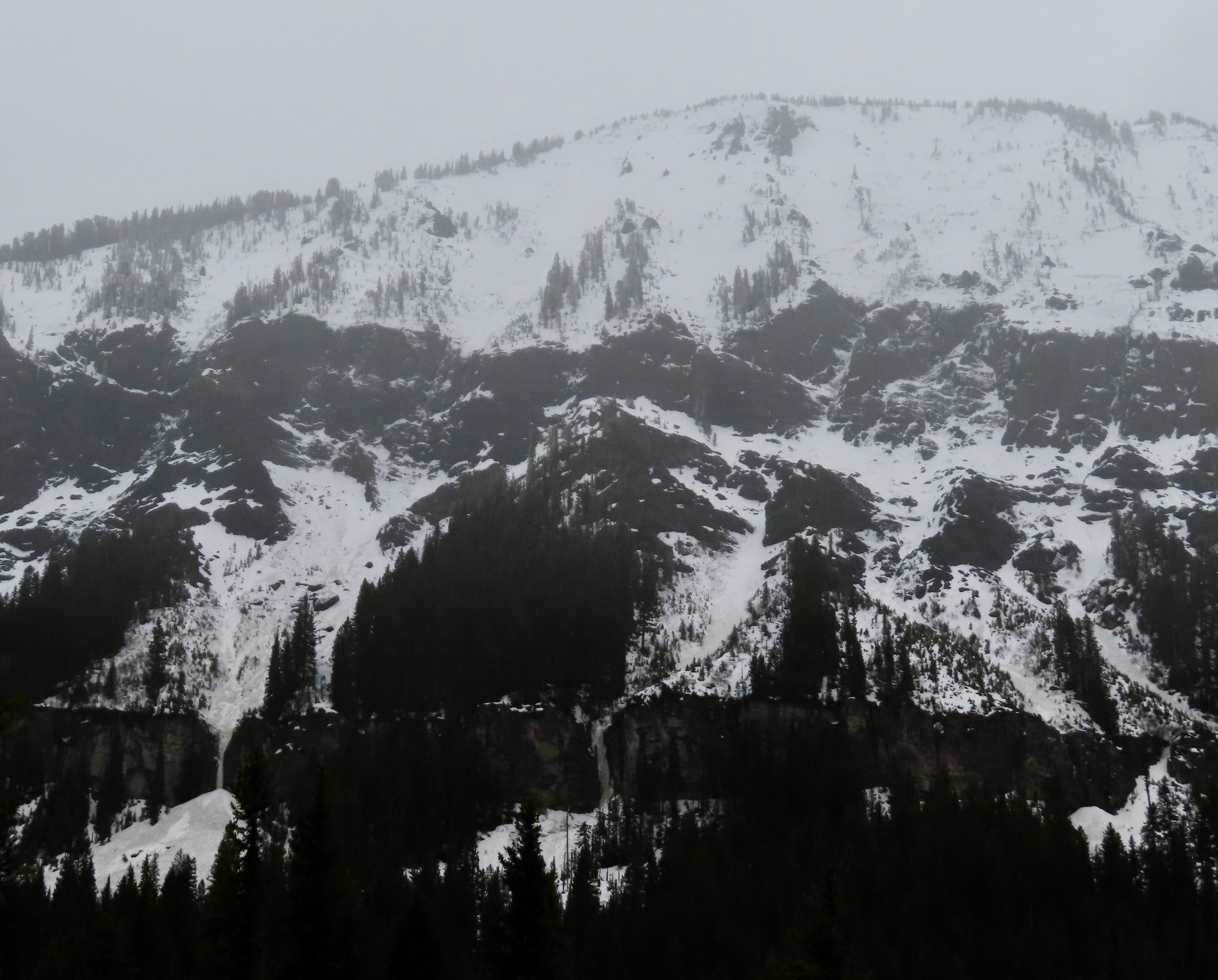

From IG on 04/26/2024
Full Snow Observation Report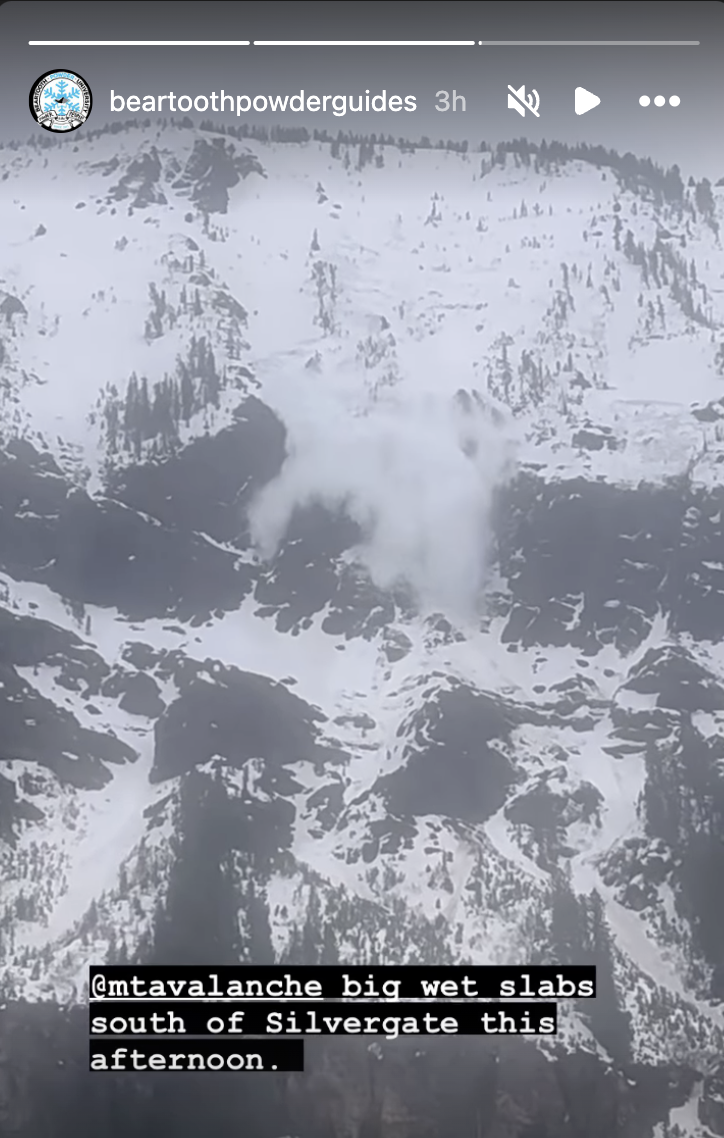
When setting out to Beehive Basin today we only imagined wanting to bail if rain line was at the trailhead, but had not expected our seasons long standing PWL to turn us around. With a few inches of snow at the trailhead and temps just at freezing we set out. The new snow yesterday/last night capped a warm snowpack, keeping the snowpack from freezing at all (no crusts or other signs of superficial freezes up to 9,200ft where we bailed despite the mid-20’s temps recorded overnight). Almost immediately out of the trailhead we got thunderous collapses so big we at first thought it was noise from control work at Big Sky. Further along we got collapses extending hundreds of feet out, valley wide and echoing up the basin. We dug to the bottom out of curiosity and found a saturated and unfrozen snowpack. The bottom 30cm was still all facets, giving the appearance that the remaining 90-110cm of consolidated snowpack was floating on air. We’re assuming the whumps/collapses are traveling along this layer of basal facets.
Full Snow Observation Reportthoughts/questions clipped from public obs. "I’m sure once it gets a solid freeze things will be alright again, but will the new snow continue to insulate the snowpack the next few nights despite the forecasted solid freezing temps? Or is this only a phenomenon that happens the 1st night of new snow falling on a warm snowpack? "
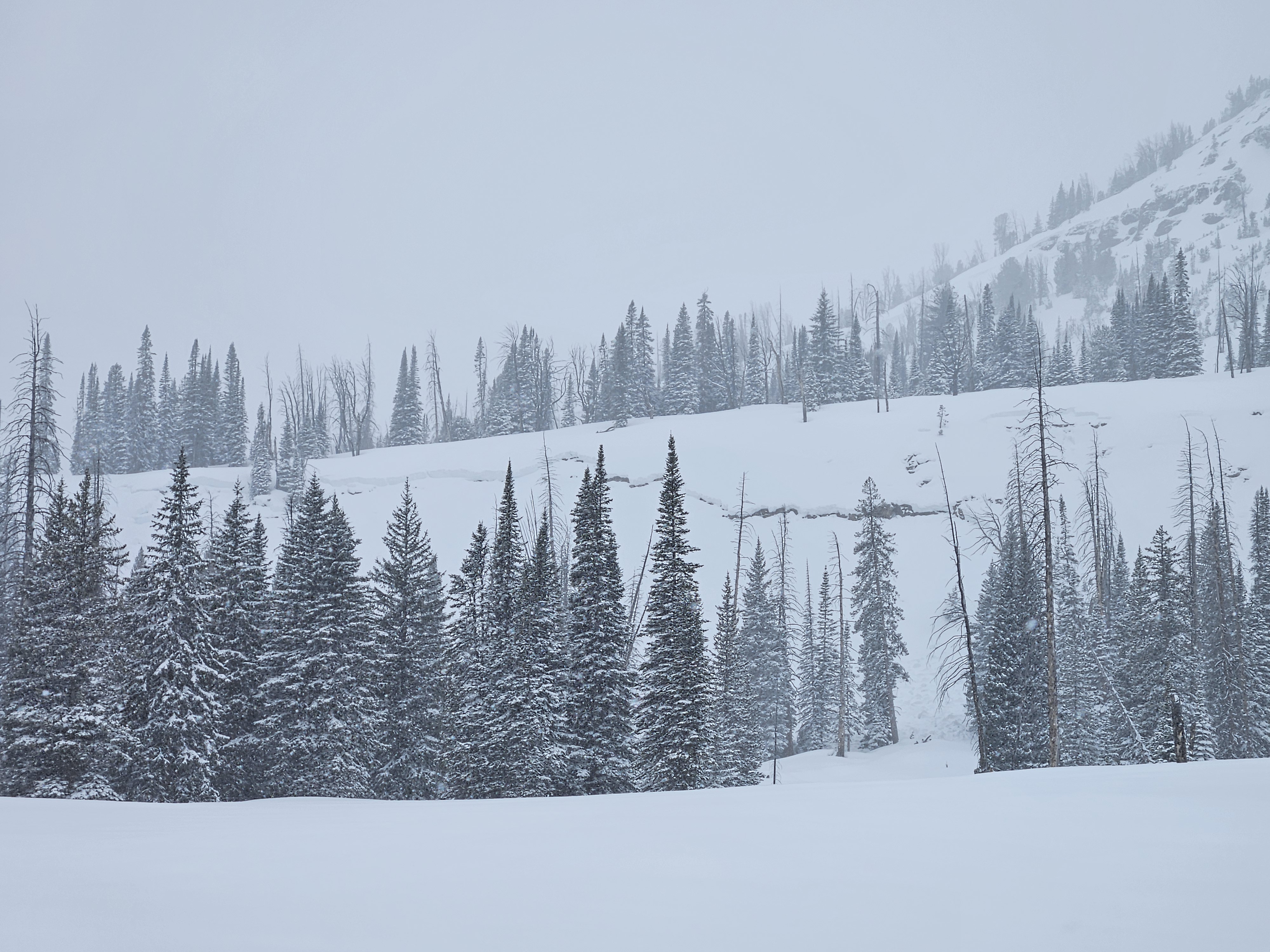
Came across a relatively large wet avalanche when approaching Texas meadows from Bradley’s meadows. Elevation around 7600ft, aspect, SSE. Depth: to ground.
Considering the new snow on top of the debris, I’m guessing this slid prior to the storm last week. The slide path was melted out to dirt. Out of curiosity, we dug just to the lookers right of the slide and found soft snow near the ground - still evidence of crystal structure but could make a snowball if squeezed. Best guess is that a point release wet slide entrained enough snow to step down and release the whole face.
Full Snow Observation Report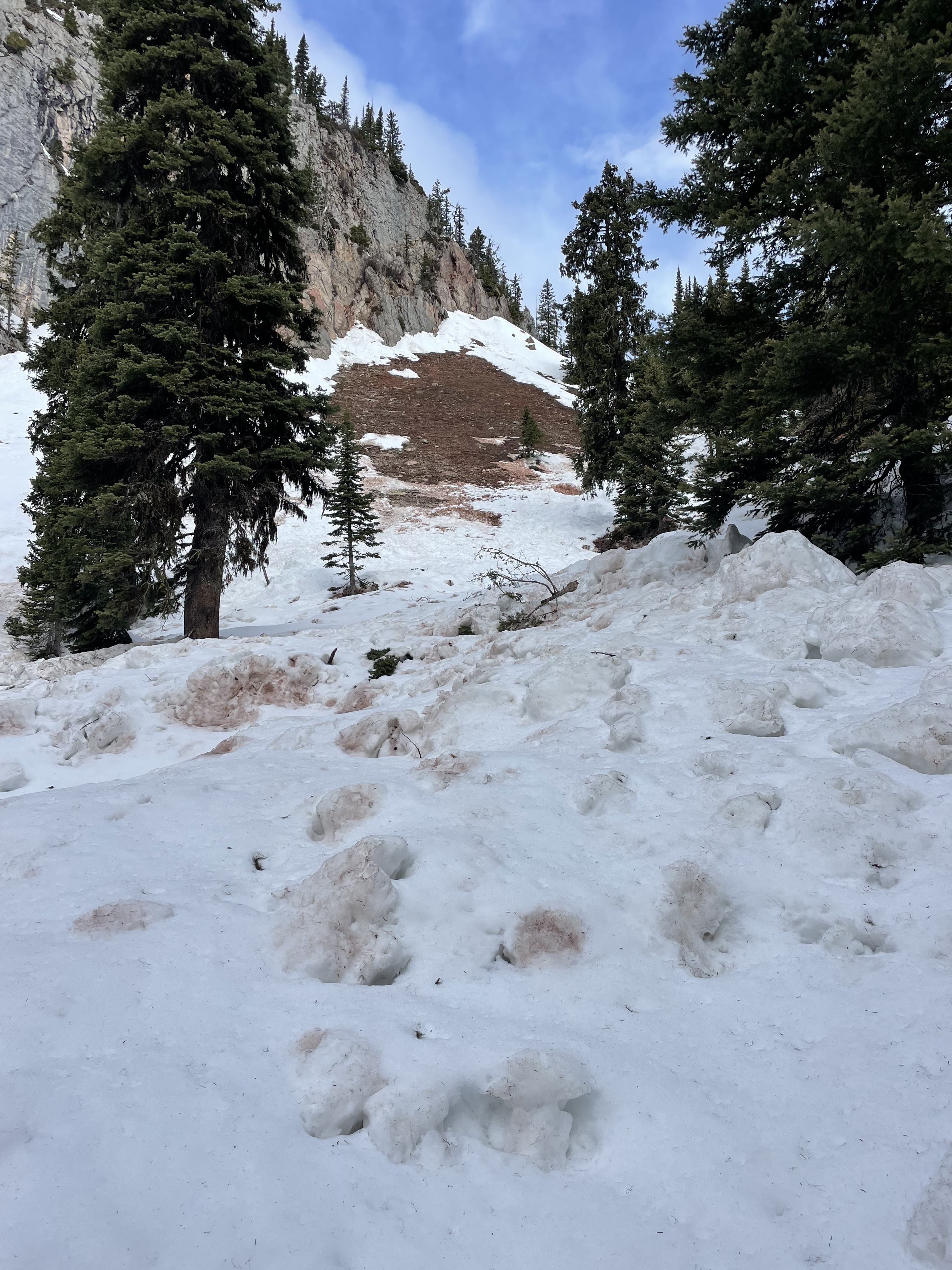
Elevation: 10231
aspect: ESE
time: 10:35, April 22nd
CTX - broke below isolated block, pit depth ~100cm
Avalanches in the goose lake area: small loose snow avalanches on shady aspects. Evidence of rollerballs and small cornice falls on sunny aspects from previous days.
Full Snow Observation ReportToured up around bell lake today and after a night of wind, triggered a very small wind slab in a north facing couloir at around 9500-10000ft. It was almost 10” deep and was about 10-15ft across. Snow was being loaded through out the day and was staying cold up high.
Full Snow Observation ReportDug a pit around 9700' on a WNW shaded aspect below a couloir on Miller Mountain in Cooke City. We found ~95cm snowpack, with 5-10" of lower-density fresh snow. We dug to the ground and found a consistent and firm snowpack all the way down, didn't find any facets at the ground. Isolated cracking, ECTN25 ~20-25cm down, below the thick melt-freeze crust from the warm-up immediately before this week's snow. The fresh snow had sluffed out on most chutes before we got there (likely during the storm) but we saw very little sluff triggered by our skiing
The fresh snow skied great on shaded aspects that hadn't been affected by wind. Non-shaded snow surfaces were definitely getting wet by 1 pm, the sun felt hot, but we didn't observe any wet slides before we left. The snow on the ride out was very wet, with watery-slush puddles on the lower parts of the trail.
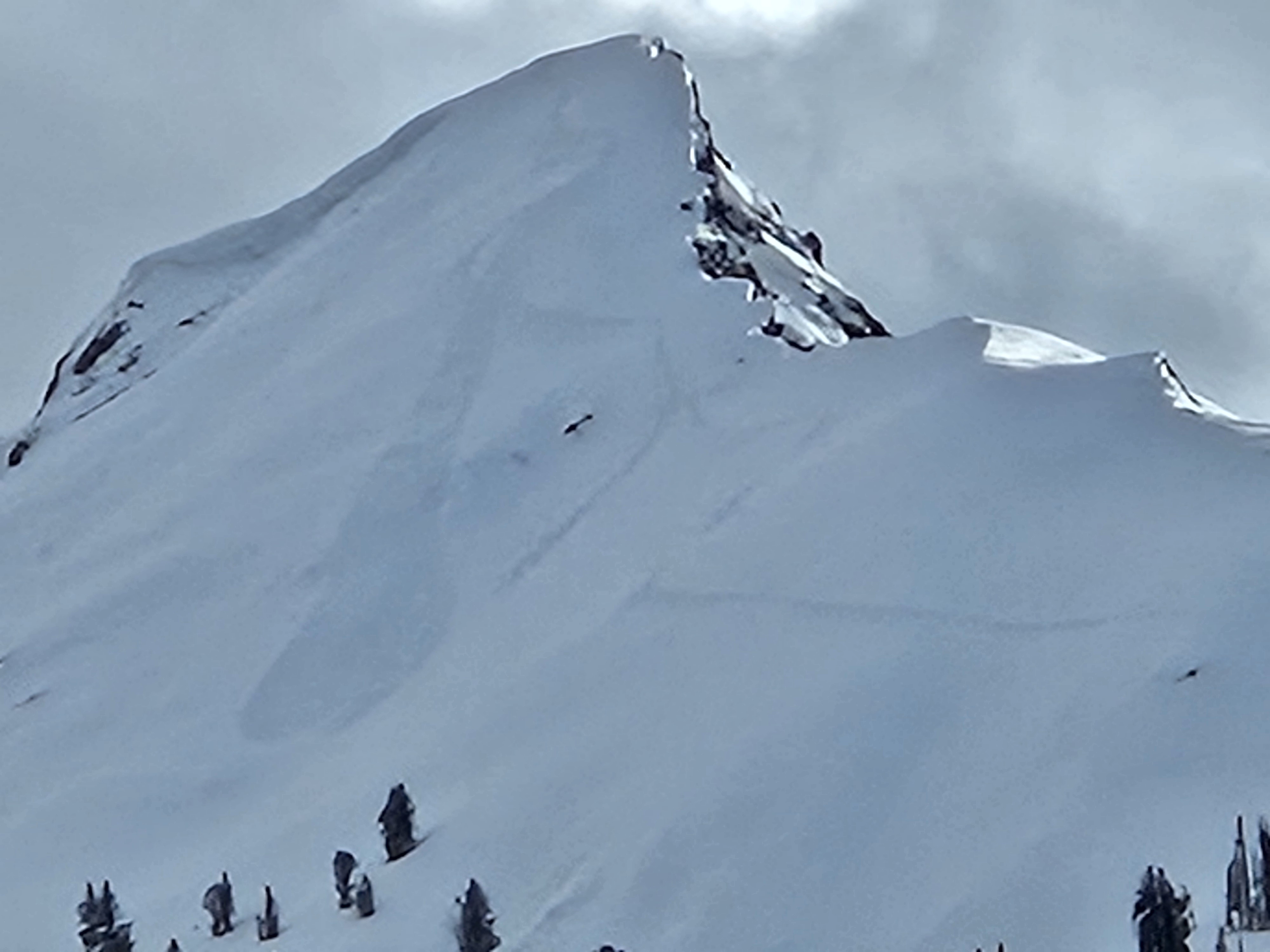
Full Snow Observation ReportCookes' always interesting in the spring, deep slab goes to sleep and the Grizzlies wake up. Curious how she knew to thread the cornice just right(Sheep Mt). Second Pic is a large sluff on the Fin, couldn't quite make out the track route till I drove to Silver Gate. He skied the hanging gully to the east of the third pic and rock climbed across the cliff to this sluff and tracks... Don't ask how I know it was a grizz, no time to get a pic.
Full Snow Observation Report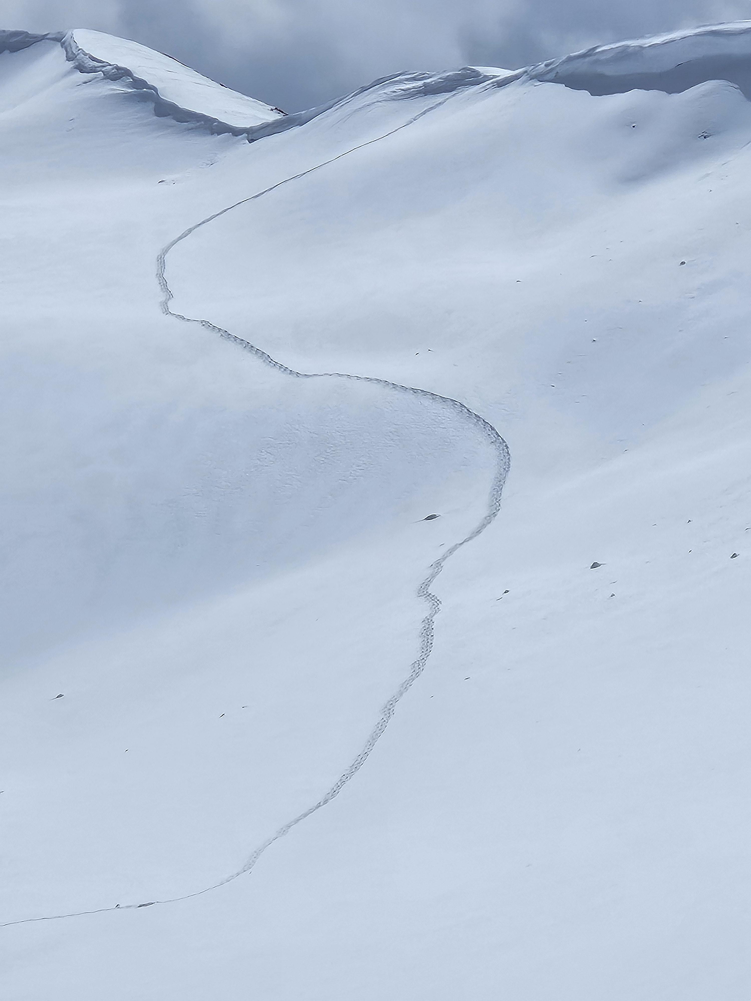
We saw several loose avalanches on WSW, ESE & SSE aspects of the ridge between beehive and bear basin. The one on the ESE slope may have been skier triggered (by another group) and the rest appeared to be natural. We found a strong crust beneath the foot of new snow throughout our route. We didn't see any cracks or whumphs, and the new snow wasn't reactive in hand pits. The snow surface was getting wet as we exited to the beehive trailhead around 3pm.
Full Snow Observation ReportOut in the Western Tobacco Roots today. Recent snow was decently wind affected and storm depths were particularly variable. One thing was common with all new snow deposits: they were bonded very poorly to the widespread underlying crust. In most areas the new snow was not cohesive or deep, so this resulted only in tricky skinning and long running sluffs.
However, where wind or sun had strengthened the slab this surface layer was reactive, with sluffs entraining significant amounts of snow and one small slab that I managed to trigger. I popped this slab underneath a mild, somewhat cross-loaded convexity on a north face near treeline, and it broke around 30 feet wide, 4-6 inches deep, and ran ~ 300 feet (N, 9500', SS- ASu - R1/D1).
The underlying snowpack showed no signs of instability, though while boot packing I did break through the crust in some shallower areas and found some basal facets. The snow surface stayed pretty cool throughout the day above 8.5 kft, and winds were light out of the west.
Full Snow Observation Report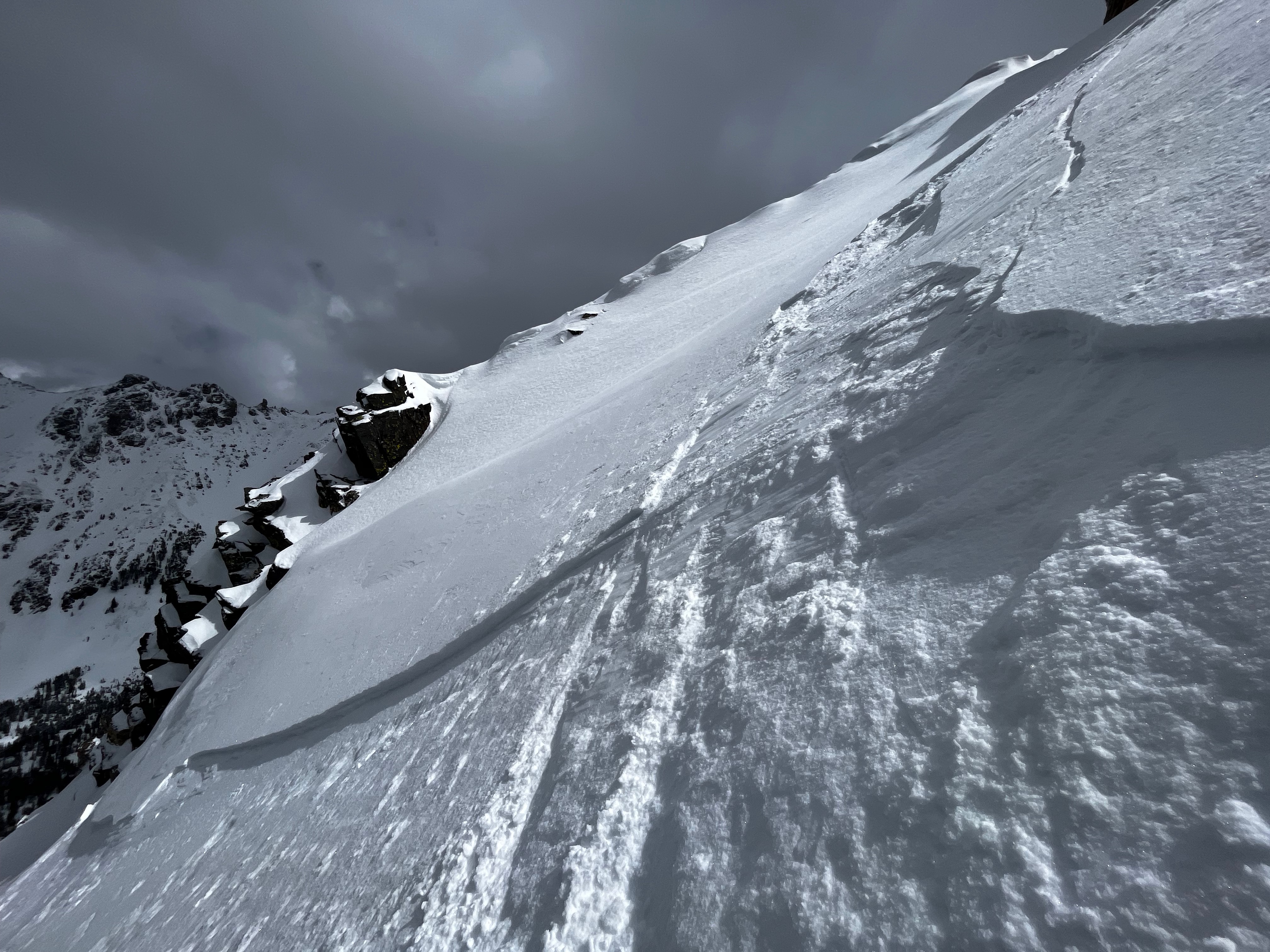
Skied the Banana Coulior off Ross today. 6-8" of fresh, dry snow has fallen and lies above a bomber crust that was observed on all aspects we traveled on. The weak interface between new, dry snow and the pervasive crust allowed for a large sluff, or dry-loose slide, that began near the top of the Banana Coulior and ran for ~ 500'
Full Snow Observation ReportFrom IG message 4/17/24: "Remote trigger up little bear today. Went to the groundish."
Full Snow Observation Report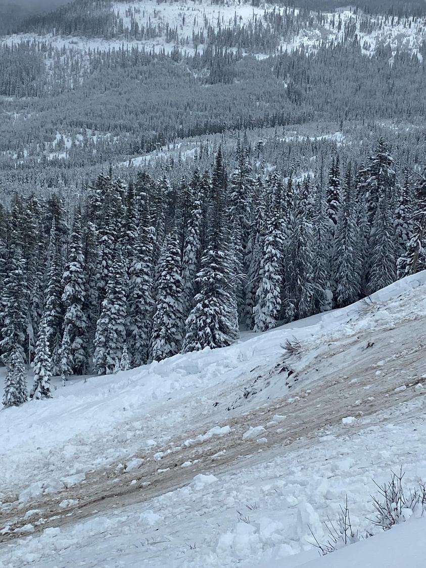
Wet slab 150-200 ft across, SE shoulder of Abundance towards Wolverine. Looks to have maybe happened before new snow. New snow 6-8 was extra funky, 2-3 powder on a rain? crust on heavy wet. Bonded to unsupportive melt freeze on completely saturated glop. Lots of short running sluffs
Full Snow Observation Report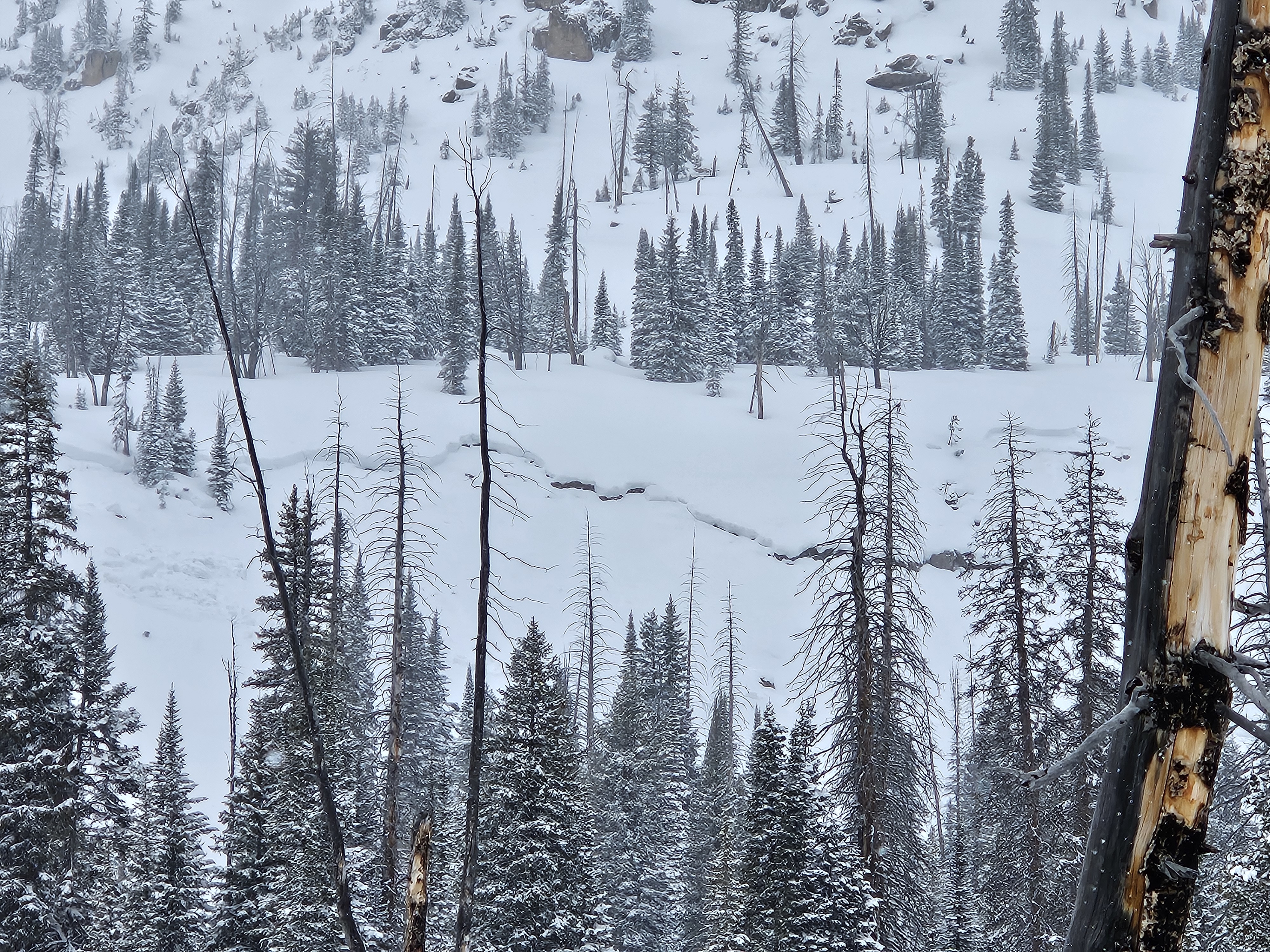
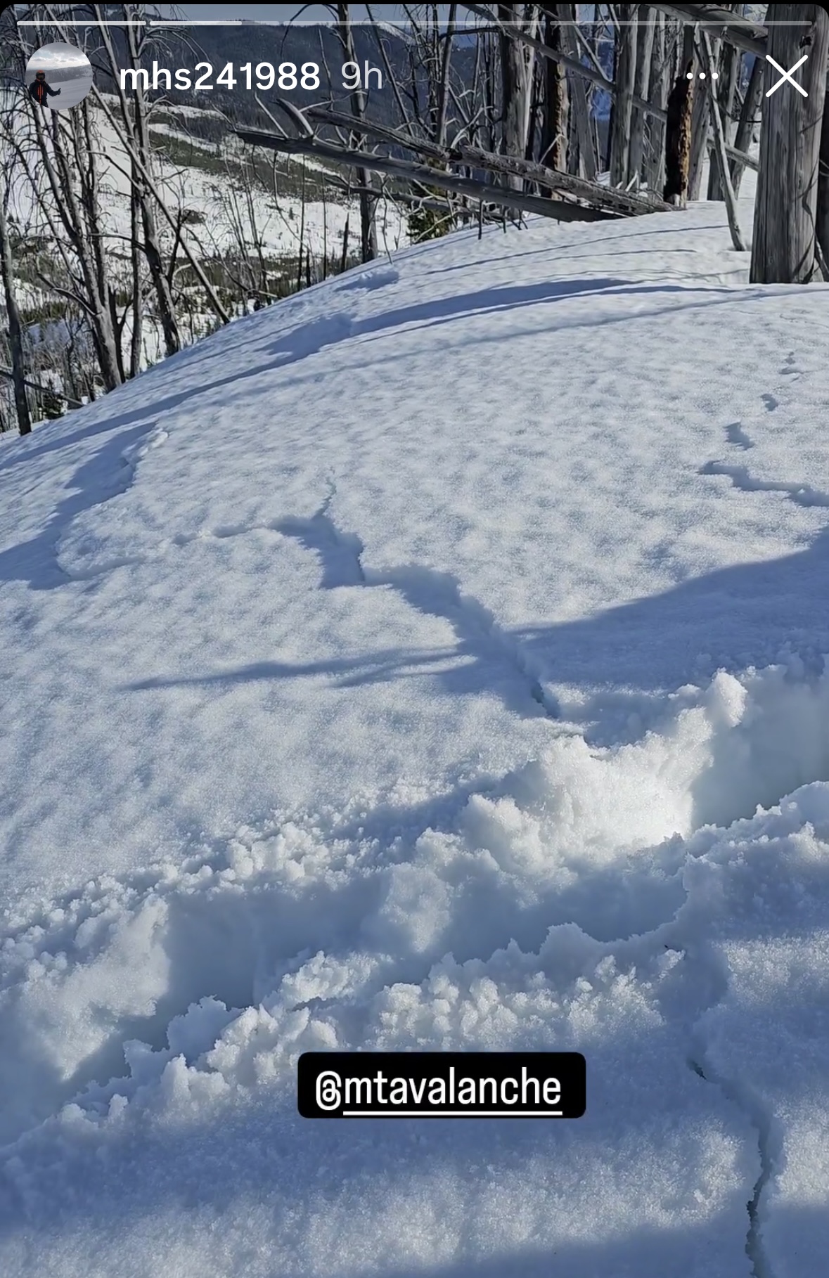
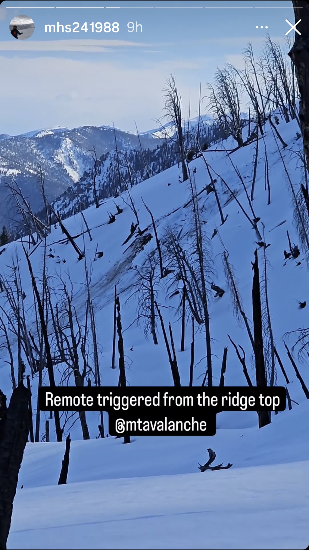
From IG: A group of riders noted very wet snow west of Cabin Creek and Southwest of the Taylor Fork. They were sinking to the ground where it was unconsolidated. The group remotely triggered a wet slab avalanche from the ridge top. There were shooting cracks that connected their location to the avalanche. This is an interesting of persistent weak layer and wet snow avalanche problems.
Full Snow Observation Report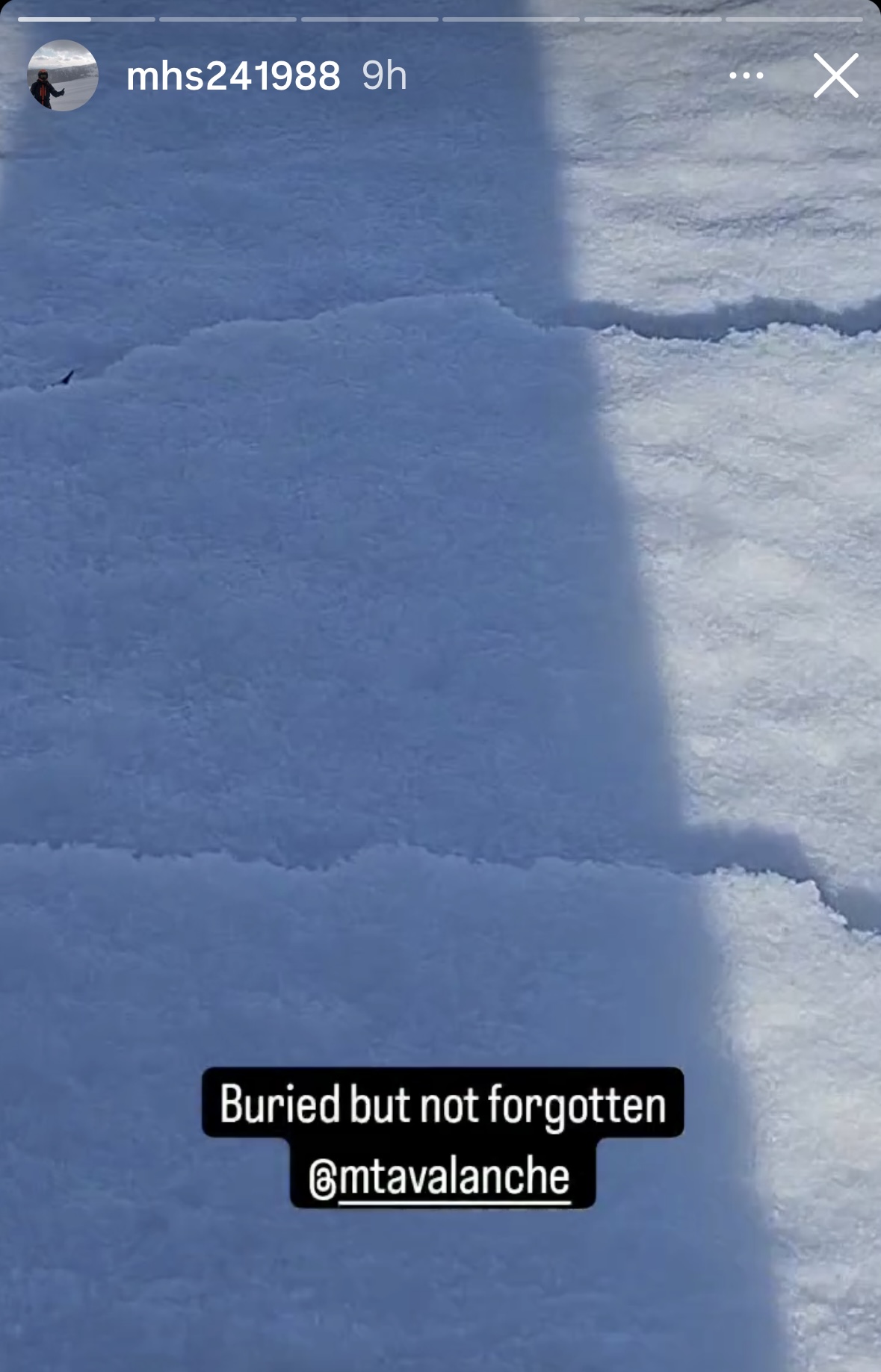
From IG: Wet slide to the ground above Quake Lake.
Full Snow Observation Report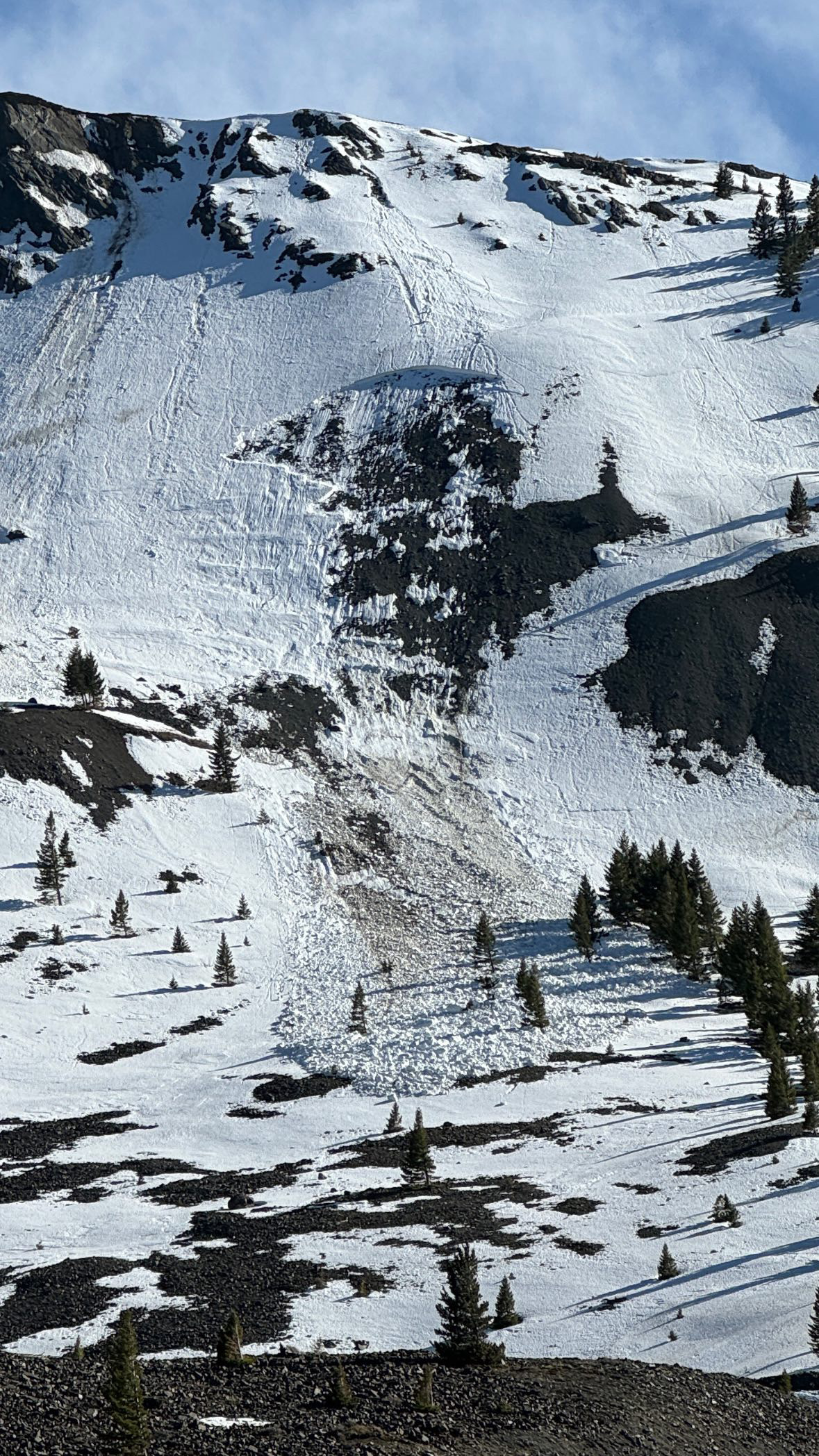
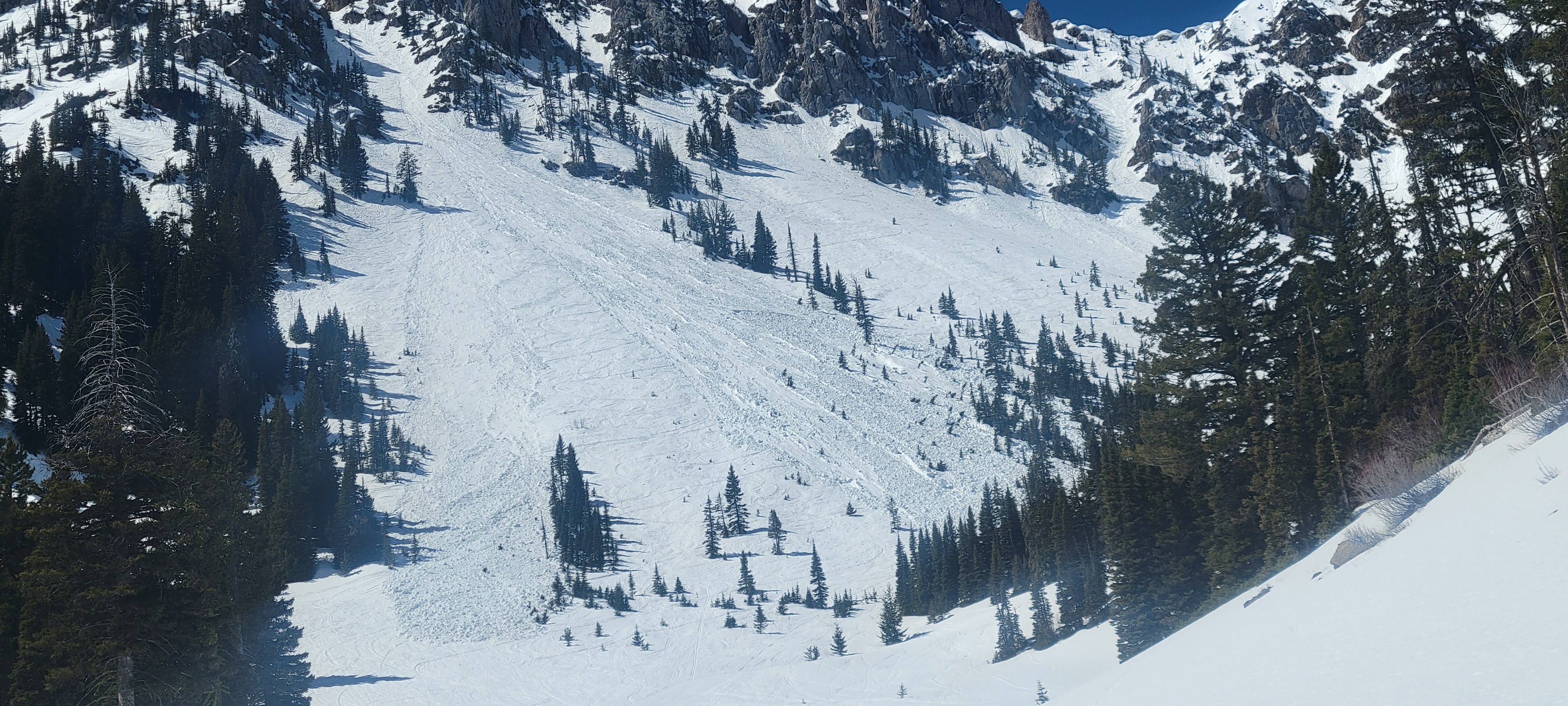
On sunday 4/14 a large wet loose avalanche ran naturally in closed terrain at Bridger. The larger of the two in the photo is from 4/14 at 1230pm. The other slide, on the left, happened yesterday or late in the day Friday.
Full Snow Observation Report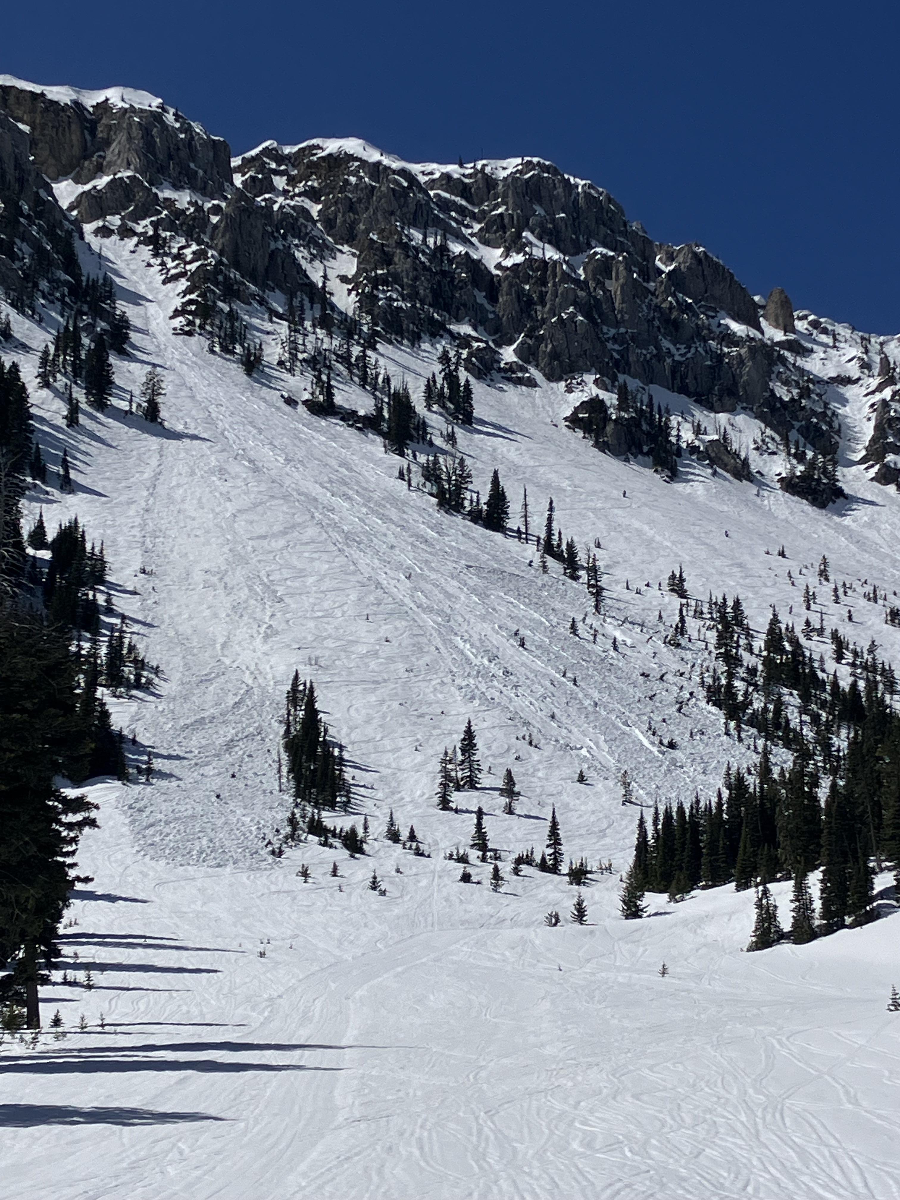
Saw what looked like a wet slab avalanche from the road along the Madison River. Roughly north facing slope at 7500'.
Full Snow Observation Report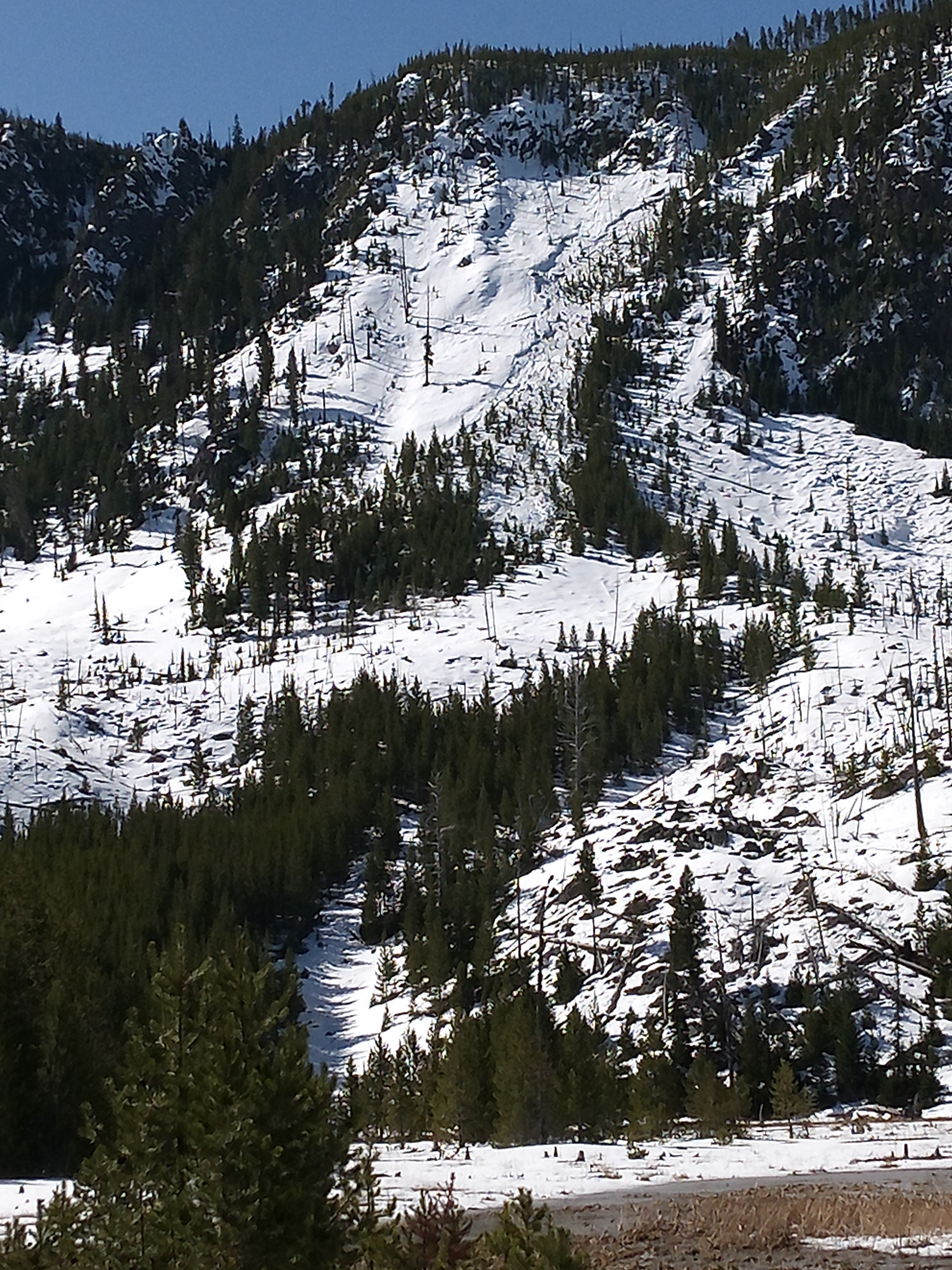
Saw a slab avalanche on a NE face at around 9000-10000 feet. Did not see any signs of instability on the tour, but there was not a very concrete freeze. Everything below 8000 remained unfrozen.
Full Snow Observation Report