Snow Observations List
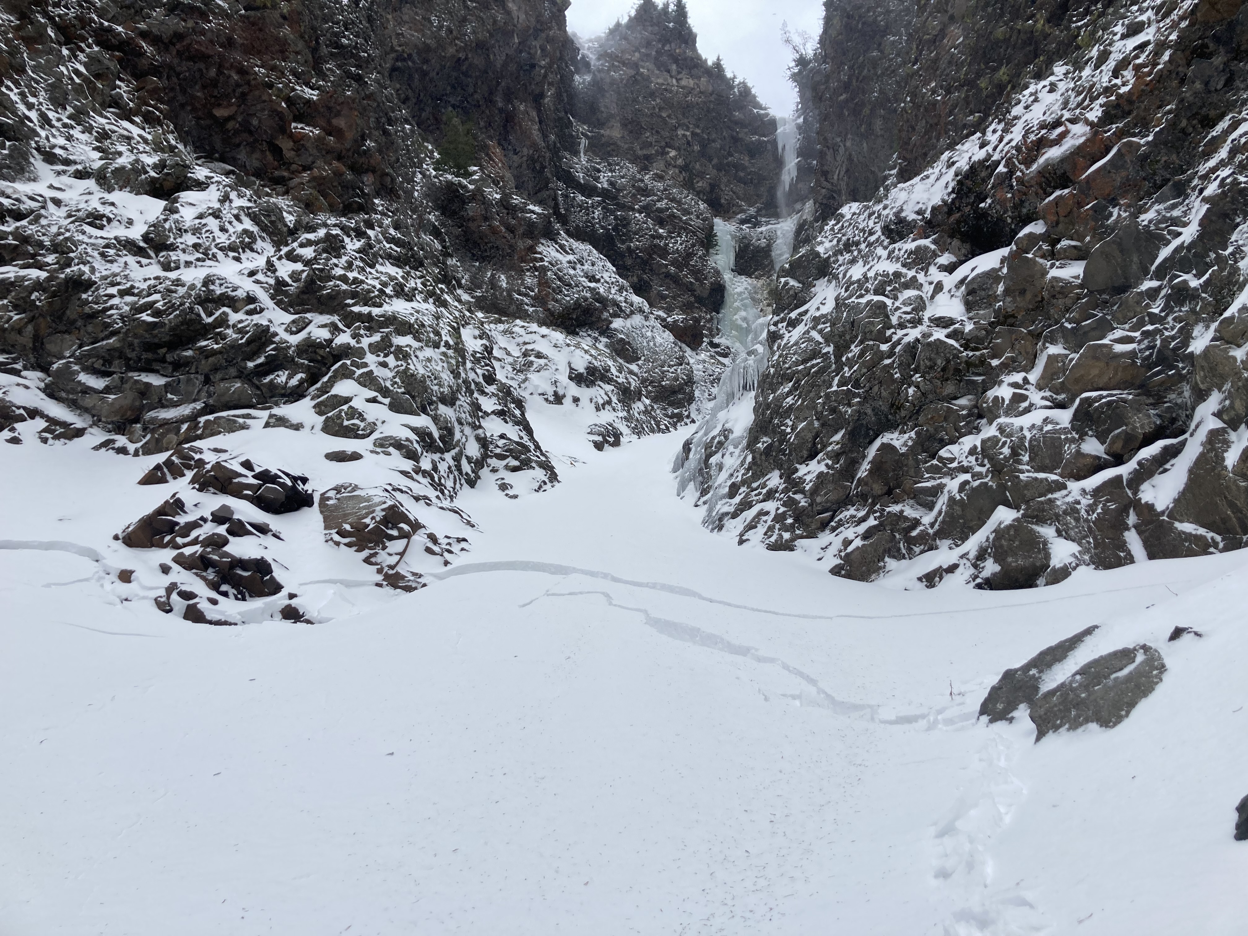
8" of snow fell in 3 hours this morning. We inspected the snowpack in the gully above Silken Falls for the Bozeman Ice Festival. New snow and wind are increasing the avalanche danger. Be careful crossing gullies, especially the one above the Sceptor, the one below Responsible Family Man, Avalanche Gulch and Silken Falls. Triggering an avalanche in these is a very real possibility as they continue to get wind-loaded.
Full Snow Observation Report
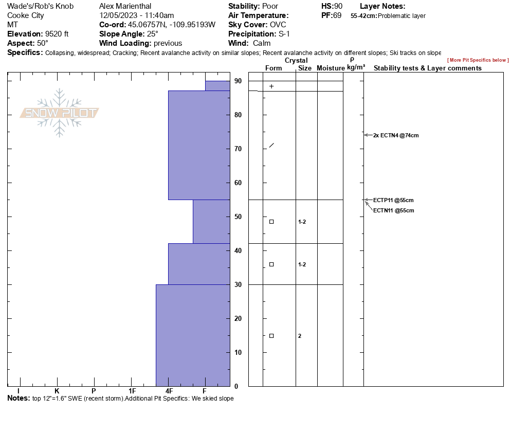
We rode up Daisy Pass road and dug below the road at 9,510' on a WSW aspect. Snowpack was 2.5feet deep (87cm). The recent snow was 1 foot =1.6" SWE (measured in field), sitting on a hard crust above 2mm facets which made up the bottom half of the snowpack. We got an ECTP11. We dug a second pit near Lulu Pass on a NE facing slope at 9,520', and found a very similar snowpack structure, without the crust below the recent snow, and also got ECTP11 as well as some ECTNs.
We saw a couple 8-10" deep natural avalanches on the steep slopes above Miller Creek that probably ran in the last 24-48hours. We had multiple collapses on the NE facing slope where we ski toured to dig our second pit.
Full Snow Observation Report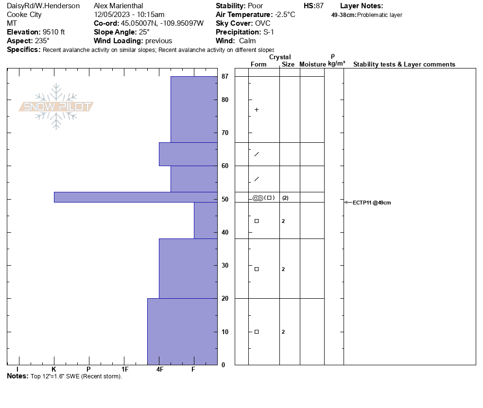


Constant red flags on W Henderson.
Full Snow Observation Report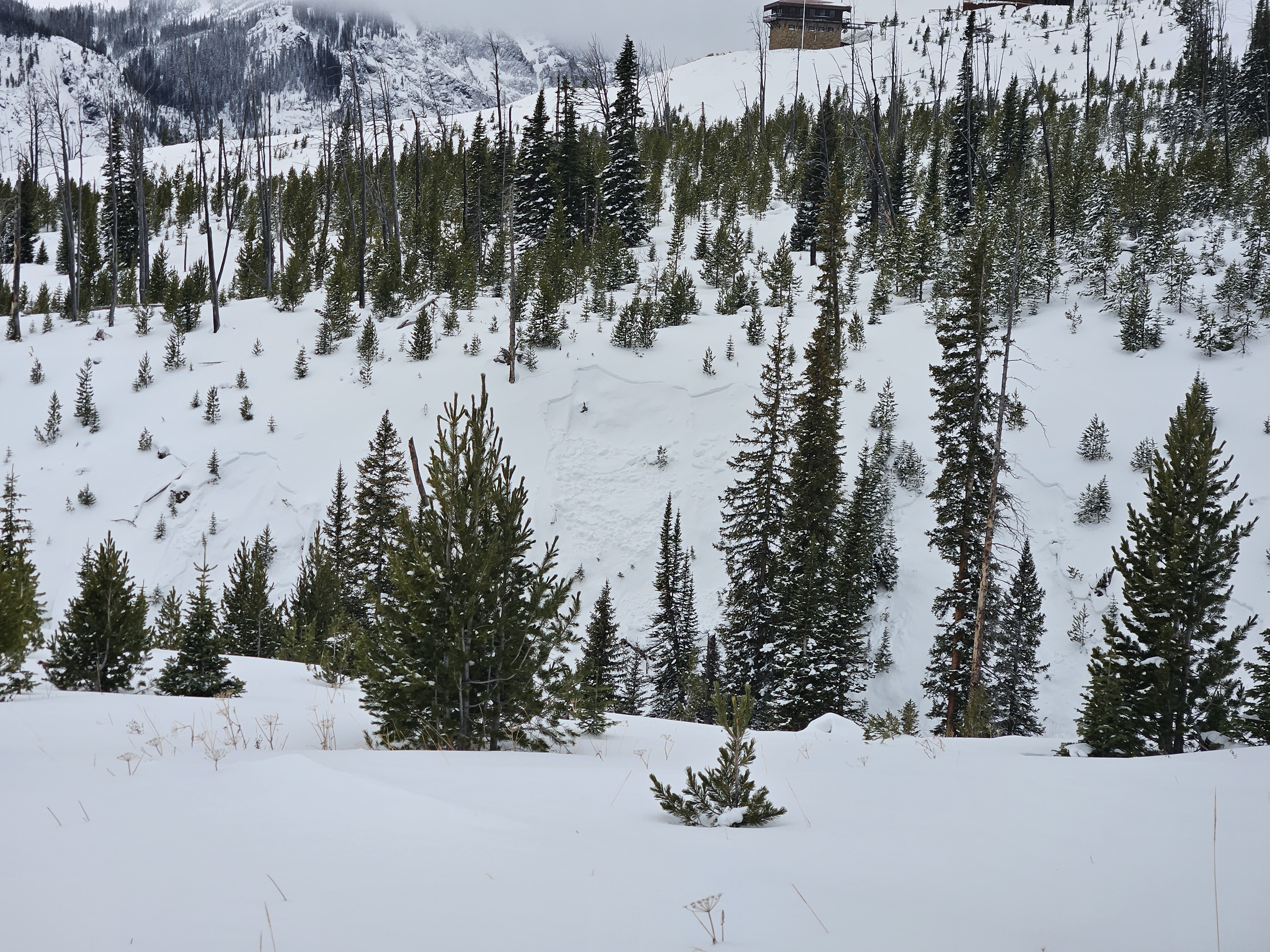
From FB Comment: "We were seeing shooting cracks in the snow Sunday in the Black Canyon area."
Full Snow Observation ReportFrom text message: "The attached picture is a little slide that went off when I was doing small turns on an adjacent slope. That's Beaver Slide! There was more small slides south in the trees. Heard whumphing here and there."
Full Snow Observation Report
Toured up to the east ridge of Blackmore. About what you’d expect. Old snow was only about 20cms deep. Mix of crusts and facets depending on aspect. New snow from the past few days ranged from 10cms-30cms in the most wind loaded areas. Experienced whoomfing and collapsing while skinning in wind loaded areas. Very bony skiing off the lower ridge. Walked the trail back down due to lack snow.
Full Snow Observation ReportSkied south of Cooke City today. LOTS of collapsing and cracking. (maybe 30 good collapses throughout the day) Felt confident that one could have easily triggered an avalanche today if they wanted to.
New snow: about 10cms more last night. Warmer temps, so the new snow was slightly upside down from the weekend's fresh snow.
ECTP2 on a west aspect at 9200'. Snowpit attached.
New/ old snow interface is the layer of primary concern. (persistent slab problem)
No avalanche activity observed.
Full Snow Observation Report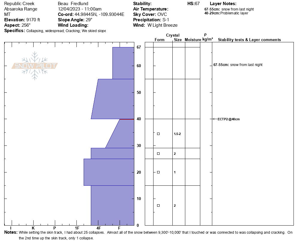
Lots of cracking and collapsing on skin track and ski cuts were reactive on steeper slopes. Dug on NE slope 9640'. HS 110cm ECTN 12 & ECTN 14 40cm down.
Full Snow Observation Report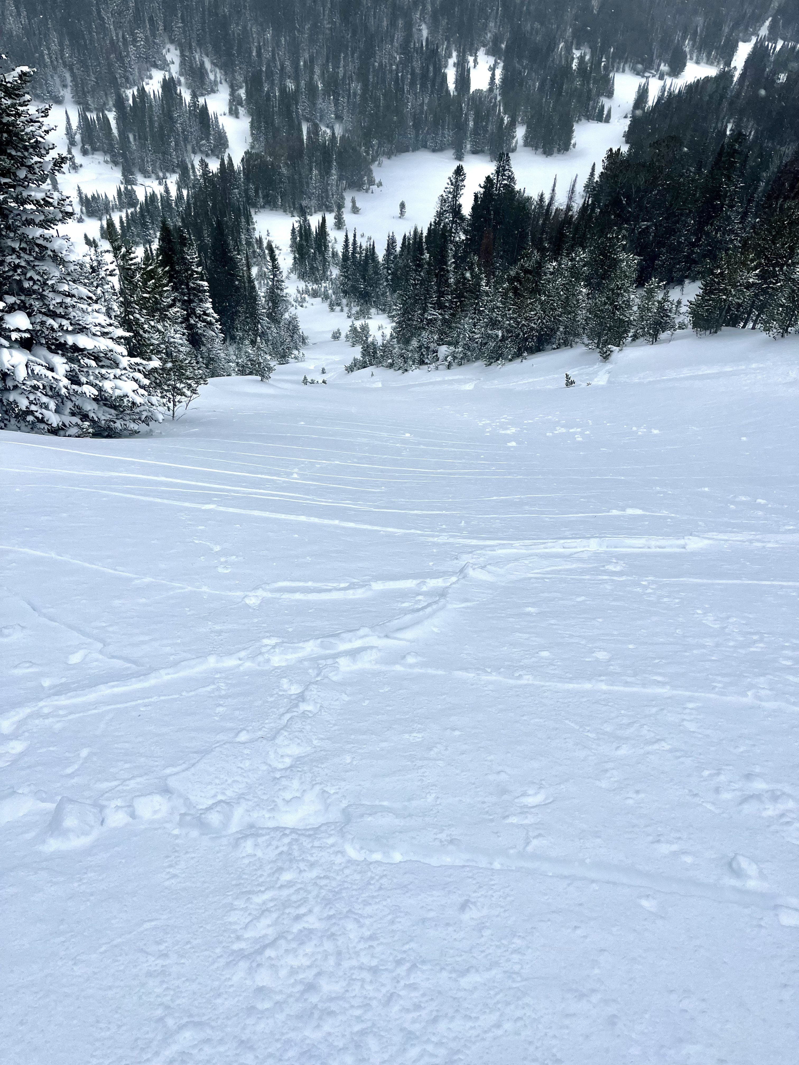
Climb above Dribbles today. No surprise but where yesterday/last nights new snow has been drifted onto old snow, there is a wind slab problem. We found this combo in gullys above 8000 ft, slab depths to 50 cm, interface is 1-2mm FC. There are also graupel layers within the new snow that were reactive but less concern about those. We experienced numerous collapses and triggered a size 1 pocket that moved 6 in downhill. Just needs a steeper slope angle or a bit more slab and things will get interesting.
Big picture with all the kooks coming to town for icefest it’s kind of funky conditions up there right now, lots of bare ice/rock making for a fall hazard in many places we normally don’t, and poor structure in the gullys, especially higher up. You can go from bare rock/ice to 1.5 m snow in just a couple steps. With continued wind and/or precip things could get active.
Full Snow Observation Report

I skied the E. facing meadows above the Erma Mine. 15 -20 cm new snow in meadows.
Cloudy and cool teens F. calm.
Good skinning/skiing on supportable m/f crust below new snow. This layer was quite reactive with cracking/sliding on steep side gully features.
Full Snow Observation ReportUser comment on FB: "Lotta slides in black canyon island park."
Full Snow Observation ReportFrom IG: “Skied in the lions head today on a northeast slope at 8,300 feet. Clear wind loading and reactive cornices, however storm snow was low energy with little movement. 10-14 inches of medium density snow. Whumpfing was noticed on all slopes on the eastern half of the compass.”
Full Snow Observation Report
Skied around Mt. Henderson today. Was finding around 28-35 cm of new snow at 9k'. Perhaps 10cms in town. Light density. Minor wind effect. Partly cloudy morning, turning mostly cloudy. Cold temps. Calm to light winds where I was, but lots of snow was being transported off the exposed ridgelines south of town. Quite a bit of cracking of the new snow this morning while breaking trail and while skiing, even though the wind effect was still Fist hardness. A couple of collapses noted as well in the deeper drifts.
Full Snow Observation Report
Was splitboarding up near lions head ridge today. Made some bad decisions and kicked off a good slide in a NE facing chute. Was with 2 buddies, 1 of which skied the line 3 weeks ago. Underneath about a foot of new powder snow there was a firm crust that seemed like it was old hard windslab in the gut of the chute, and I think a sun crust on the riders left side(East aspect). We had 2 spots where we were planning to re group at, first was a small cubby area right before a slight rollover about 75 ft from the top. I dropped first, made some turns down toward the pulloff, as I pulled in, I triggered a good size slab that propagated maybe 40-50 ft across, at the rollover as I carved into the pulloff. Pulled all snow out of the chute down to the ground. Seemed to have failed on sugary facets on ground/ice crust close to the ground...
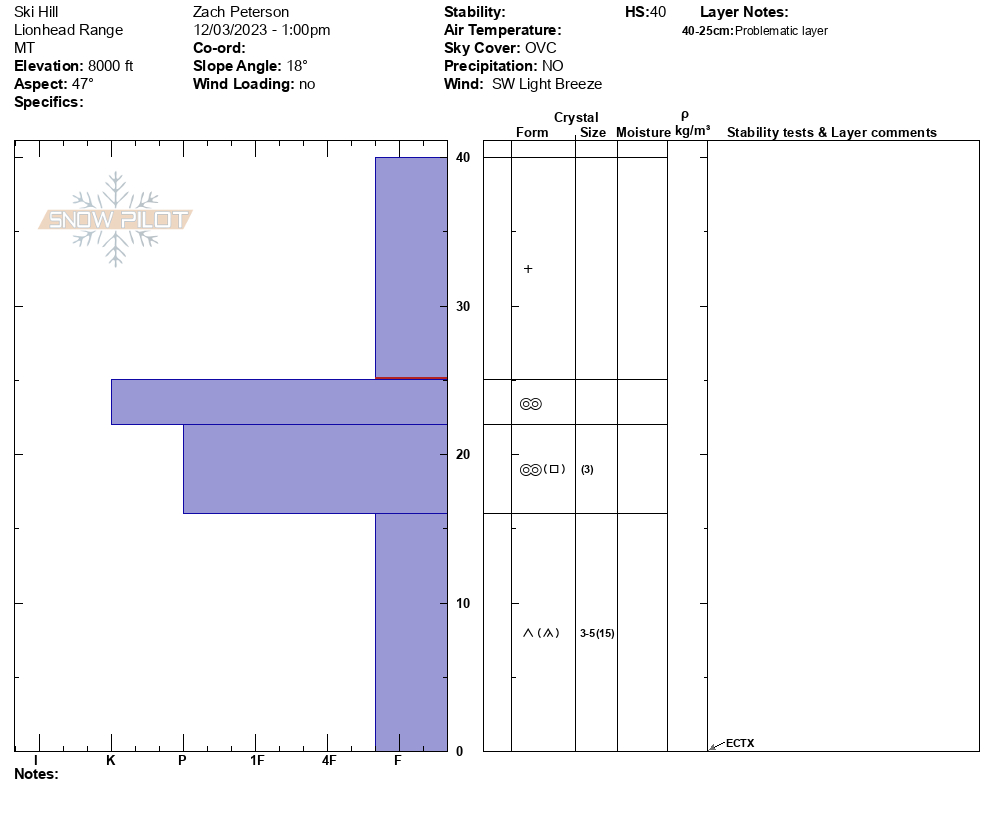
Full Snow Observation ReportWe rode to Ski Hill and dug on a NE aspect at 8000'. The HS was 40 cm with the top 15 cm being from yesterday's storm. This soft new snow was sitting on a thick supportable crust, and below that crust was weak-faceted snow. Stability tests showed no results, ECTX. From here we transitioned to skis and began walking towards the Lionhead Ridge. As we increased in elevation the amount of new snow increased and we experienced small whumpfs and cracking as we approached the ridge. Below the ridge, we dug on a NE aspect at 8700'. The HS was 56 cm and there was 22 cm of new and wind-drifted snow on top of similar layering. We got an ECTP1 at the interface between the new snow and weak snow just above the crust. We saw no recent avalanche activity but another party reported seeing a small avalanche further along the ridge.
Full Snow Observation Report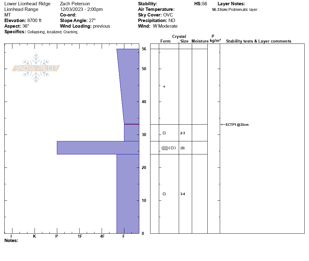

Skinned above alpine lift (just beyond the beacon checker) to get an idea for snowpack depth/ layers. A quick dig revealed a shallow, faceted snowpack!
Full Snow Observation Report
Shooting cracks on the apron. Shallow and firm but reactive windslab breaking on the faceted layer bellow it. About 10cm of new snow sitting atop the windslab as of this afternoon.
Full Snow Observation Report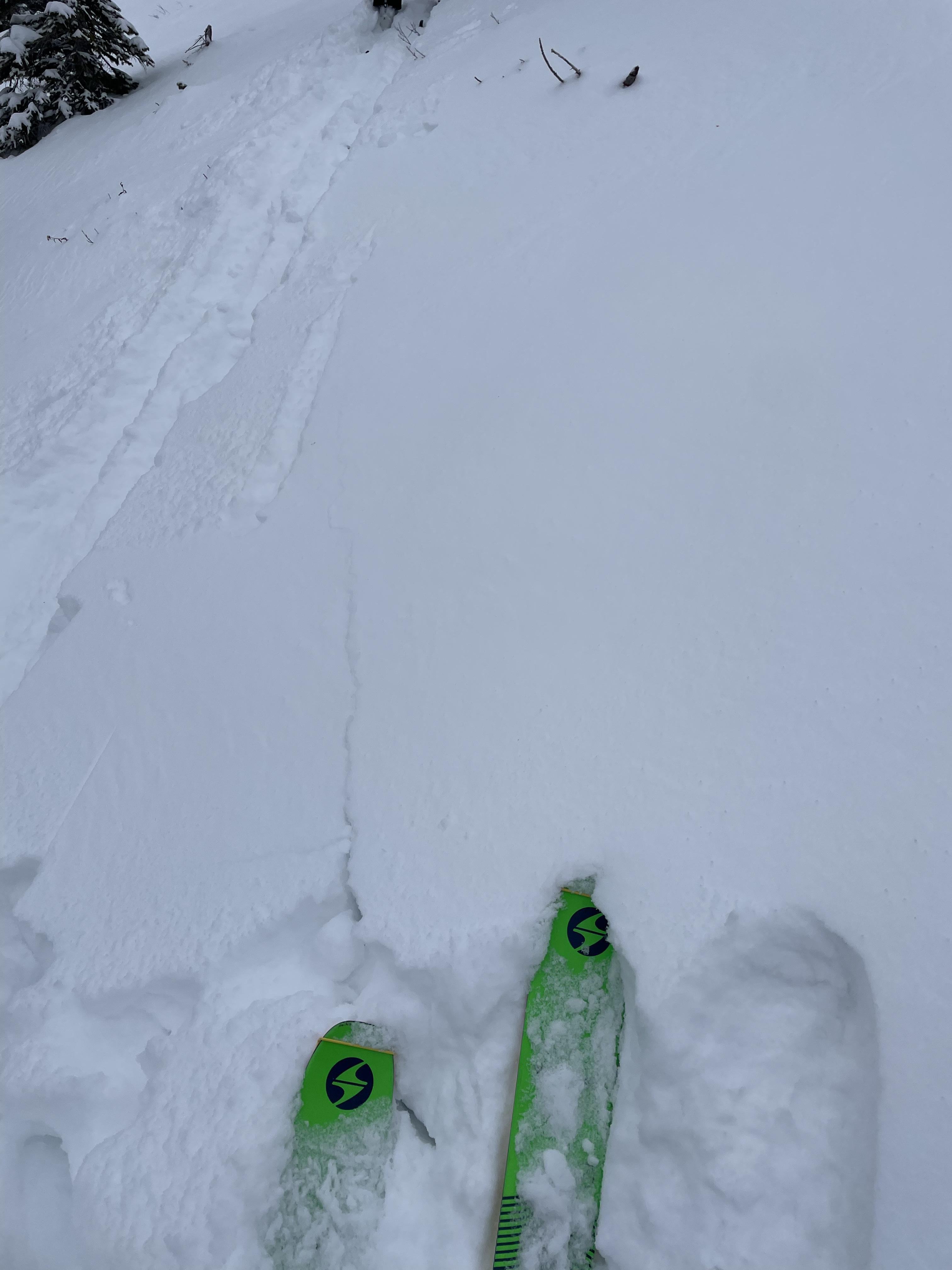
At 9,000 feet there was about an inch of new snow. It was calm at first light, but by mid morning winds were gusty and blowing straight down the gullies. It stripped what little snow there was and did not create an avalanche hazard. However, the 6+" in the gullies are all faceted, and with even a thin wind-load it was easy to get cracking. With snowfall predicted for the next 48 hours and again later this week, we'll need to be on the lookout for pockets or gullies of wind blown snow.
Full Snow Observation Report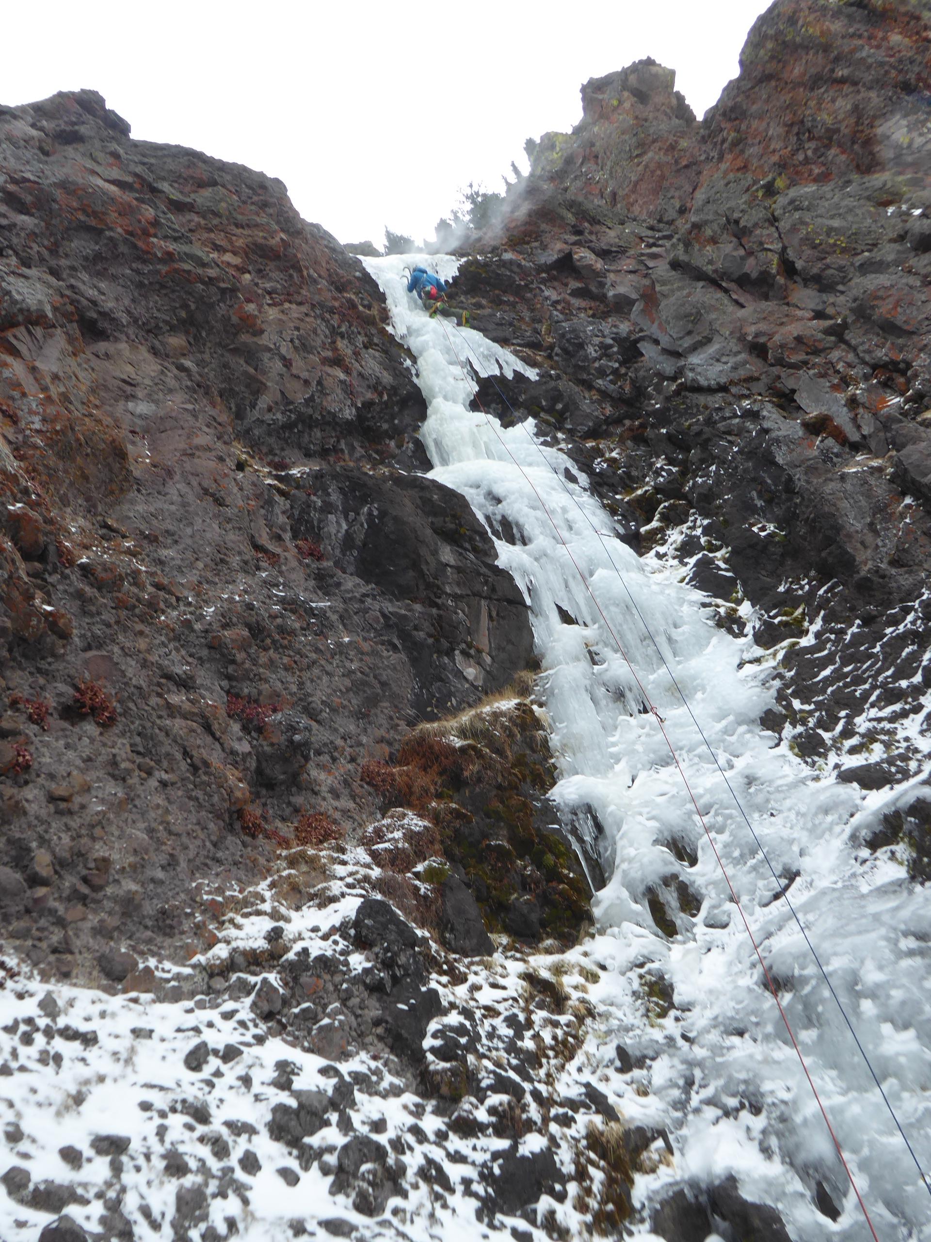
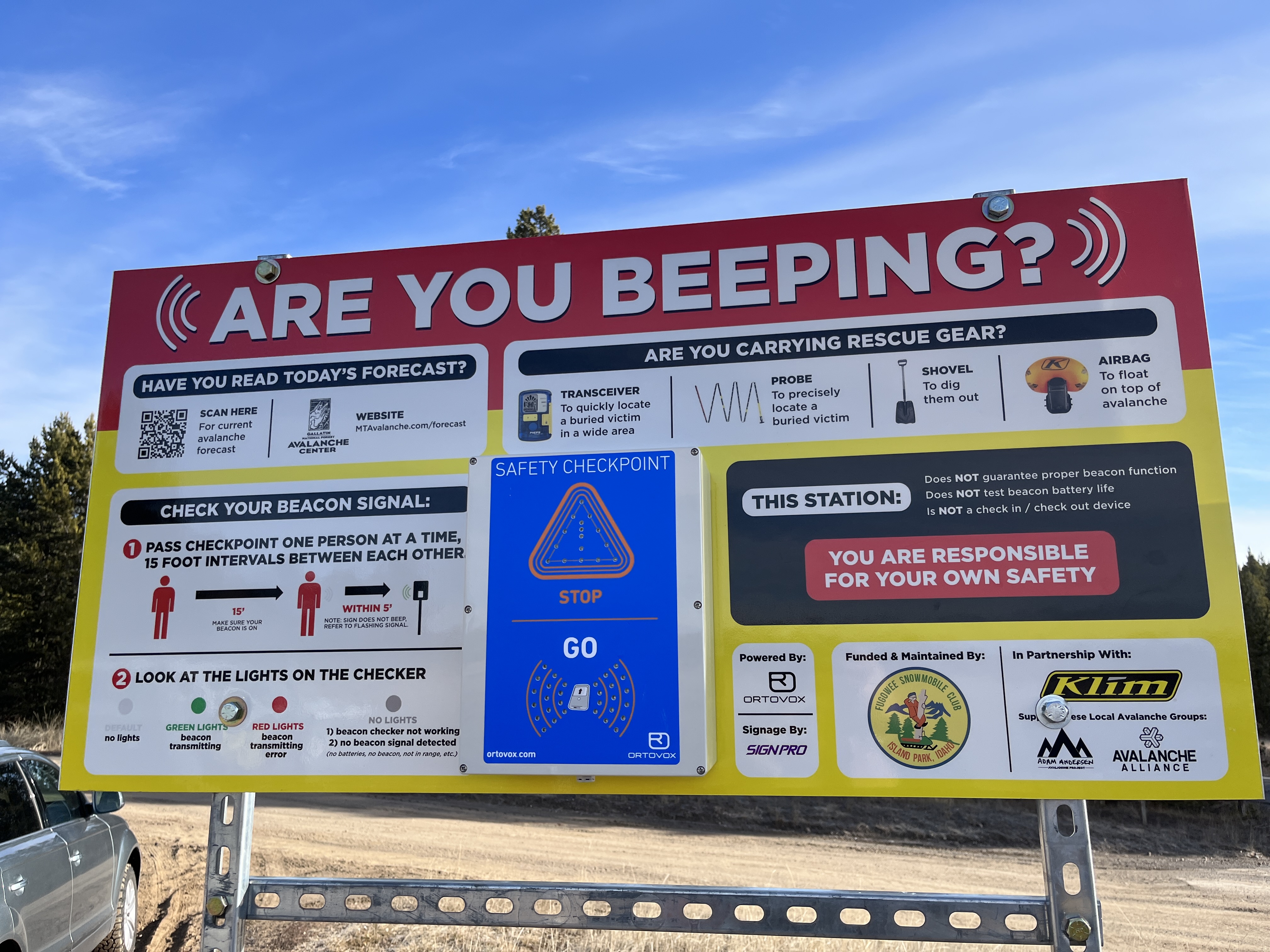
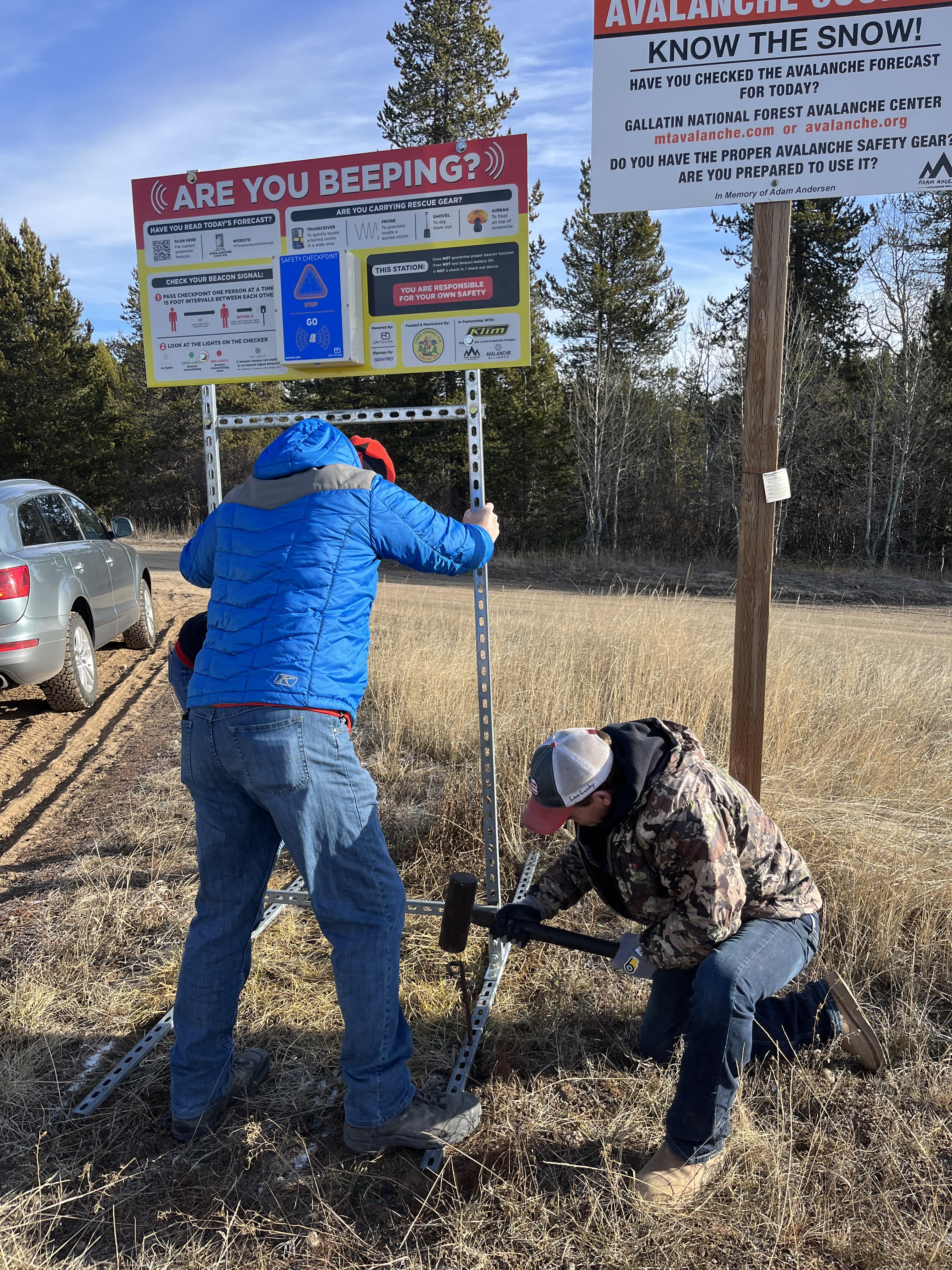
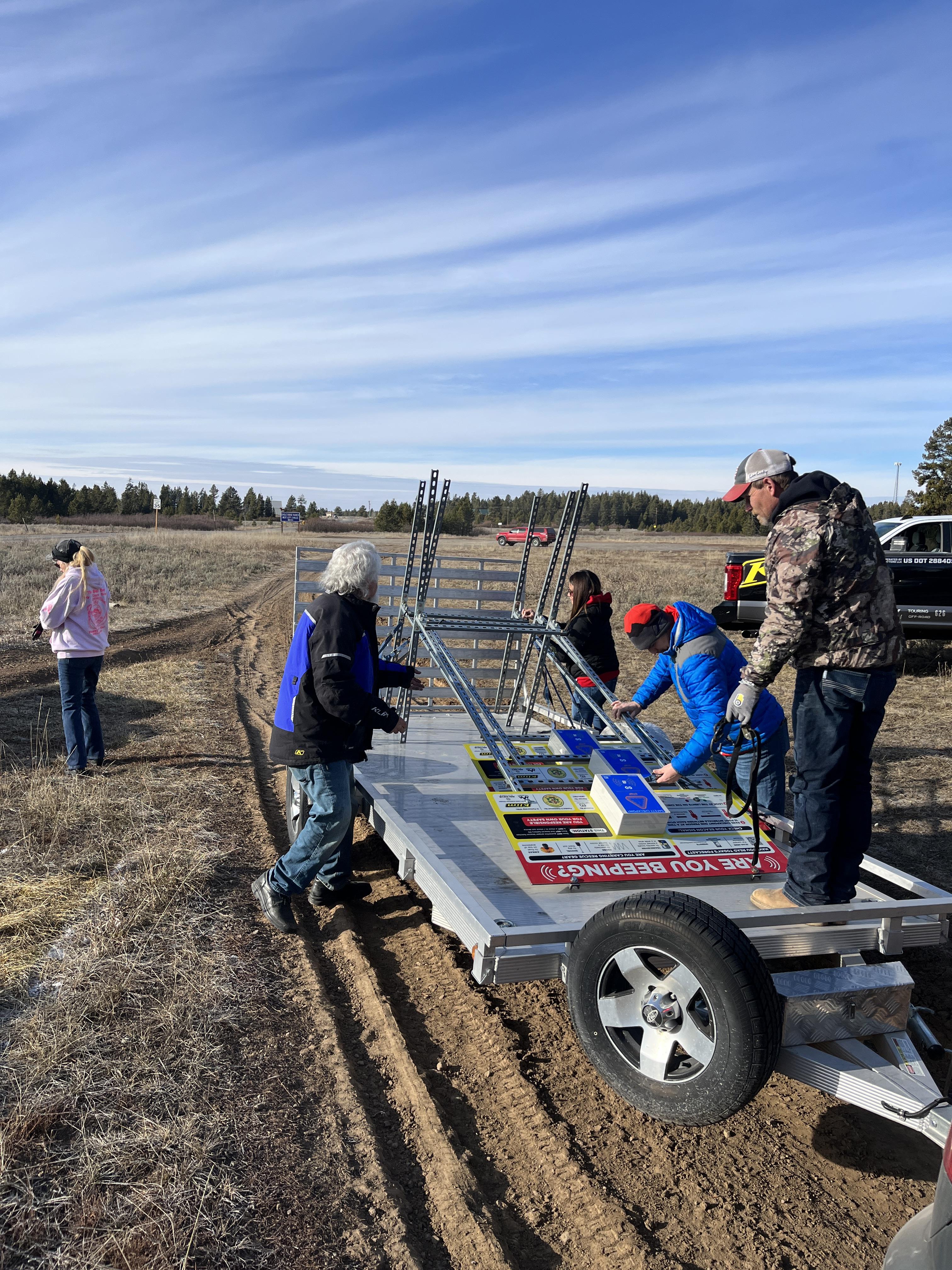
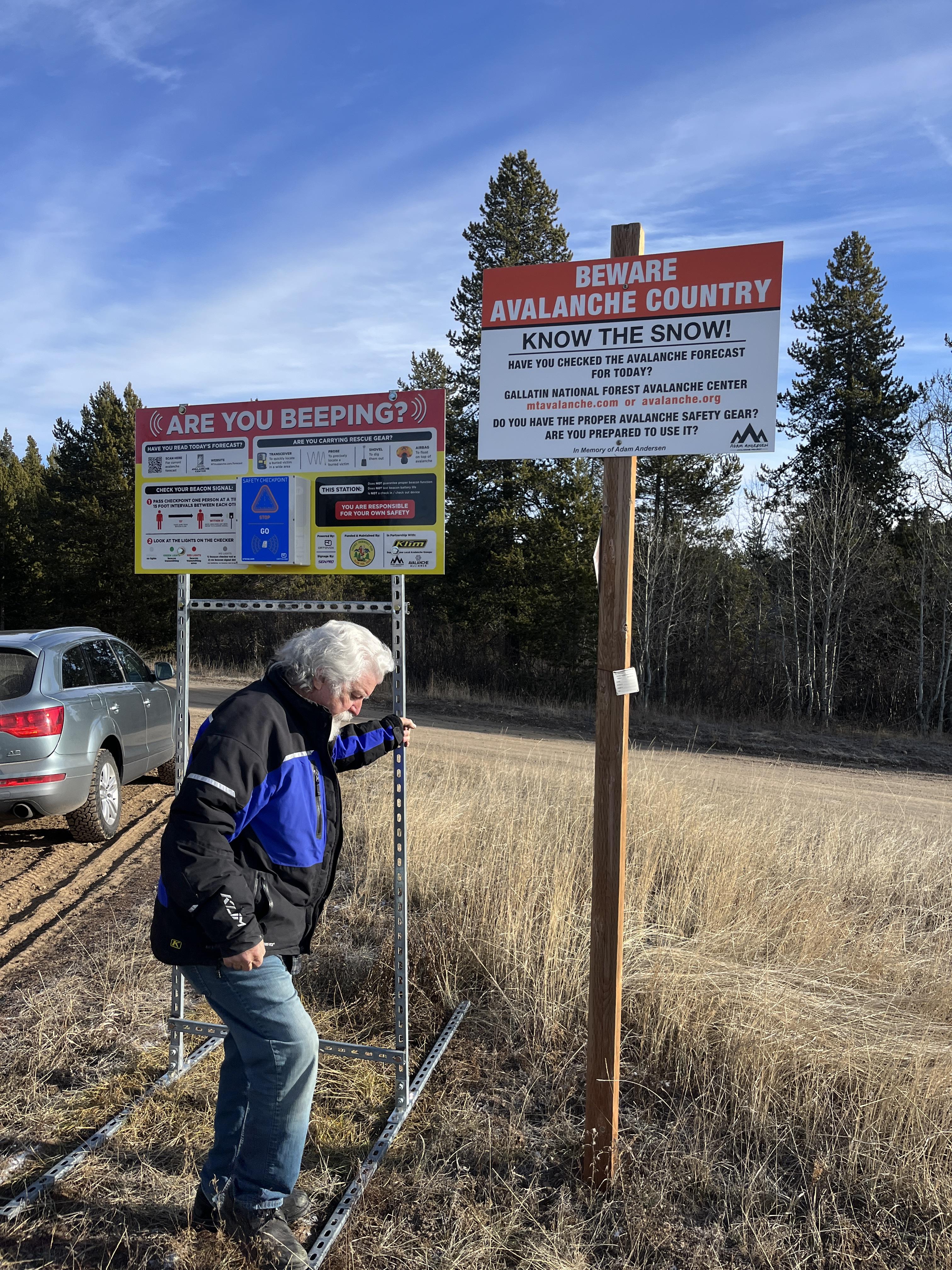
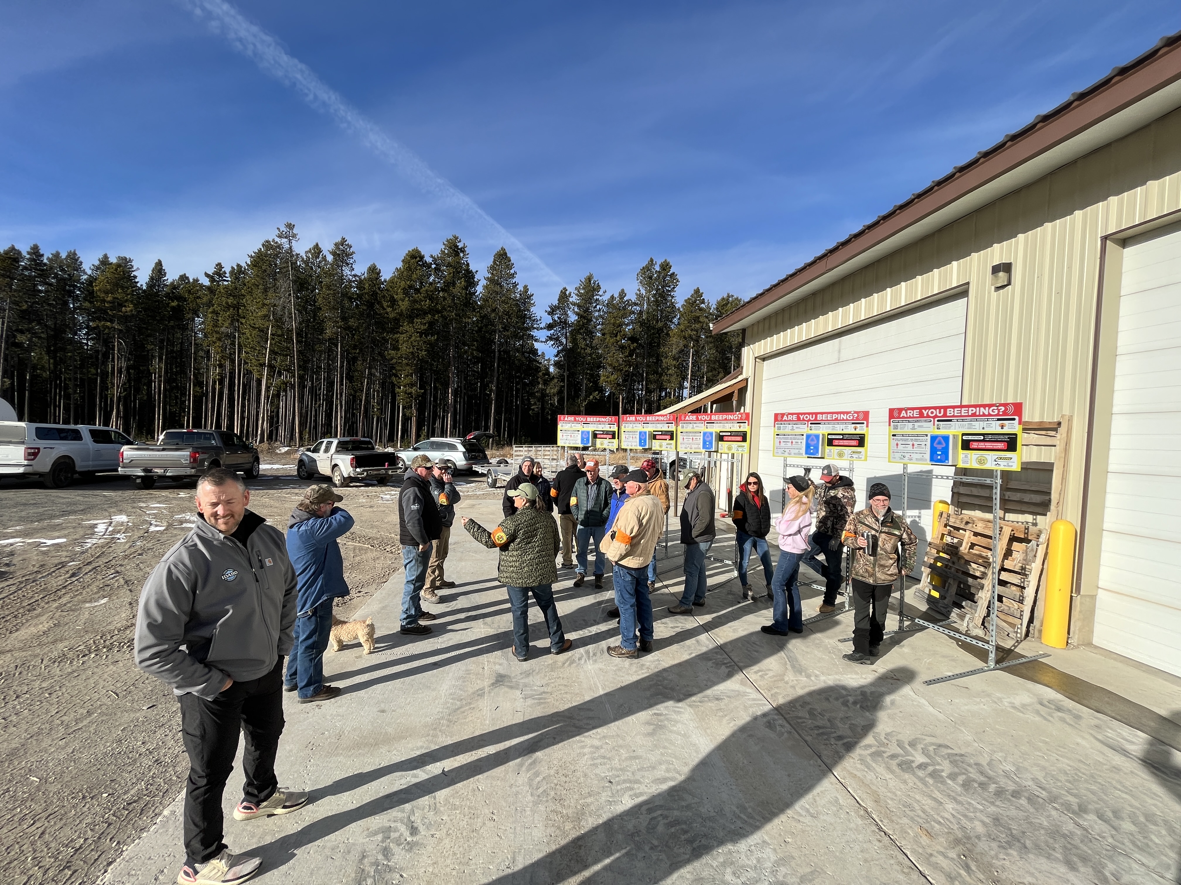
We met up with the Fugawee Snowmobile Club, Idaho Parks and Recreation, and Klim to install new beacon checkers at the trailhead in Island Park. Great work to the team! Photos: GNFAC
Full Snow Observation Report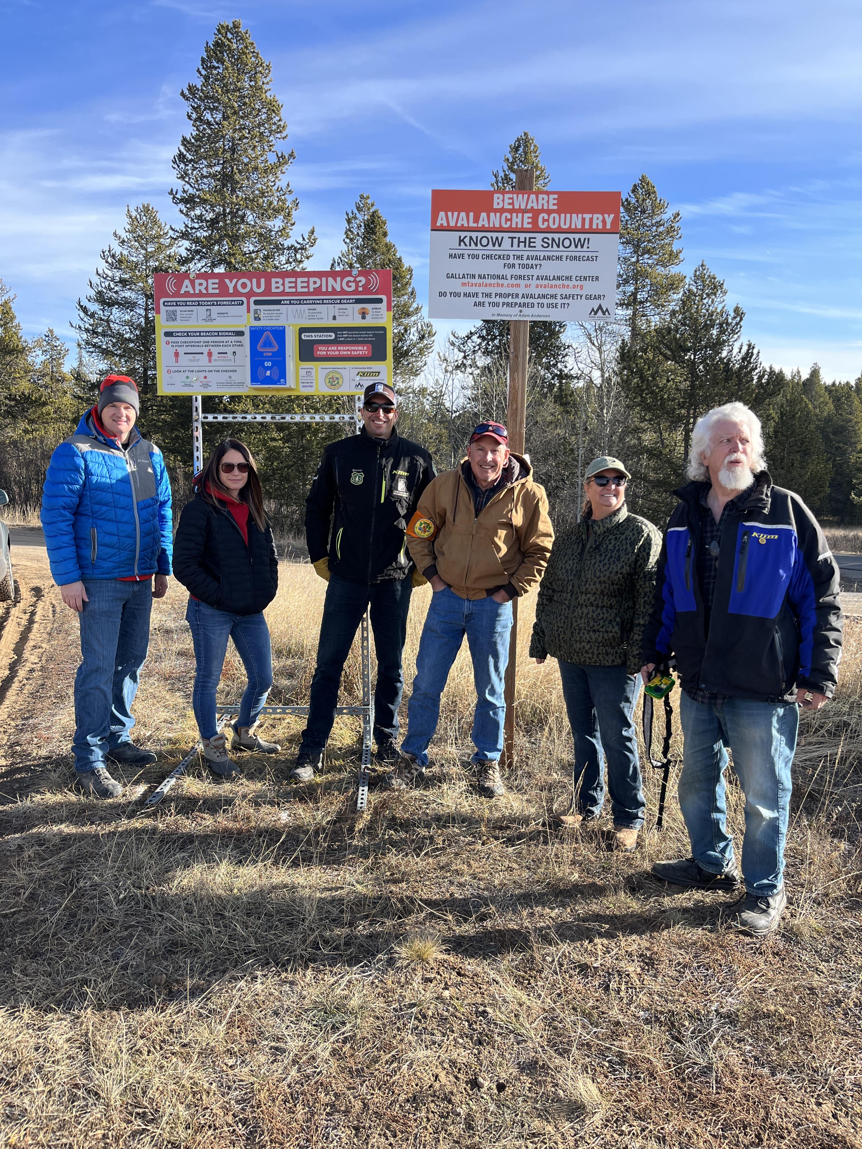

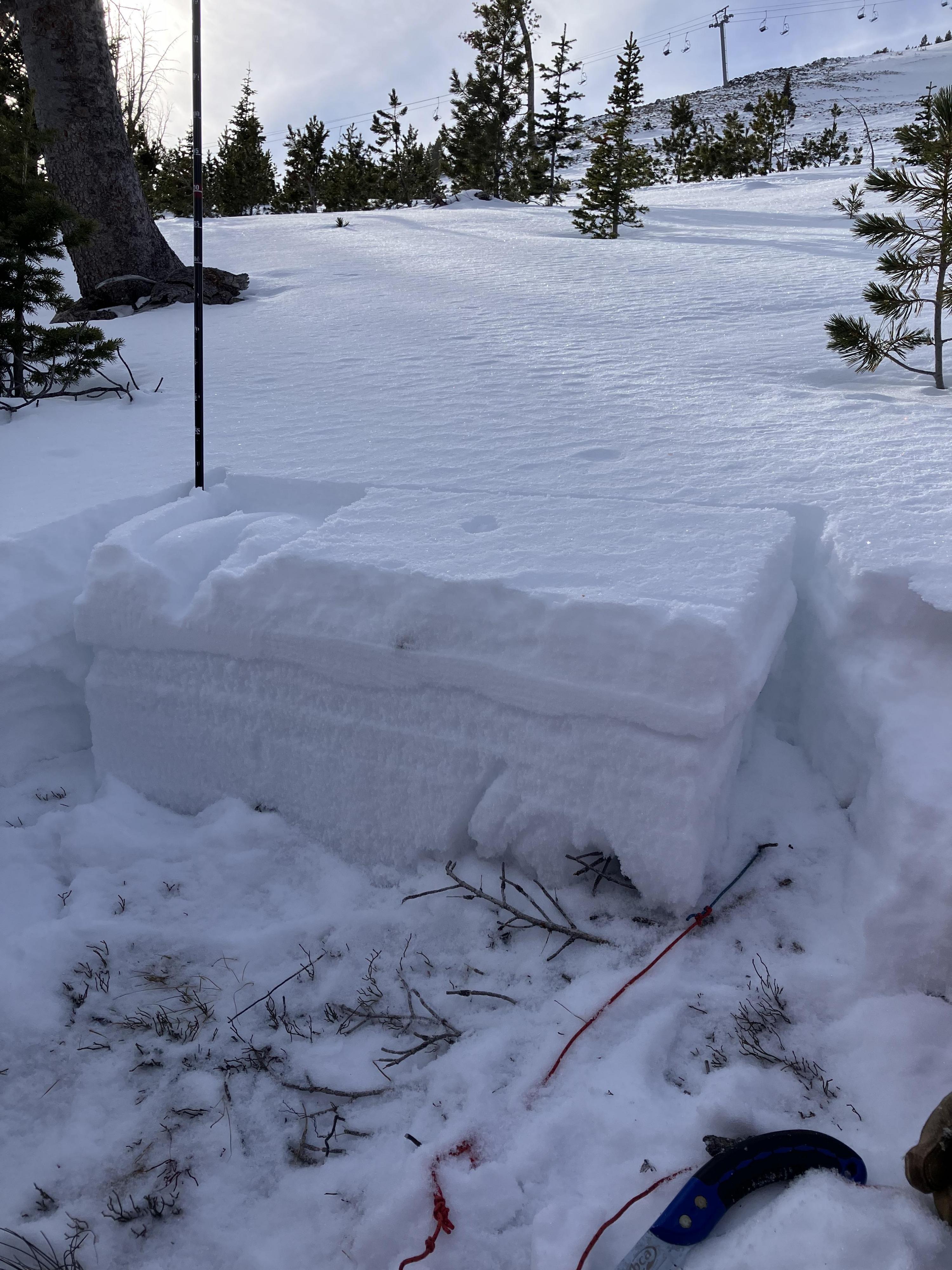
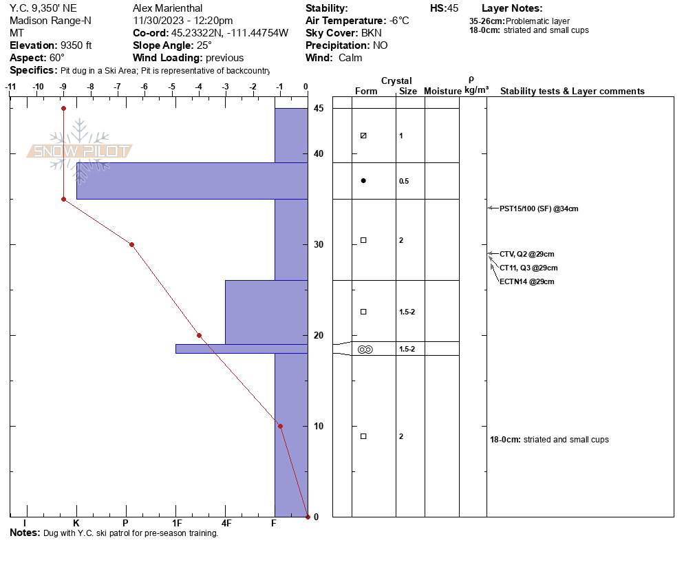
Today (11/30/23) we looked at the snowpack in the northern Madison Range/Big Sky area. At 9,300' on a northeast aspect there was around a foot of snow (30-45cm) which is mostly weak layers of facets. When the mountains get more snow we expect avalanches to break on this weak snow.
Full Snow Observation Report