Snow Observations List
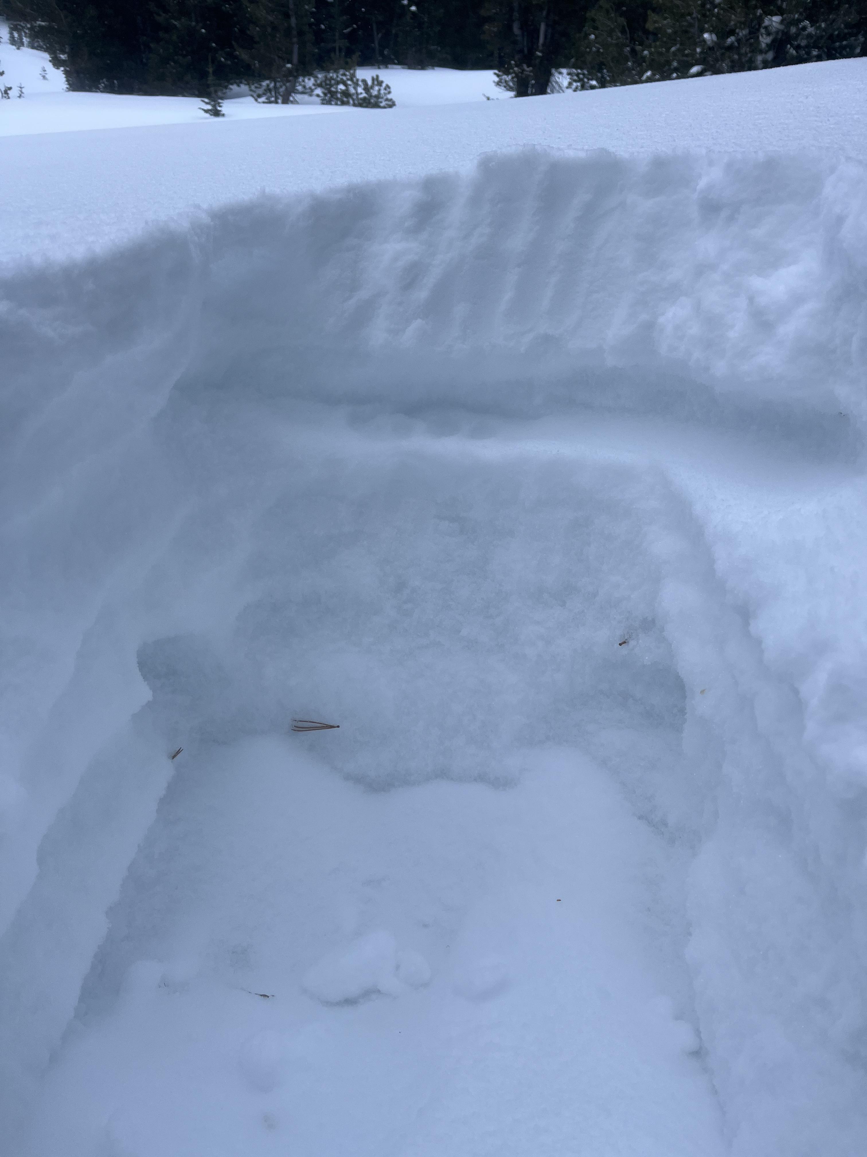
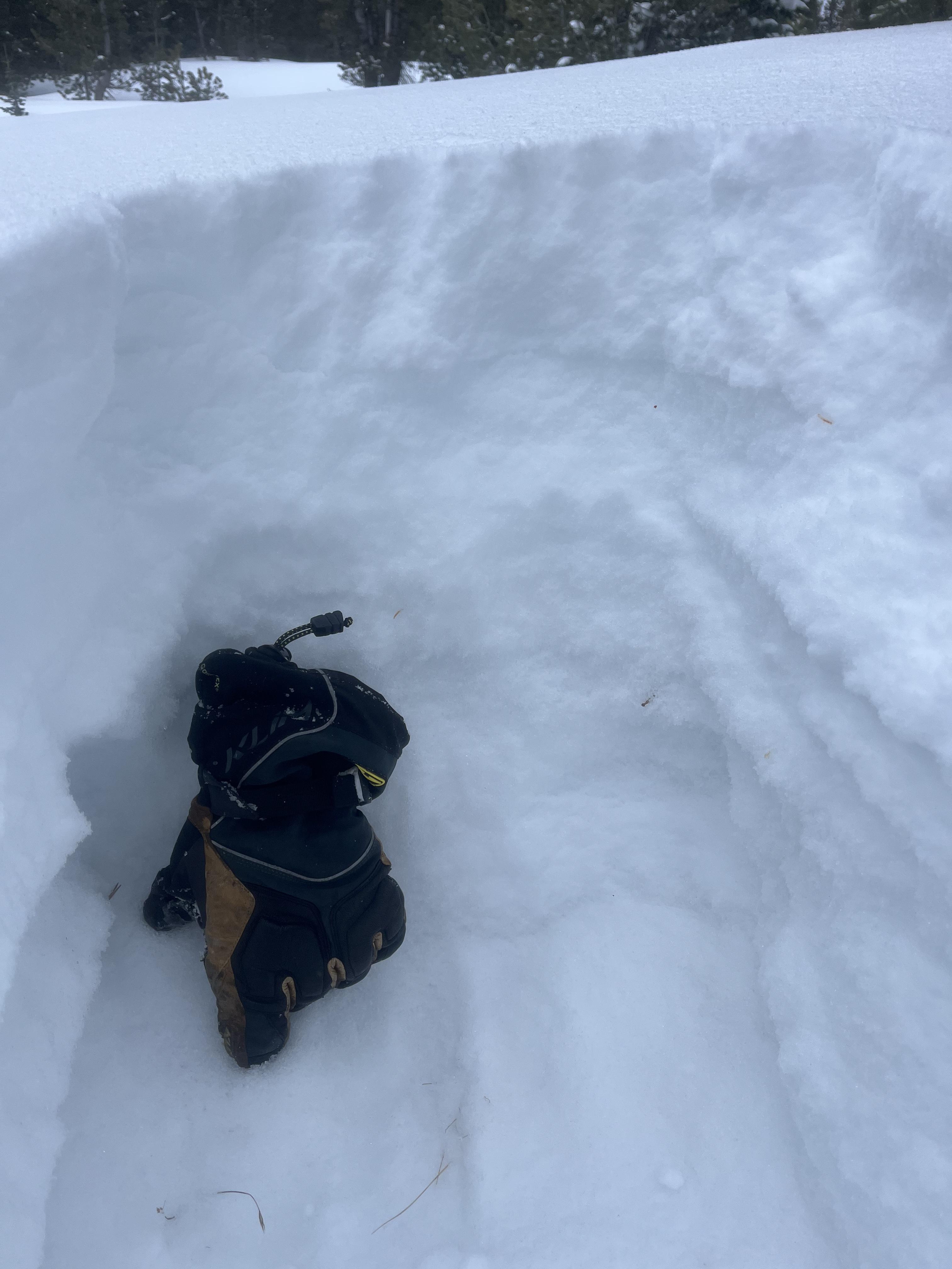
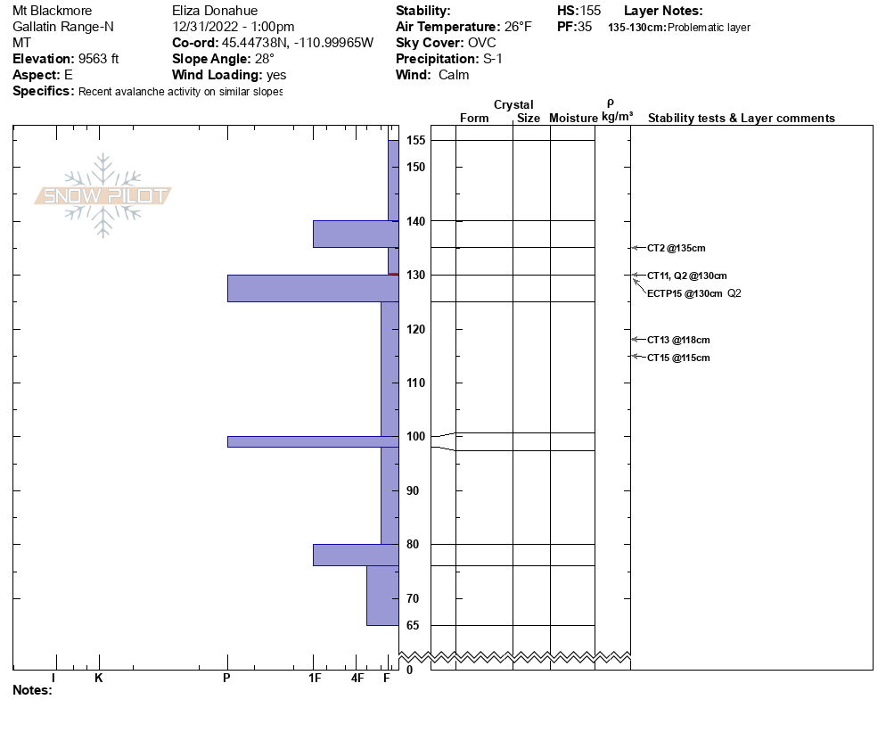
Toured up to the east face of Mt. Blackmore today. We observed two small natural loose dry avalanches occurring right around noon on the new/old snow interface at about 9700' on the E aspect. The largest one ran about 200 feet down into the bowl.
We observed a hollow snowpack on our ascent and dug a pit at 9600' just below the northeast ridge. We found several weak layers that were fracturing beneath two well-defined crusts. We got a CT2 @ 135cm, CT11 @ 130cm, CT13 @ 118cm, and CT15 @ 115cm; in our extended column test we got ECTP15 Q2 @ 130cm.
Full Snow Observation Report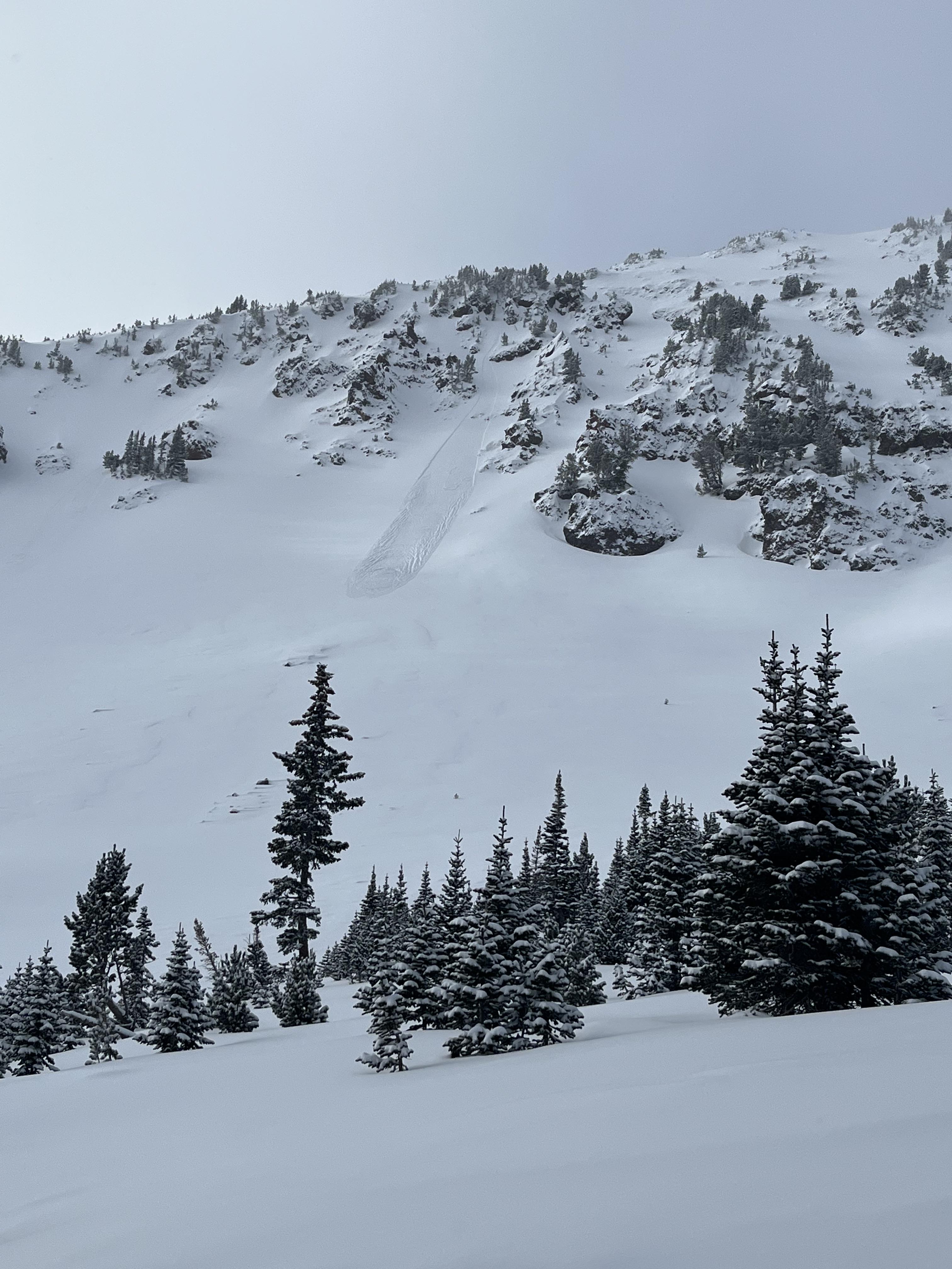
Went to jones creek yesterday, 20 cm facets underneath everything it seems. Depth where the wind could reach it(sw aspects mostly) was averaging 60 cm, 100 to 120 cm where it was more protected. Not a lot of weight yet but columns failed on isolation. No cracking or whumphing
Full Snow Observation ReportClimbed up to the ridgeline above Hebgen lake and dug on a SE aspect at ~8800 ft. HS 112 cm. Found around 8 inches of new snow at upper elevations and both of the weak layers we’ve been concern about. ECTN11 x 2 on the facets just beneath the new snow and no results on the lower facets. No signs of instability observed throughout the day. Not quite enough of a slab here above the upper facets, but definitely wouldn’t trust them in places with a wind load or more new snow.
Full Snow Observation Report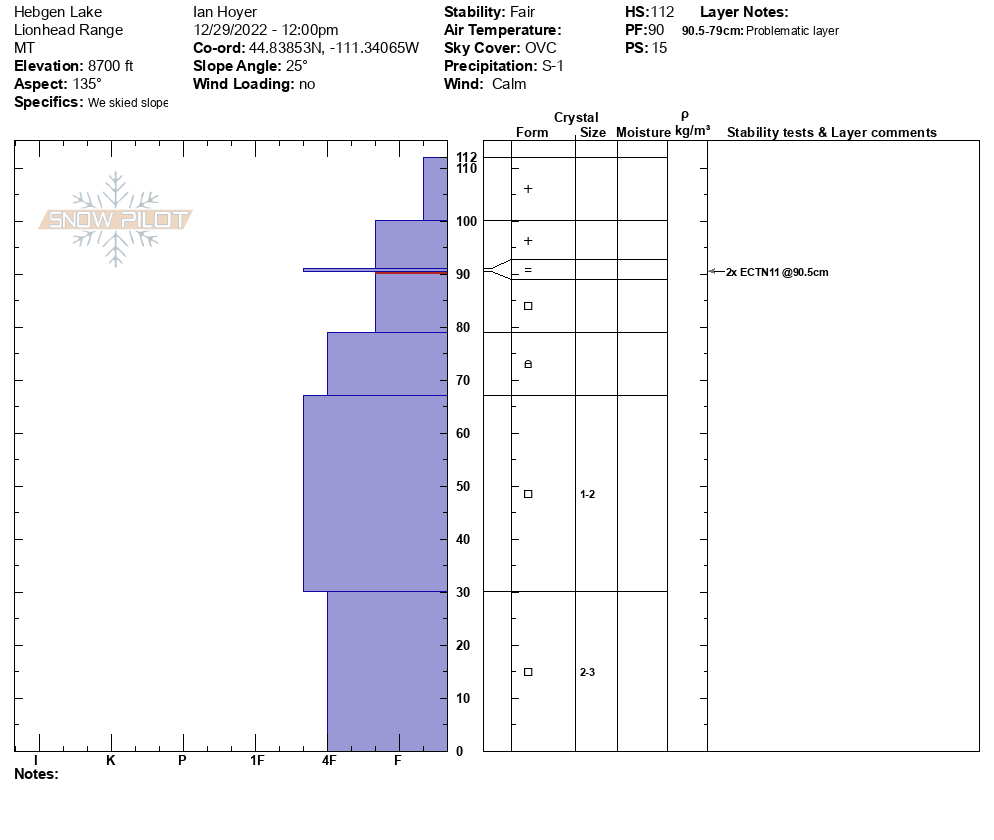
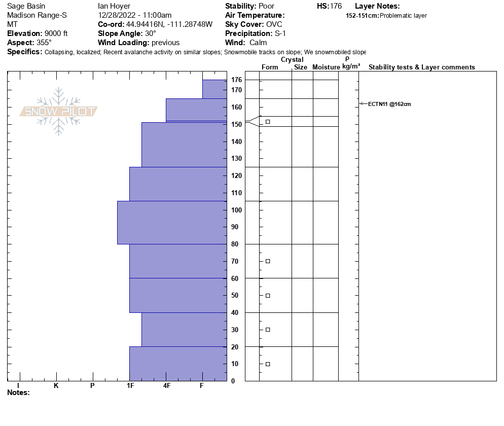
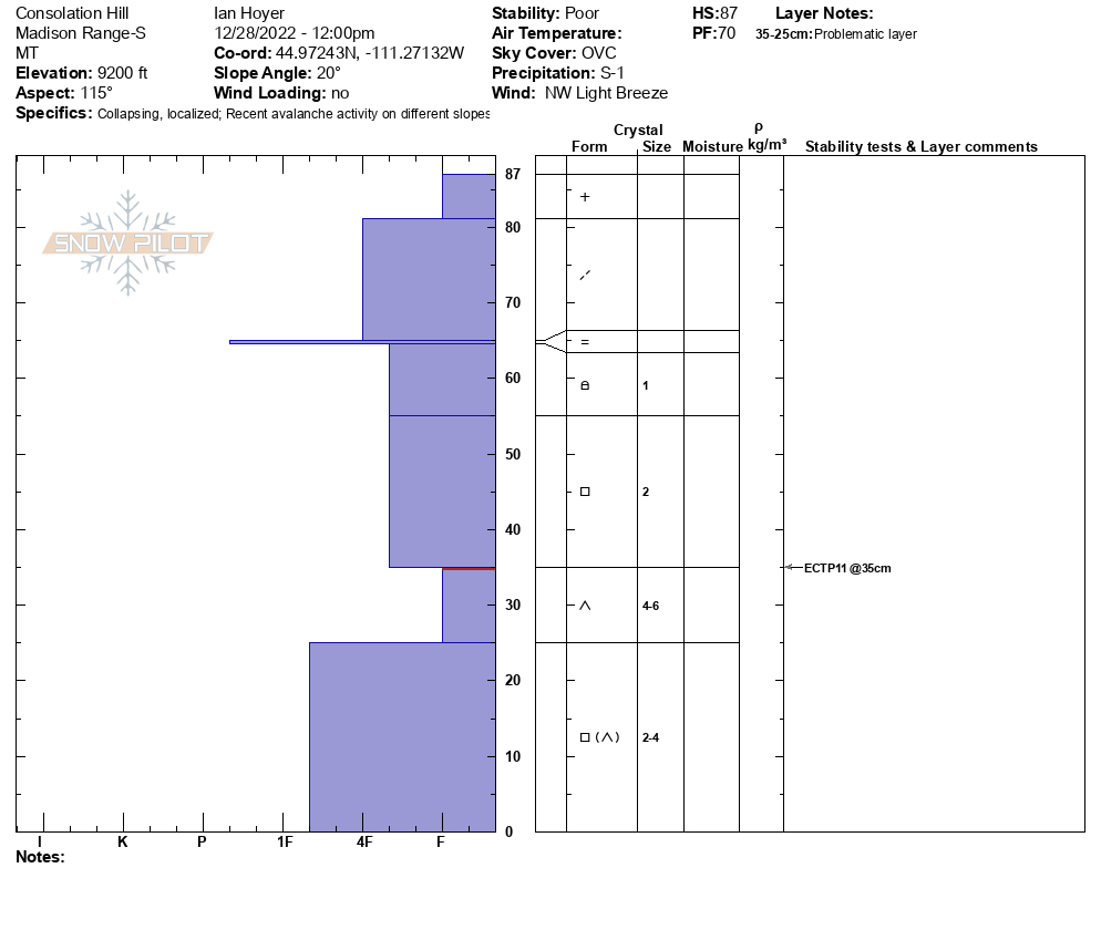
Visibility was good enough so we headed into the weather station and dug on the E facing slope. The instability was concerning and we tip-toed out onto the slope with an inclinometer in hand. It was thin (HS 105) and the 2 prominent weak layers were there: ECTP11 on the upper one and ECTP12 on the facets/depth hoar. We then rode into Sage Basin and found natural avalanche activity on the N facing side. It looked like the slope fractured on the upper layer and on steep terrain it broke to the ground. We dug another on the east end of Sage and had a 176 cm deep snowpack that was unremarkable. On the way out we stopped at Consolation Hill (SE facing) and I got a big whumpf with a body slam as footsteps were just sinking to the ground. This snowpack was thin (HS 87) and it broke on the depth hoar at 35 cm (ECTP11).
Full Snow Observation Report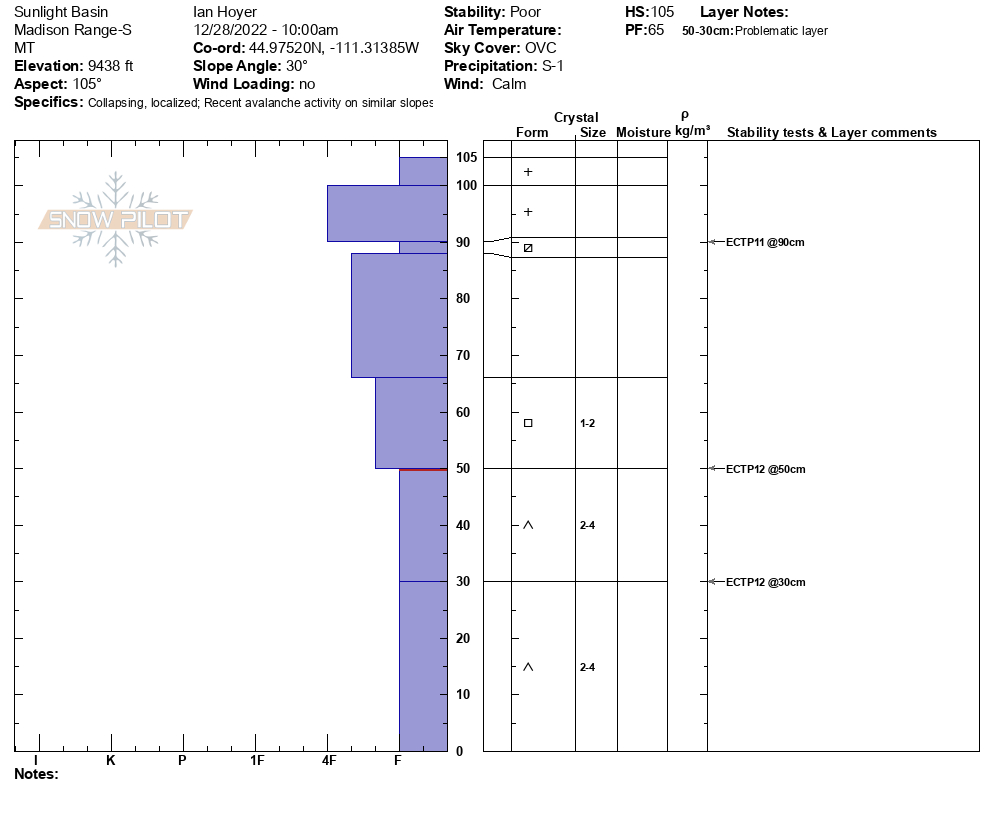

I toured up toward Divide today, mostly just to get out and take a peek at the snowpack. The storm overnight dropped 10-20 cm up high, and it was getting moved around a fair amount by the wind.
I dug my first pit on an east aspect at 8900’. The snow was 165 cm deep here, and there was a visible dark band 20 cm down that was pencil-hard and 1 cm thick. I got an ECTN13 on this, failing on a thin layer of facets just below the harder snow. I also got an ECTN 17 on another thin layer of facets another 20 cm down. When I filled the pit in, the top 20cm readily came off of my extended column, and the rest stayed cohesive to the ground as I tipped it over, save for the rotten stuff at the very bottom of the snowpack.
I dug another pit at 9550’ on the SE aspect of Divide. This one was 145 cm deep and had a similar structure to my first one, and gave me ECTN14 and ECTN18 on what I believe to be the same layers, although the firm band of snow 25 cm down didn’t have as obvious of a layer of low-density facets beneath it. I did get a clean, fast propagation 60 cm down at ECTP22. The slope I was on was only 28 degrees, but I bailed to head home and eat cheesecake instead.
Full Snow Observation Report
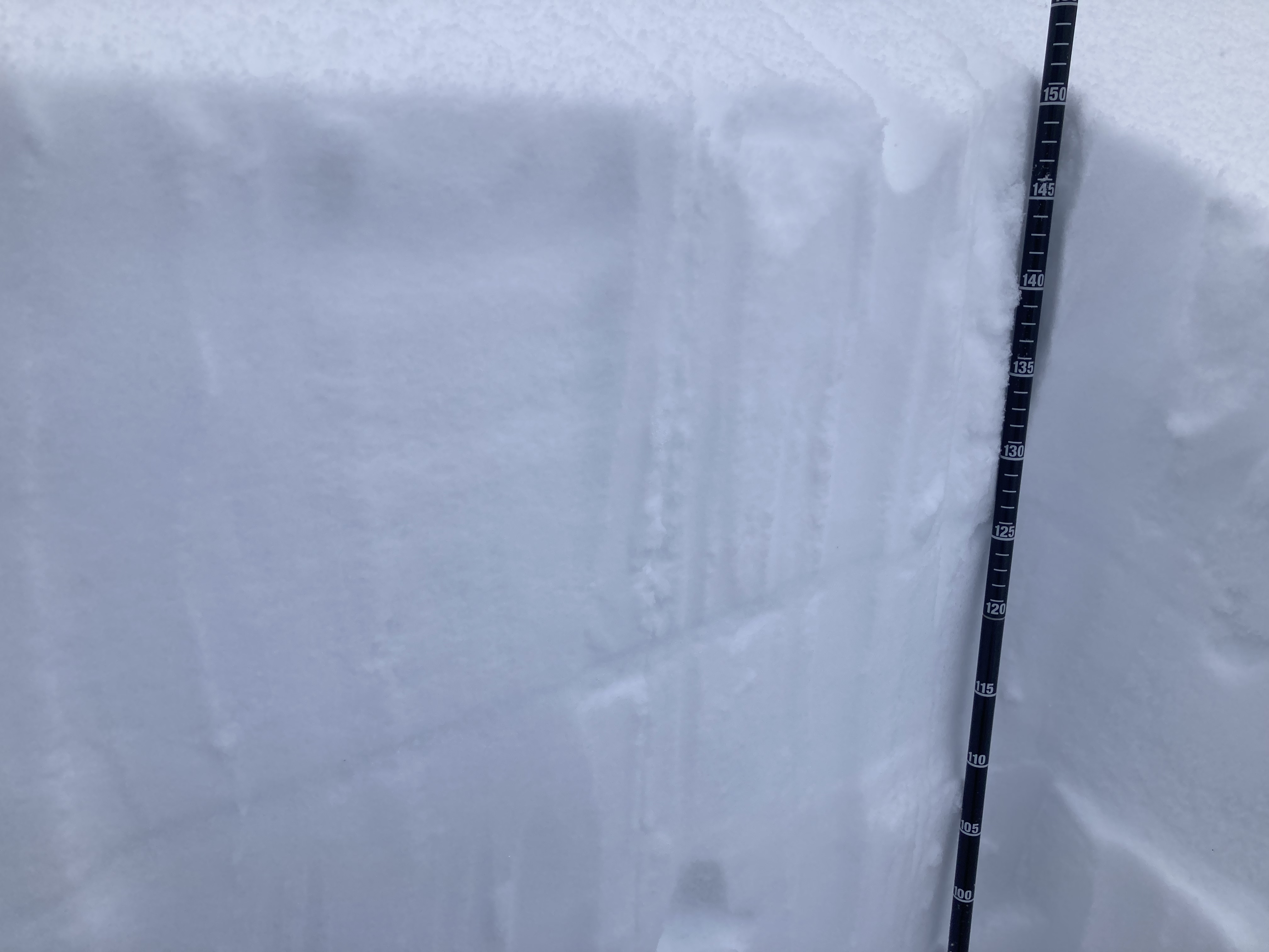
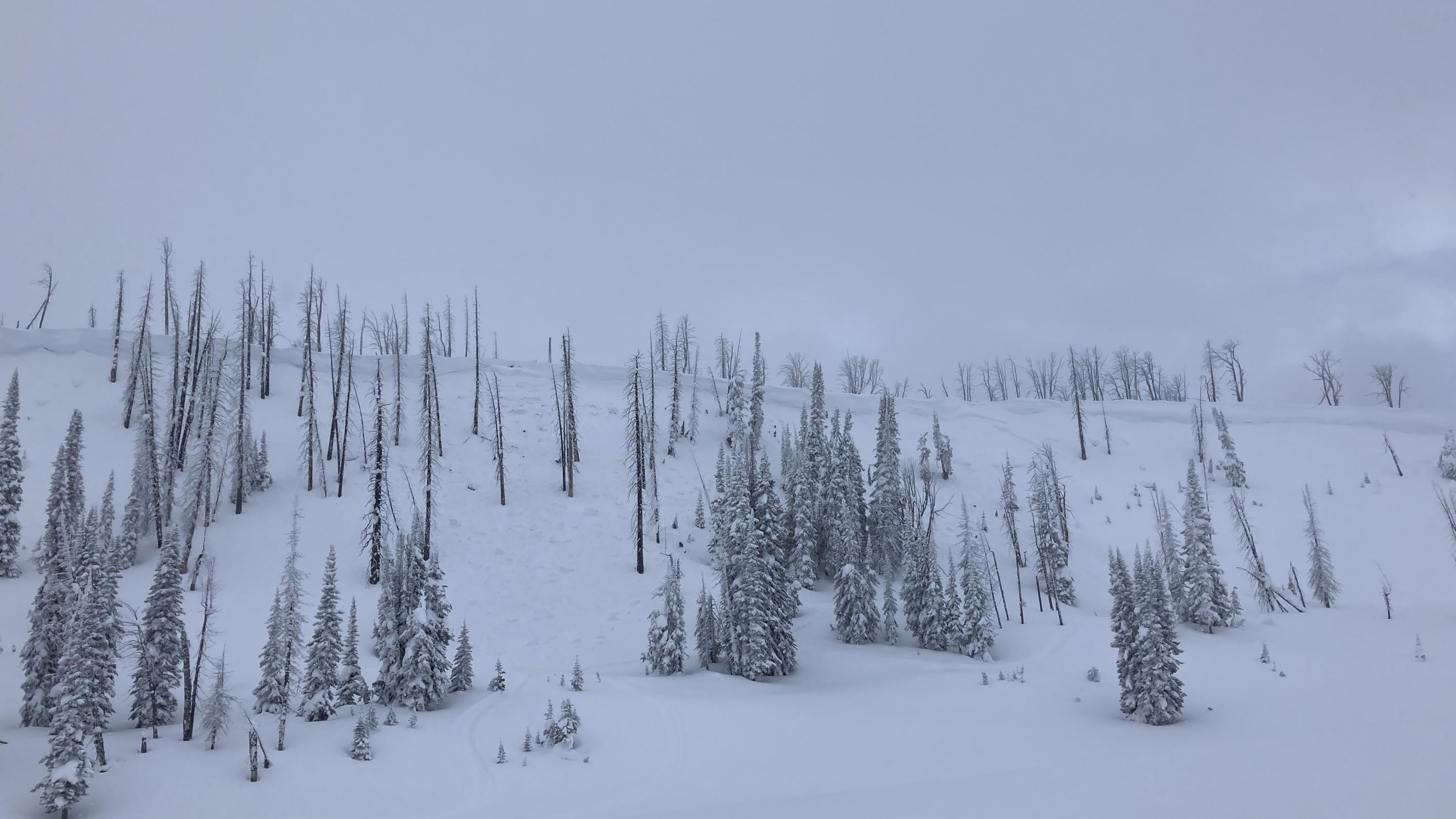
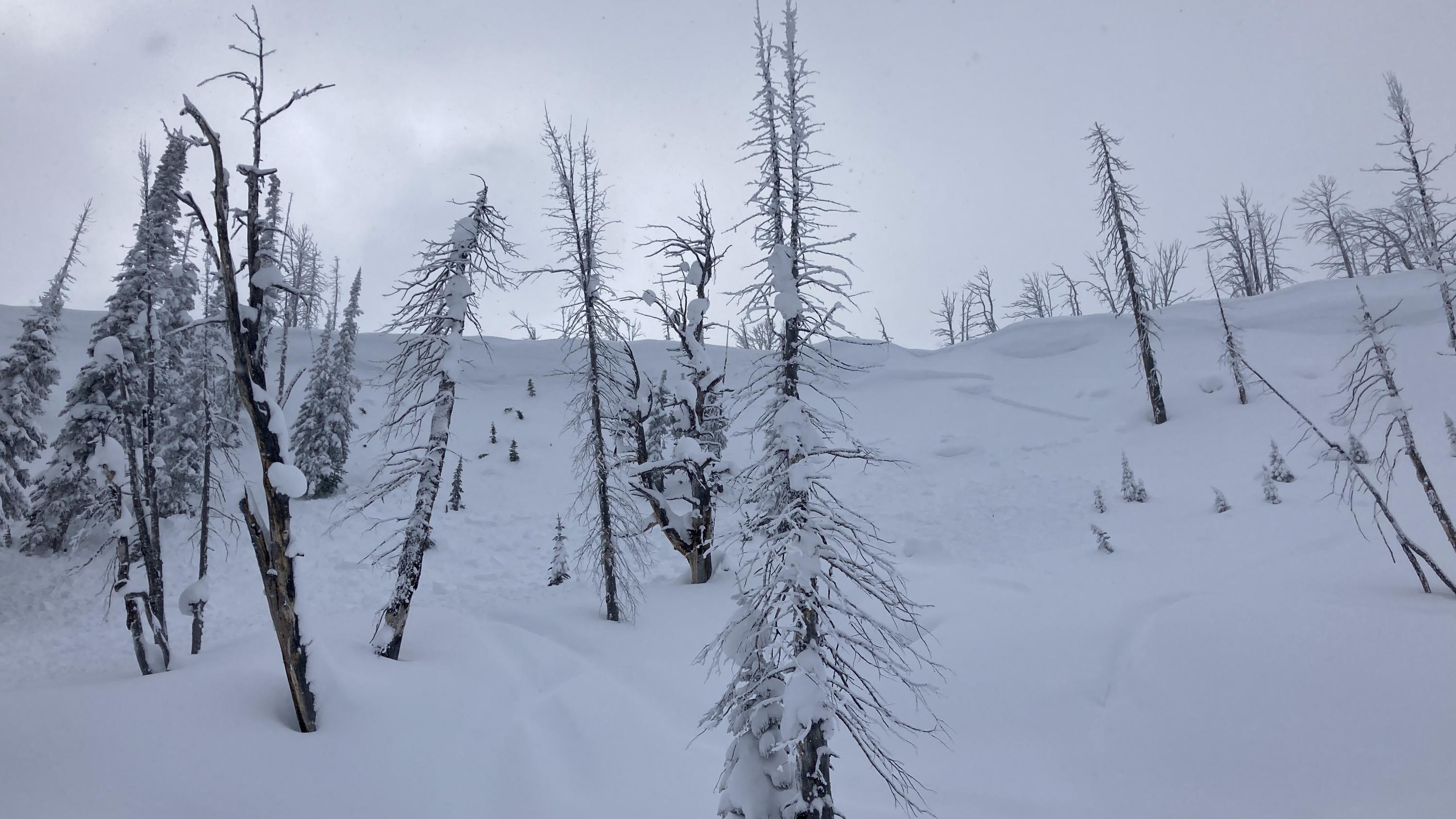
Today in Beehive we found blowing snow which has grown the easterly cornices significantly since two days prior when we were there as well as pillows of wind drifted snow on leeward slopes. In wind protected locations we found excellent skiing. Previous tracks were filled in with right side up snow that seemed to be bonding well to the previous snow surface. In our pit on a east aspect at 9,000' we found two very thin melt freeze crusts in the top 30cm that produced ECTN as well as facets on the ground that produced no results. On a west aspect we felt that same melt freeze crust buried under the new snow breaking and hooking up our skis. A quick hand pit showed this crust to be a little thicker and harder.
Full Snow Observation Report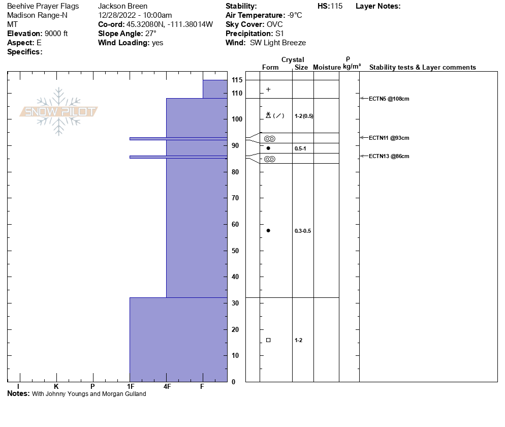
Natural avalanche from the top of the popular snowmobile climbing spots on McDermott Hill in the Flint Range near Philipsburg. There have been several close calls and a fatality in this same path. It is named for the person who was killed in an avalanche there in the 70s. It appeared to be a wind load on the ridge that initiated the slide. In the background of a janky video, it appears there were other naturals as well. The slide ran an estimated 800 ft, but no other information was obtained.
Full Snow Observation ReportSnowmobile club members texted me that they triggered a 3' deep slab, that ran 100 yds., from connected terrain in Frog Pond Basin. It sounded like a heavily wind loaded slope.
Full Snow Observation ReportPit Location: E / ESE Aspect | 10,000' | 220 - 230 cm snow depth | Near Treeline | 28 degree slope
Weather at 14:15: OVC | S1 | Winds Strong out of the S / SSW
Test Results:
16cm down from surface; ECTN2 PC and ECTN3 PC at the newer snow interface, still a fairly soft slab without a lot of cohesion in this particular area
71cm down from surface; ECTP21 SP and ECTP23 SP, broke on the same layer of small facets (~0.5-1.0mm) noted in 12/27 forecast below this week's more recent storm snow
Mostly minor cracking observed at the snow surface during today's outing, a couple of shooting cracks were observed in steeper wind drifted snow in more exposed areas
Full Snow Observation ReportDug and skied in a protected, treed little bowl I visit at 9500 ft. with a general ENE aspect. The approach is on a solar aspect with minor avalanche terrain between 8-9K. The quick n dirty pit was about 130 cm, ENE, 9300ft., just off ridge top. Bottom half was faceted, 2mm generally, but surprisingly tightly packed together. Hardness of 1F in much of the faceted section, with a couple of layers of 4F. Upper half of the pack was generally rounds until near the surface where it was a bit more faceted. We got a CT6 Q2 on a wind slab interfaced with other wind slabs about 30 cm's down. The deeper pack did not fail in CT. The unstable result near the surface did not scare me particularly due to the nature of the terrain, isolated nature of the wind slab confined to the very top of the ridge, ability to safely cut entrances to runs, relatively thick timber, etc. We skied dense powder with no signs of instability beyond the snowpit; all about terrain choice yesterday (every day?).
Full Snow Observation ReportWe parked at the bridge and headed up from there. We dug our first pit on a south facing mid-elevation hill. There was 75 cm of snow (HS) a 5 cm thick faceted layer 1 foot deep, then solid snow to the ground. The facets are the same we are finding elsewhere and I got a CT0, which denotes instability. We went to the upper meadow and dug 2 pits (125 and 100 cm HS) but this same faceted layer was thin and not reactive. Neither were the facets in the lower third of the pit. We went to the Skillet and dug there. Again the upper faceted layer was thin and not an issue. The CT0 has me concerned and I am ruling the ECTNs as being irrelevant.
Full Snow Observation Report
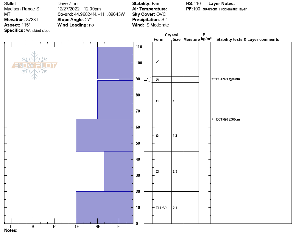
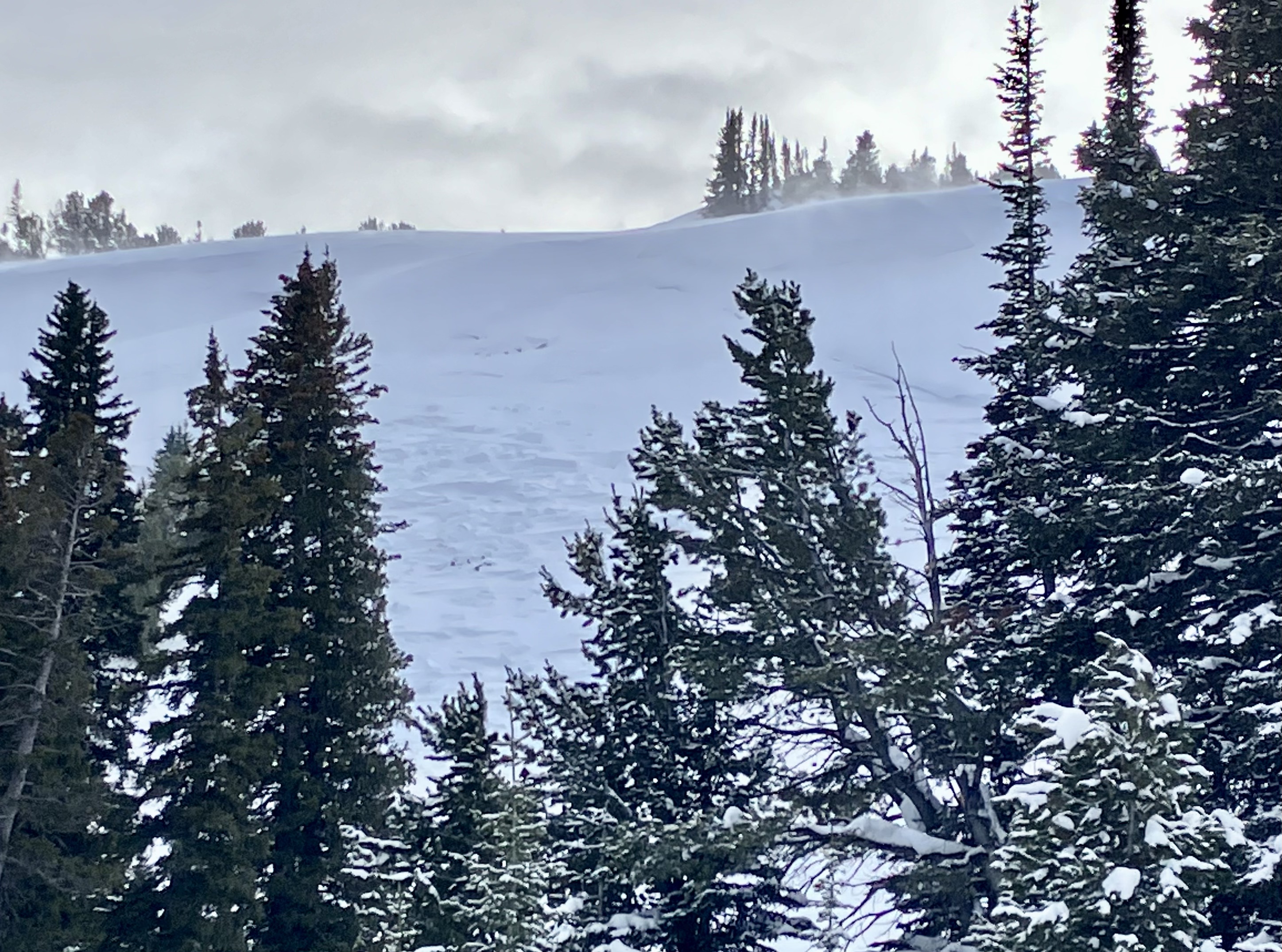
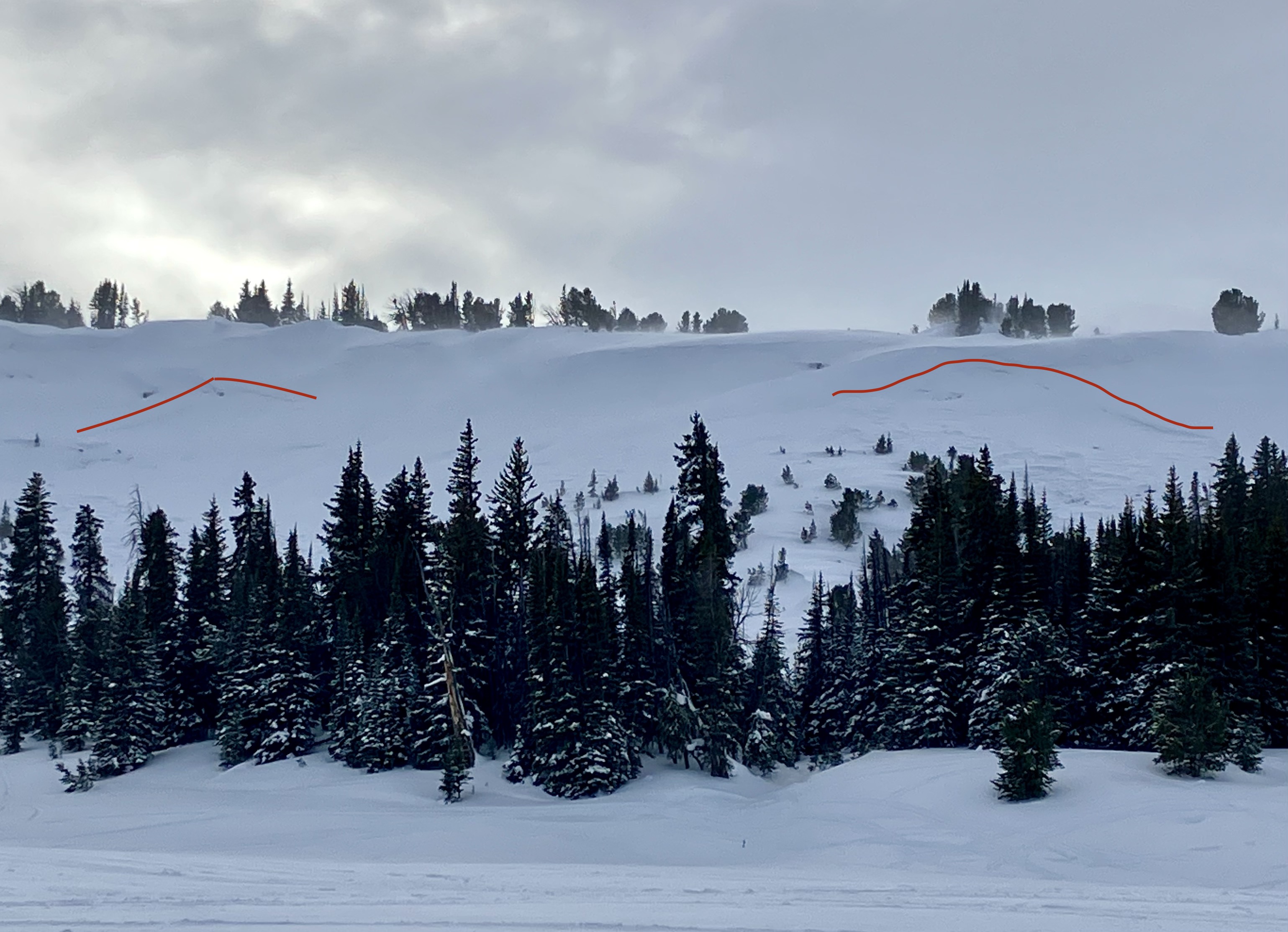
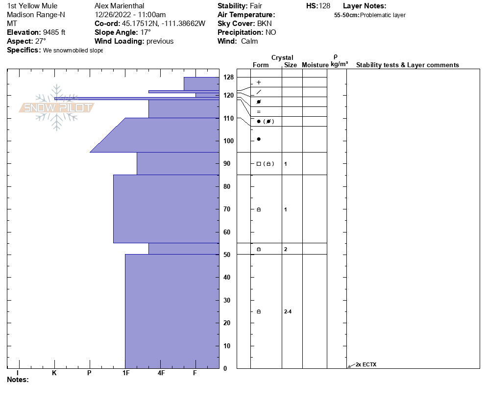
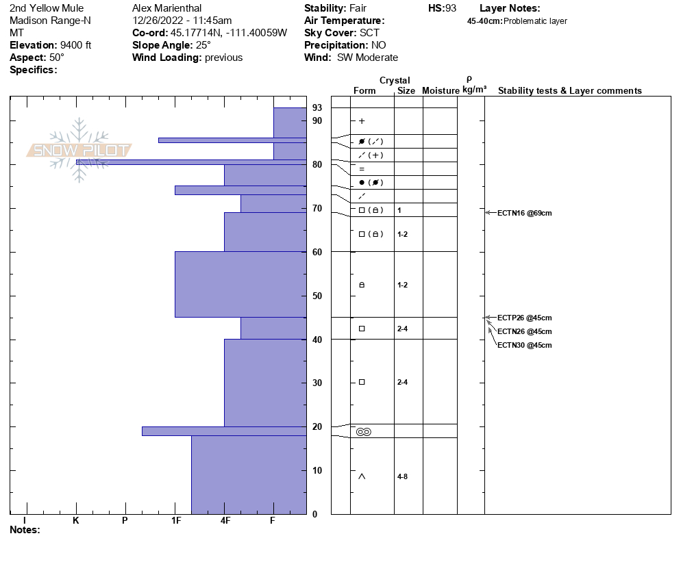
We dug in the first yellow mule, NE aspect at 9,400'. HS was 128cm and we had two ECTX. We identified the two weak layers we have been talking about in forecasts (see video), but they were not reactive here in our tests. We dug in the second yellow mule, NE aspect 9,300' and HS was 93 cm. Here we had ECTP26 on the layer of facets near the bottom of the snowpack. In both pits and a quick pit in 3rd yellow mule there was a stout ice crust (maybe a rain/mist crust) about 10cm down that is not a problem at the moment, but notable due to being widespread and unusual for our normally dry snowpack (see picture).
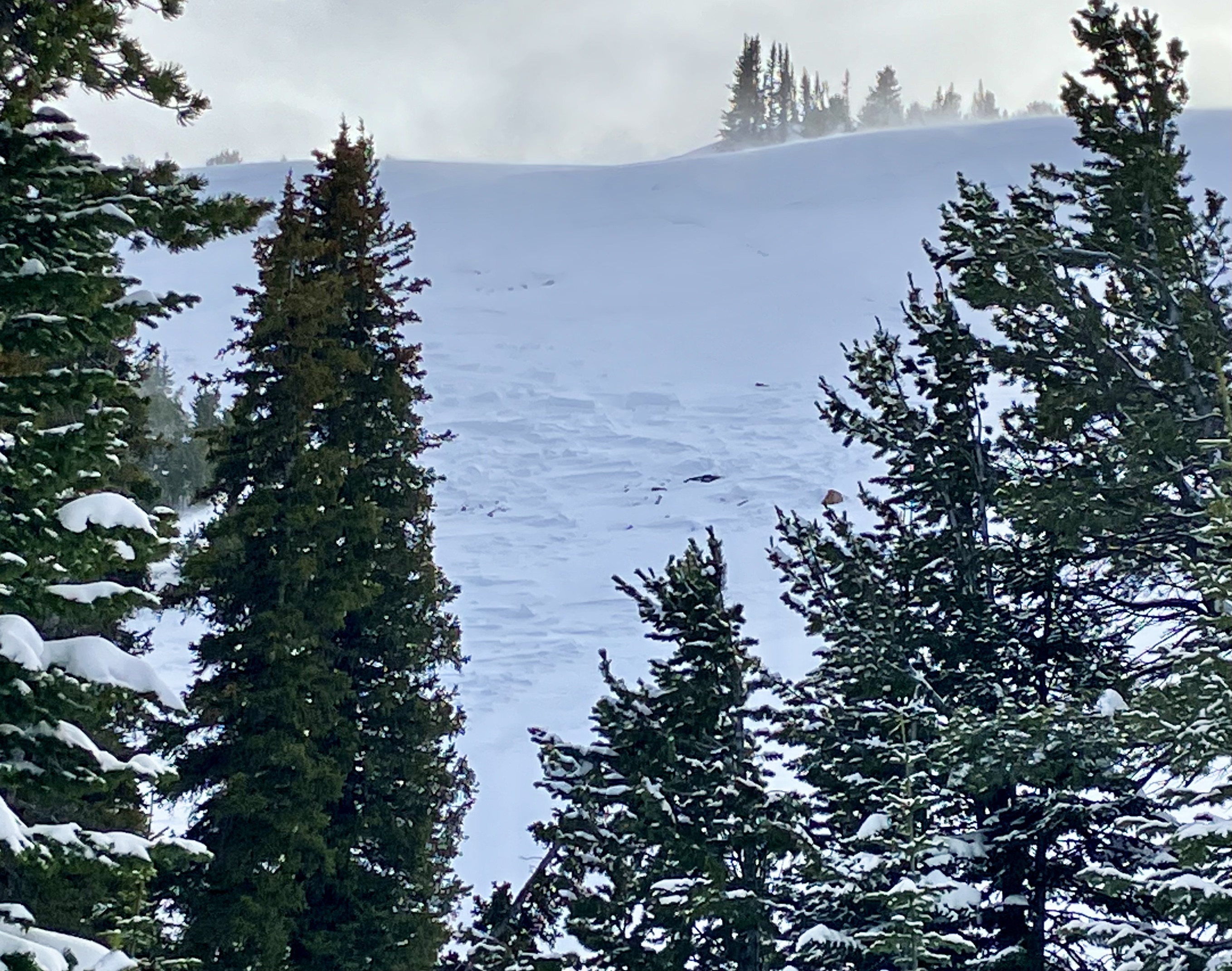
We saw two large avalanches in the 2nd Yellow Mule that were probably 2-3 days old, and likely broke on the weak layer near the bottom of the snowpack. Hard slabs on heavily wind-loaded slopes.
Full Snow Observation Report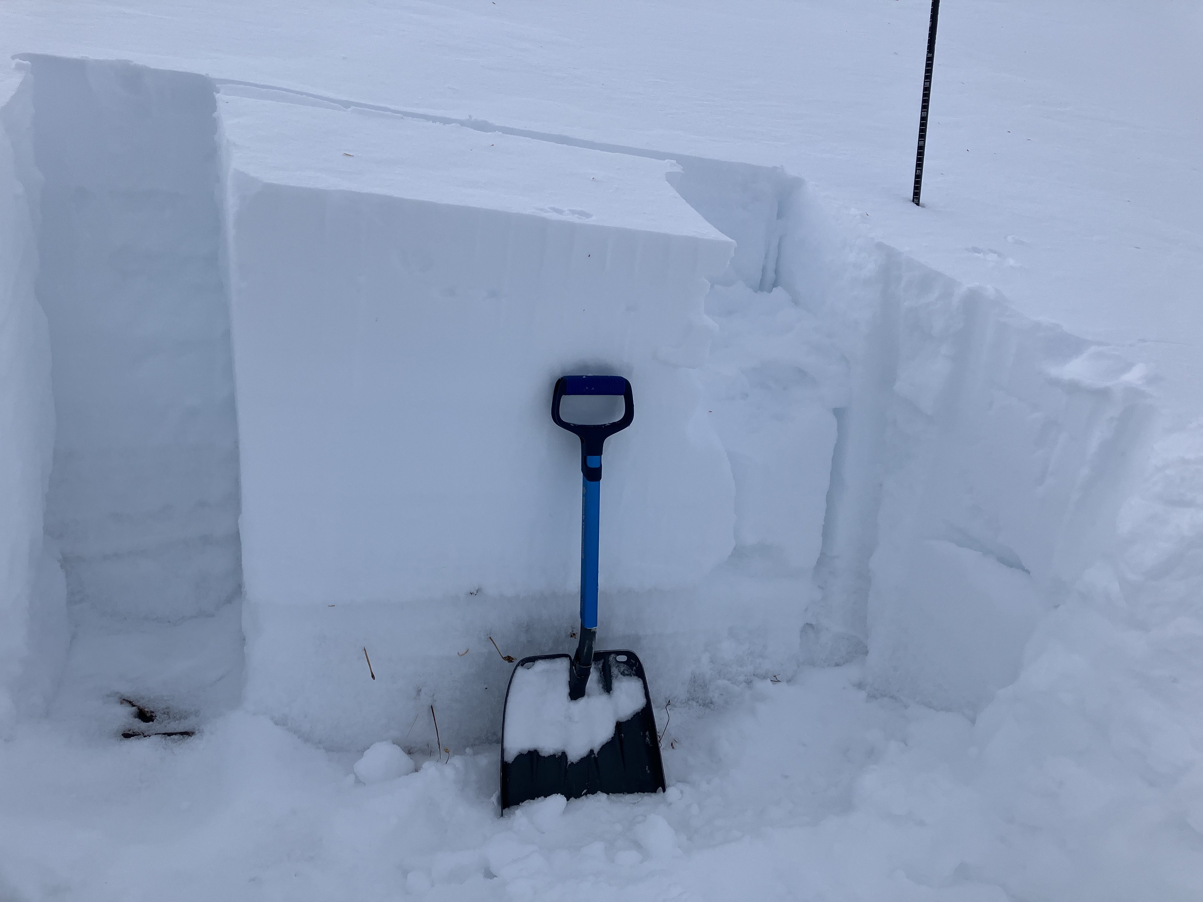


Pit Location: E / ESE Aspect | 8900' | 150 - 160 cm snow depth | Near Treeline | 29 degree slope
Weather at 15:20: OVC | S-1 to S1 | Winds Strong out of the WSW / SW
Test Results:
14cm down from surface; CT1 (2x) at the new snow interface, fairly soft slab without a lot of cohesion in this particular spot NTL
43cm down from surface; CT11 SP and CT17 SP, broke on a layer of small facets (~0.5-1.0mm) below this week's more recent storm snow
Did not have time to do a full ECT, however the interface was very planar and yielded a sudden collapse at the layer in question
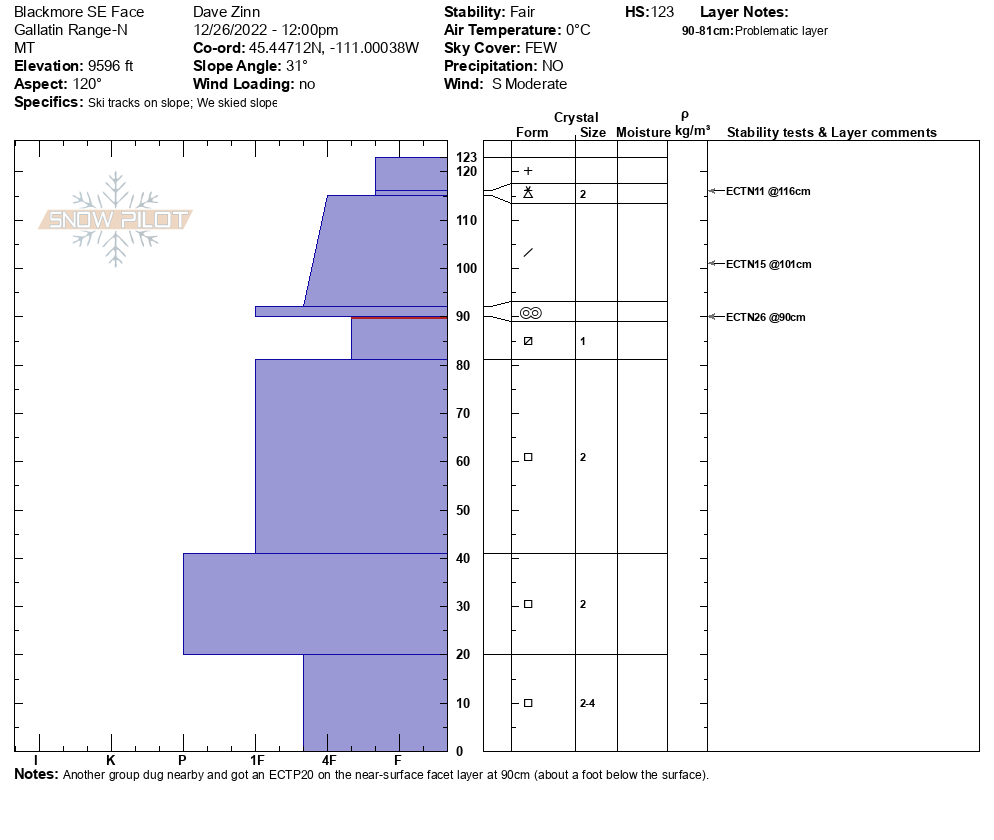
Full Snow Observation ReportWe found the recently buried weak layer of near-surface facets one foot deep. The sugary facets lower in the snowpack were also present but neither propagated in our stability tests. Thankfully, another group dug a pit nearby. They got an ECTP20 on the near-surface facet layer one foot down. This means the layer is confirmed in Hyalite, Buck Ridge, and Lionhead. A similar story is coming out of the Bridger Range. Until proven otherwise, I am operating with the assumption that it is everywhere from north of Bozeman to Island Park. I am worried about this layer when more snow starts adding up.
The wind was blowing ~ 20 mph on the ridge and depositions of wind-drifted snow near ridgelines, in cross-loaded gullies and near wind-breaks like trees, cliffs, and outcroppings were the most likely place to trigger a slide today.
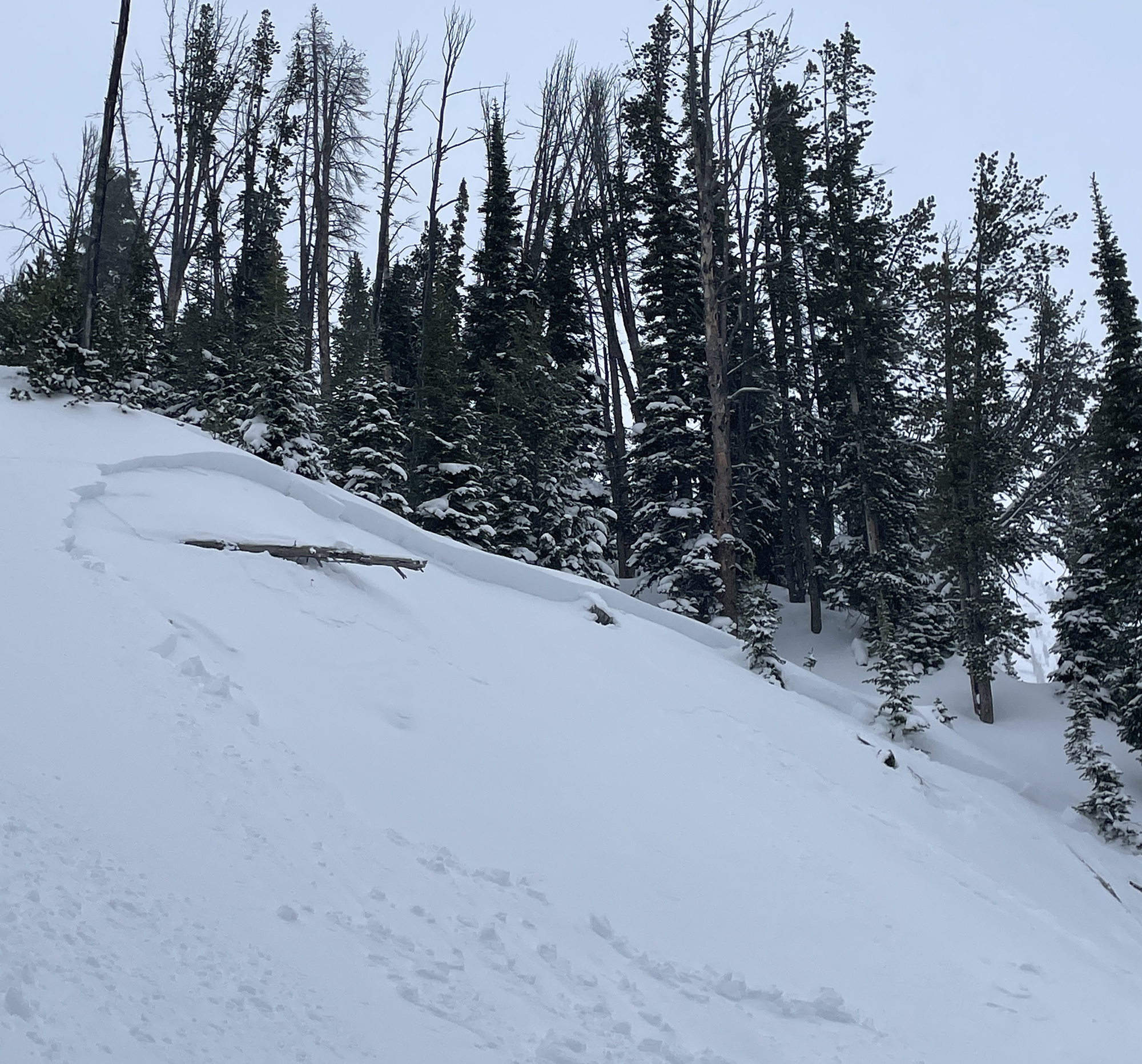
Temperatures were above freezing when we got back to the car. Some small, wet-loose snow avalanches slide from road cuts and piled up a few feet deep next to the Hyalite Canyon Road.
Full Snow Observation Report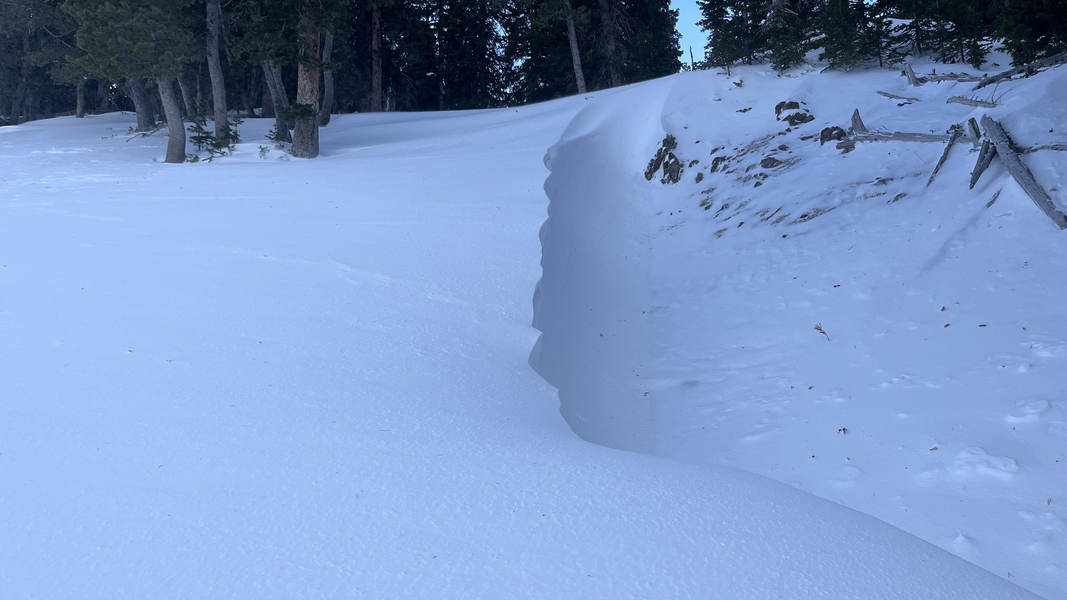


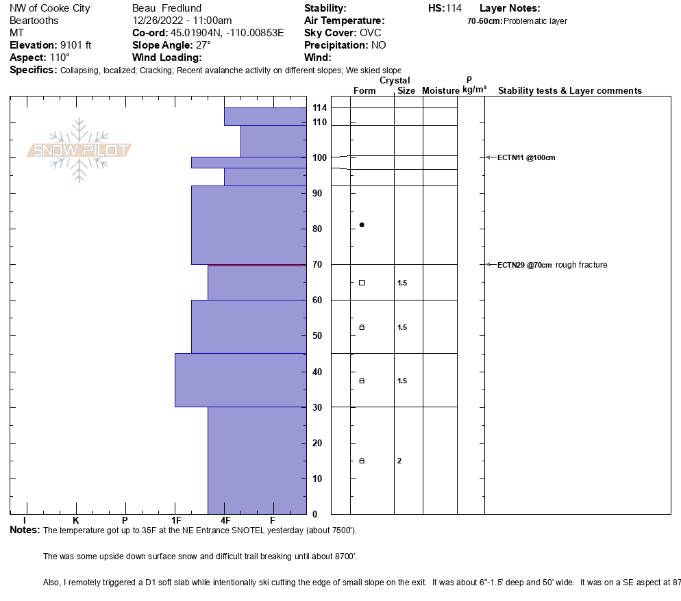
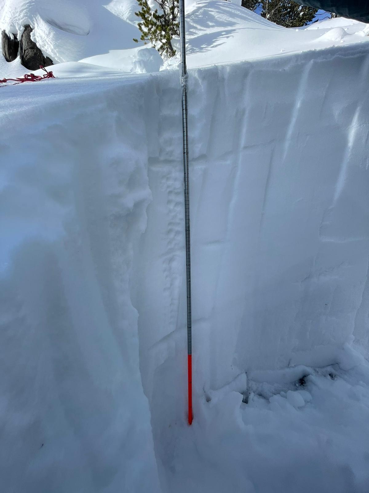
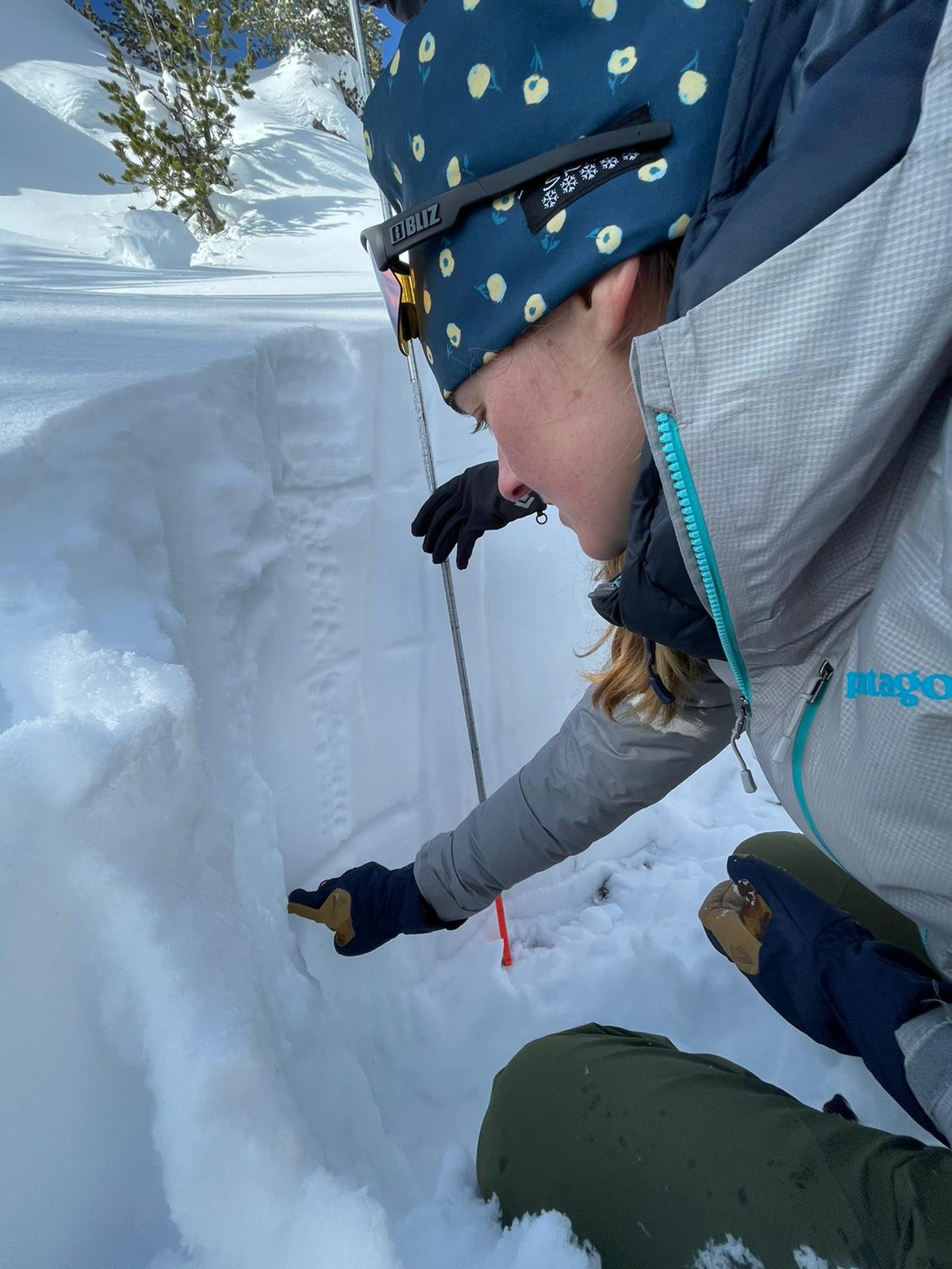
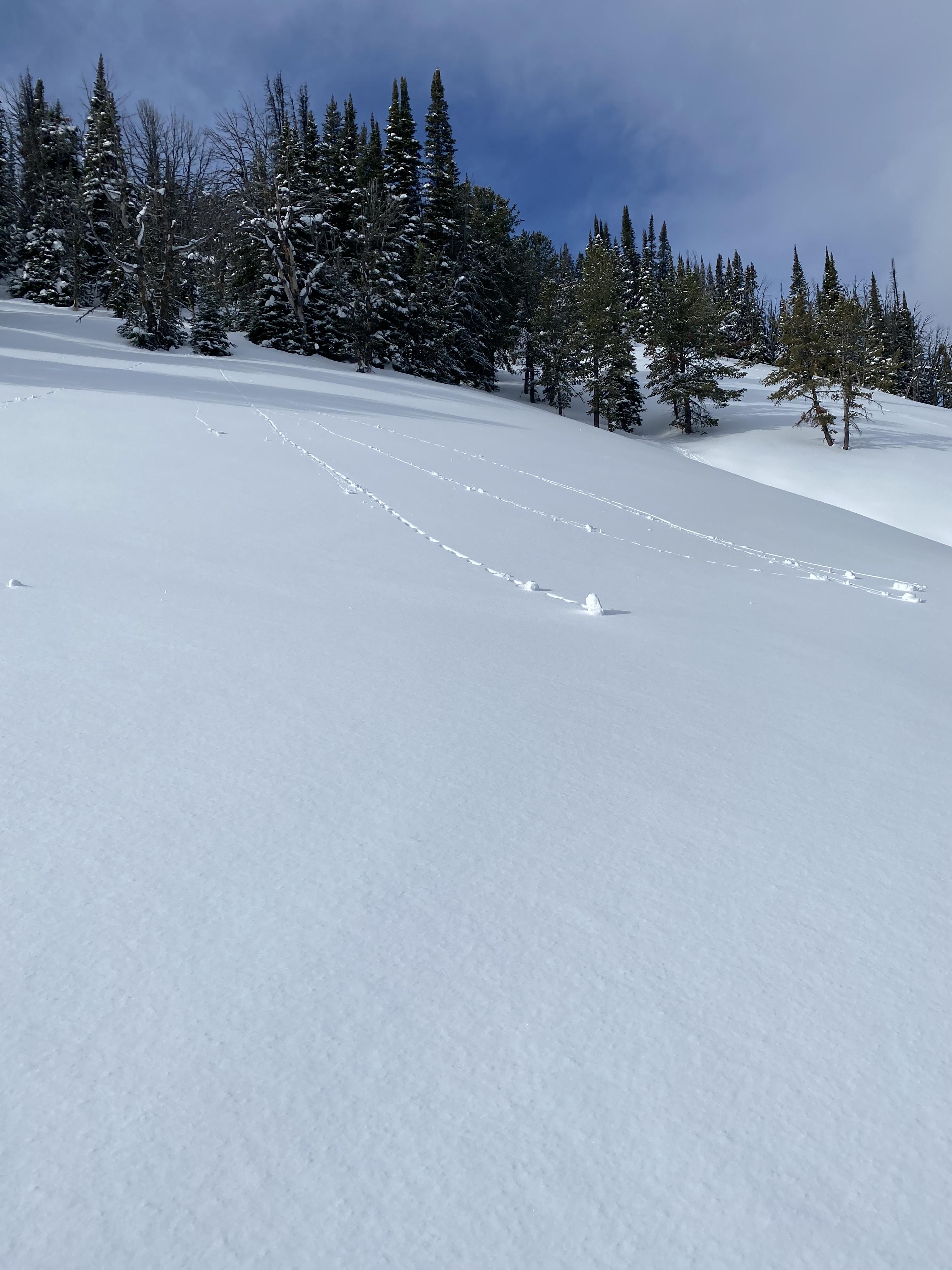
From email: "Skied NW of Cooke City today.
Yesterday the temps got up to 35 deg F at the NE Entrance SNOTEL. (It was raining hard and in the low 40's F yesterday between Laurel and Big Timber on I90.)
It didn't appear that it rained here, but there was upside-down trail breaking in the lower elevations today and hazardous conditions around 8700' as the slab got thicker. The cold temps of last week definitely weakened/ faceted the snow in the thinner snowpack areas. Photos attached of some cracking and a D1 soft slab that I remotely triggered with an intentional ski cut. The slab was about 6"-1.5' deep and about 50' wide. It was a SE aspect around 8700.
Above 9k', the snow structure was looking a lot better, and I was getting ECTNs (snowpit attached), and no more collapsing nor cracking. The trees are CAKED with snow above 9k' in wind-sheltered areas."
Full Snow Observation Report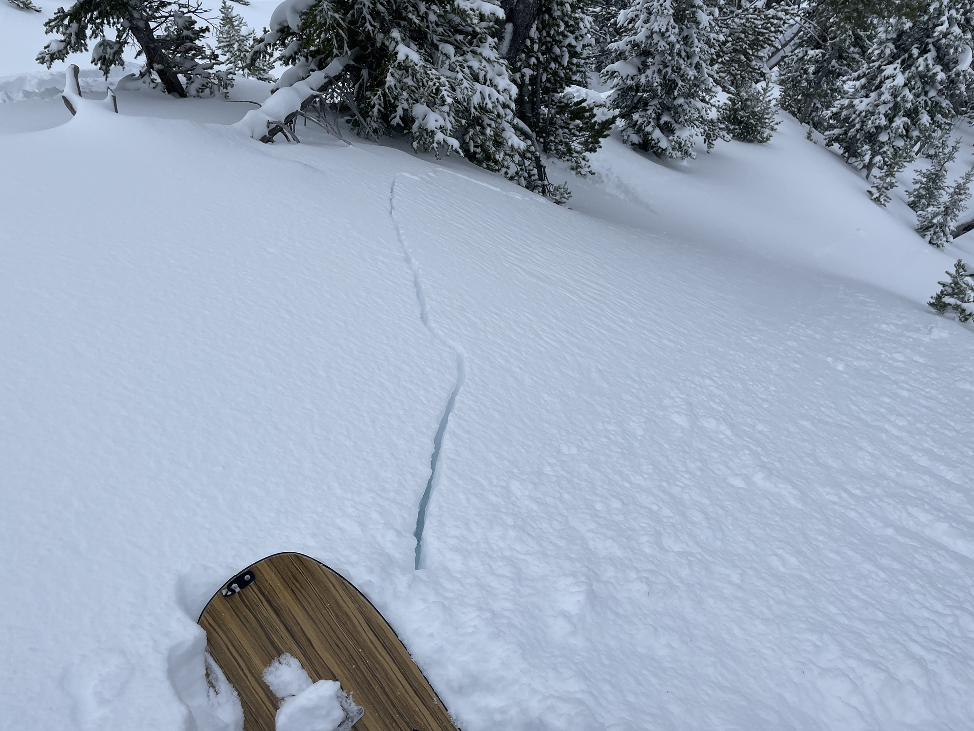
location:
Northern Madison Range
9,400 ft (below ridge top leeward and trees)
130° SE aspect
110cm Depth of Snow
24° slope
CT 12
ECTN 11 @ 20cm down
Widespread collapsing.
Terrain choices: very simple
Toured up to Texas Meadows yesterday, it was spring-like conditions the whole way. We dug a pit at approximately 7600ft on an east aspect, HS was 114cm, and we got an ECTx. There was 10 to 20cm of weak rounds on the ground, and a layer of weaker snow at about 67cm. Our shovel shear broke on the 67cm layer, but it wasn't planar.
Full Snow Observation ReportWe went for a short tour this morning in Beehive Basin up to Prayer Flags. We found about 2 inches of dense snow that did not appear to have been transported by the wind. Beehive peak was painted white by the dense snow that stuck to it. We found good skiing conditions on our first run into Middle Basin. On our way back up, the sun came out and the snow surface started to rapidly warm on any aspect the sun touched. Snow bombs fell from trees, skins glopped, and we noticed pinwheels and small point releases around rocks. At that point the skiing began to deteriorate and we decided to call it a day early around 11 AM. On our final run back to the car we saw a sluff in the going home gully on a west aspect around 9,000’ that ran into another party’s old tracks (photo included).
Full Snow Observation Report
36” total. 24” sugar on bottom.
From Email: It was actually great riding up there. Just no base once you broke through. Definitely solid on top and held weight of the sled.
Full Snow Observation Report