Good morning. This is Doug Chabot with the Gallatin National Forest Avalanche Forecast on Tuesday, February 20th at 6:45 a.m. Today’s forecast is sponsored by Avalanche Alliance and Idaho State Snowmobile Association - Avalanche Fund. This forecast does not apply to operating ski areas.
At 5 a.m. the mountains around Cooke City and West Yellowstone got 1” of new snow with 2” falling at Island Park. Wind is steady at 15-20 mph with gusts of 35 mph except in Island Park where 60 mph was recorded. Temperatures are in the high teens today and will rise into the upper 20s F under partly cloudy skies in the north and mostly cloudy in the south. A trace to 1” of snow will fall in the southern mountains today.

All Regions
The mountains have been talking to us through avalanches, whumpfs and shooting cracks. The translation is easy; she’s telling us the snowpack is dangerous. Dave was in Cooke City the last 2 days and his findings can be extrapolated throughout the forecast area. Avalanches are still breaking deep, people are triggering them from far away, and stability tests are only valuable when they show it’s bad. Tests are not to be used to show us it’s good-to-go. As he safely ascended next to a gully in Republic Creek he got an unremarkable test result. As he approached the top he and his partner got a gut-wrenching collapse and crack that shot out hundreds of feet across the slope. A couple degrees steeper and it might have avalanched.
Dave’s message: Let’s put stability tests on the back burner when Mother Nature is shouting in our ear that it’s dangerous.
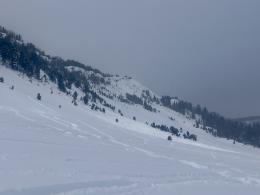
The snowpack is weak: the lower third is loose, faceted, sugary snow that struggles to support the snow above it. Skiers and sledders are collapsing this layer and triggering slides from far away. Riders on Buck Ridge triggered 2 large slides from hundreds of feet away on Saturday (observation), and Alex and I had similar instability on Sunday in the same area (observation, video). Yesterday skiers and riders had collapses in Tepee Basin, Bacon Rind, and around Cooke City. These and 28 other reports since Friday, can be viewed here.
The instability is widespread and triggering avalanches is likely throughout our forecast area. Conditions are dangerous and we recommend avoiding avalanche terrain and being wary about traveling underneath steep slopes since avalanches can release far above. The danger is rated CONSIDERABLE near Bozeman to Big Sky, West Yellowstone, Island Park and Cooke City.
If you venture out, please fill an observation form. It does not need to be technical. Did you see any avalanches? How much snow is on the ground? Was the wind moving snow? Simple observations are incredibly valuable. You can also contact us via email (mtavalanche@gmail.com), phone (406-587-6984), or Instagram (#gnfacobs).
Upcoming Avalanche Education and Events
Our education calendar is full of awareness lectures and field courses. Check it out: Events and Education Calendar.
Every weekend in Cooke City: Friday at The Antlers at 7 p.m., Free Avalanche Awareness and Current Conditions talk, and Saturday from 10 a.m.-2 p.m. at Round Lake Warming Hut, Free Rescue Practice.
Loss in the Outdoors is a support group for those affected by loss and grief related to outdoor pursuits. Check out the link for more information.
A recent article, As radio use spreads in backcountry, so do community channels, describes the benefits of communicating amongst groups in heavily trafficked areas.