Good morning. This is Dave Zinn with the Gallatin National Forest Avalanche Forecast on Monday, February 26th at 7:00 a.m. Today’s forecast is sponsored by Klim and Cooke City Super 8/Bearclaw Bob’s. This forecast does not apply to operating ski areas.
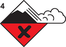
AVALANCHE WARNING
The Gallatin National Forest Avalanche Center is issuing a Backcountry Avalanche Warning for the mountains around Cooke City, where 10” of snow fell in the last 24 hours, and an additional 7-10” is forecast for today. Strong southwest winds are blowing snow and exacerbating instability. The snowpack is unstable, and triggering avalanches is very likely. Avoid avalanche terrain and avalanche runout zones. The avalanche danger is HIGH on all slopes. Contact the Gallatin National Forest Avalanche Center for more detailed information.
This warning will expire or be updated by 6:00 a.m. on Tuesday, February 27th.
Strong winds are blowing from the west to southwest at 20-45 mph, with stronger gusts. The mountains around Cooke City received 10” of new snow in the last 24 hours, with 1” near West Yellowstone and Island Park. Mountain temperatures are in the teens to 20s F. Today, high temperatures will be in the 20s to mid-30s F, with winds blowing 20-40 mph from the southwest and shifting to the northwest. Snow will spread across the advisory area this morning, with 7-10” in Cooke City, south of Bozeman and in Island Park, and 5-8” in the Bridger Range, near Big Sky and West Yellowstone by tomorrow morning.
Avalanche Warning
Very dangerous avalanche conditions exist in the mountains around Cooke City, where 12” of snow, equal to 1.2” of snow water equivalent, fell in the last two days. Strong winds from the southwest are drifting snow and wind-loading slopes. Human-triggered and natural avalanches are likely. From Henderson Mountain, Alex described the snowpack as one of the weakest he has observed and cautioned that avalanches will break 2-4 feet deep and propagate widely across slopes (video). Avalanches could break more deeply on wind-loaded slopes.
Yesterday, a skier triggered a small avalanche on a wind-loaded slope south of Cooke City that broke one foot deep and slid 300 feet (photos and details). On Friday, a rider was caught and carried in a large avalanche near Lulu Pass and thankfully walked away unharmed (Cooke City photos). Conditions are more unstable today.
Avoid all avalanche terrain (slopes steeper than 30 degrees) and areas immediately below, as backcountry travelers have triggered many avalanches from the bottom of slopes and nearby areas this season.
The danger is HIGH in the mountains near Cooke City.
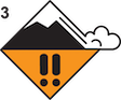
Dangerous avalanche conditions exist in the mountains around Bozeman, Big Sky, West Yellowstone and Island Park. Heavy snowfall will begin this morning, and strong winds will continue throughout the day, drifting snow into thick slabs sensitive to human triggers. Persistent weak layers buried 1-4 feet deep are likely to fail under the weight of a skier or rider, resulting in large avalanches that break widely across slopes. As I mentioned in my video from Buck Ridge yesterday, dangerous conditions don’t mean you can’t go into the backcountry. However, accurately identifying slopes steep enough to slide and their safer counterparts is an essential skill (avalanche education and resources, 20-30 Rule).
Yesterday, a skier intentionally triggered a slide that broke 100 feet wide and ran a short distance down a wind-loaded slope adjacent to Beehive Basin in Big Sky (photo and details). Multiple avalanches in McAtee Basin near Big Sky, on Bridger Peak, south of Saddle Peak and in the Mount Bole Basin are recent evidence of instability that today’s new and wind-drifted snow will exacerbate.
The avalanche danger is CONSIDERABLE and may rise further if snow totals outpace forecasted amounts. Cautious route-finding and conservative terrain selection are essential to returning home safely.
If you venture out, please fill an observation form. It does not need to be technical. Did you see any avalanches? How much snow is on the ground? Was the wind moving snow? Simple observations are incredibly valuable. You can also contact us via email (mtavalanche@gmail.com), phone (406-587-6984), or Instagram (#gnfacobs).
Upcoming Avalanche Education and Events
Our education calendar is full of awareness lectures and field courses. Check it out: Events and Education Calendar.
Friday evening and Saturday, March 1 and 2. Companion Rescue Course. More information and registration HERE.
March 8-10. Bozeman Splitfest. Check the Bozeman Splitfest website for event details and avalanche education opportunities offered by the Friends of the Avalanche Center.
Every weekend in Cooke City: Friday at The Antlers at 7 p.m., Free Avalanche Awareness and Current Conditions talk, and Saturday from 10 a.m.-2 p.m. at Round Lake Warming Hut, Free Rescue Practice.
Loss in the Outdoors is a support group for those affected by loss and grief related to outdoor pursuits. Check out the link for more information.
On Thursday Ian rode in the Independence Mine area (up the Main Boulder, outside our advisory area) to check out the snowpack conditions before the Sweet Grass County Recreation Association Poker Ride. Watch his video for a snowpack update. Avoiding riding on and staying out from under slopes steeper than 30 degrees would be a wise choice if you’re headed up to that area.