Good morning. This is Doug Chabot with the Gallatin National Forest Avalanche Forecast on Wednesday, April 3rd, at 6:30 a.m. Today’s forecast is sponsored by Alpine Yamaha in Livingston and the Yellowstone Club Community Foundation. This forecast does not apply to operating ski areas.
At 5 a.m. under clear skies the mountains around Bozeman and Big Sky were mostly above freezing while the southern ranges had low temperatures in the upper 20s. Wind is blowing from the W-SW at 10-20 mph in the north and 25-40 mph in the south, which will remain today. Mountain temperatures will reach well into the 50s in the north and 40s in the south. Some clouds late this evening will impede freezing overnight.

Yesterday was warm in the mountains and we had wet avalanches. Today will be even warmer. Temperatures are forecasted to hit the upper 50s F in the Bridger Range and upper 40s F around Island Park, West Yellowstone and Cooke City. All ranges will see wet avalanche activity today.
The mountains around Bozeman and Big Sky did not freeze last night. High elevations (10,000 feet or more), north facing slopes and cold drainages are the exception, which Dave talks about in his video from the Bridger Range yesterday. Without a freeze, today’s blazing April sun will wet and melt the surface snow very quickly. Wet avalanches will slide on a crust 1-2 feet under the surface. By late morning sunny slopes will be wet, gloppy, and ripe to slide. Stay out of avalanche terrain and be especially cognizant of those below you because wet avalanches can run far.
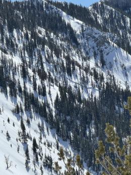
Cornices at the ridgelines will also be melting and sagging and breaking in the heat. These behemoths are great triggers (photo).
Wet avalanches sliding down the hill or cornices breaking may trigger deep and big slides. A thin layer of weak, faceted snow is buried near this upper ice crust and can avalanche. Dave found this in Island Park on Monday (video) and yesterday, Ian and I saw a small slide that broke on this layer in Lionhead (video). Even deeper are facets near the ground. Although buried under multiple feet of snow, wet avalanches or water percolating through the snowpack or cornice falls, are all possible triggers.
Without an overnight freeze, plus clear skies, only light wind and temperatures forecasted to be exceptionally warm, the mountains around Bozeman and Big Sky will see the avalanche danger rise from MODERATE to a wet snow danger of HIGH.
In the mountains around Island Park, West Yellowstone and Cooke City, breezy conditions and freezing temperatures overnight will delay wet avalanche activity. The avalanche danger will start as MODERATE and rise to a wet snow danger of CONSIDERABLE.

If you get out please submit an observation. It does not need to be technical. Did you see any avalanches? How much snow is on the ground? Was the wind moving snow? Simple observations are incredibly valuable. You can also contact us by email (mtavalanche@gmail.com), phone (406-587-6984), or Instagram (#gnfacobs).
Upcoming Avalanche Education and Events
Hyalite Road Closure: Hyalite road is closed to ALL MOTORIZED VEHICLES until the morning of May 16. This is a regular annual road closure to reduce road damage during the spring thaw. Bicycle and foot traffic are allowed. Contact the Bozeman FS Ranger District for more info.
Events and Education Calendar.
Loss in the Outdoors is a support group for those affected by loss and grief related to outdoor pursuits. Check out the link for more information.
The total number of avalanche deaths in the US stands at 13. On March 29, a snowboarder was killed on Mt. St. Helens when a cornice he was standing on broke and triggered the slope below. With warm weather in our forecast area, cornices will be prone to break and trigger big slides.