Good morning. This is Doug Chabot with the Gallatin National Forest Avalanche Forecast on Thursday, April 4th, at 6:30 a.m. Today’s forecast is sponsored by Spark R&D and Highline Partners. This forecast does not apply to operating ski areas.
Under mostly cloudy skies mountain temperatures are a few degrees above freezing and winds are from the SW-SE at 15-35 mph. Today is forecasted to become windier and still warm with cloud cover and intermittent sun. Temperatures will rise to the high 40s and low 50s before cooling tonight and a changing weather pattern back to winter(ish).

All Regions
Today’s wet snow avalanche danger is a result of the interplay between temperatures, cloud cover and wind. Yesterday’s unexpected clouds kept most large, wet avalanches at bay. Ian was in Frazier Basin in the Bridger Range, the warmest region, and found the snow surface wetting and sliding (photo). Even in Cooke City, one of the coolest areas, a few hours of direct sunshine and above freezing temperatures caused a large wet slab avalanche on the Fin on Republic Mountain (photo).
This morning the snow surface is likely frozen, even with above freezing air temperatures. Clouds and wind will keep the wet snow danger in check IF the clouds and wind remain as forecasted. That’s a big IF. Luckily, identifying conditions for wet snow danger is not subtle. A sign of impending wet danger is when the surface gets gloppy, wet and you can sink to your boot tops. Pinwheels of wet snow and loose slides releasing are another. As Ian pointed out in his video, seek shady, cooler aspects if this occurs. On Tuesday, Dave had a similar warning and observation after skiing both the west and east side of the Bridger Range (video).
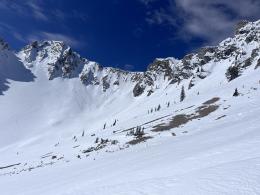
Buried in the snow are 2 weak layers we are concerned about. A thin film of facets can be found under 1-2 feet of snow from last week. This is what the Fin likely avalanched on and was the culprit of a small snowmobiler triggered slide Ian and I investigated in Lionhead on Tuesday (video). Much deeper in the snowpack, near the ground, is a thick layer of sugary facets that will not be easily triggered, but man-o-man, if it did, the slide would be deep and big. A cornice peeling off in the warm weather could be an effective trigger (photo).
The avalanche danger will start as MODERATE and may rise to a wet snow danger of CONSIDERABLE if the sun comes out and the wind decreases.
If you get out please submit an observation. It does not need to be technical. Did you see any avalanches? How much snow is on the ground? Was the wind moving snow? Simple observations are incredibly valuable. You can also contact us by email (mtavalanche@gmail.com), phone (406-587-6984), or Instagram (#gnfacobs).
Upcoming Avalanche Education and Events
Hyalite Road Closure: Hyalite road is closed to ALL MOTORIZED VEHICLES until the morning of May 16. This is a regular annual road closure to reduce road damage during the spring thaw. Bicycle and foot traffic are allowed. Contact the Bozeman FS Ranger District for more info.
Events and Education Calendar.
Loss in the Outdoors is a support group for those affected by loss and grief related to outdoor pursuits. Check out the link for more information.
The total number of avalanche deaths in the US stands at 13. On March 29, a snowboarder was killed on Mt. St. Helens when a cornice he was standing on broke and triggered the slope below. With warm weather in our forecast area, cornices will be prone to break and trigger big slides.