Good morning. This is Ian Hoyer with the Gallatin National Forest Avalanche Forecast on Friday, April 5th, at 7:00 a.m. Today’s forecast is sponsored by Bridger Bowl, Cooke City Motorsports and Advanced Innovation. This forecast does not apply to operating ski areas.
Mountain temperatures this morning are generally above freezing, in the 30s and 40s F. Winds are 15-20 mph with 30-60 mph gusts out of the SW-SE. Breezy southerly winds will continue today. High temperatures will be in the 40s and 50s F, very similar to yesterday’s. The sun may make a brief appearance in places this morning, but it will mostly be cloudy with a good chance for a sprinkle of rain or a dusting of snow today, before more moisture moves in tonight. By tomorrow morning, expect 2-4” of new snow around Island Park and West Yellowstone with a trace-2” elsewhere.

All Regions
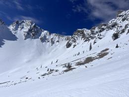
The primary avalanche concern today is wet snow. There may be a light surface crust this morning, but warm temperatures and clouds overnight have kept the snowpack from solidly refreezing. Despite very warm air temps, clouds and cooling winds today will likely keep the wet snow danger mostly in check. However, be on high alert if the sun comes out, even for just a few minutes, especially if winds are light. Thankfully, it’s pretty simple to know when the wet snow danger is rising. If the surface snow gets gloppy, wet and you’re sinking up to your boot tops in wet snow it’s about time to move to shady, cooler aspects or head home. Pinwheels of wet snow and loose slides releasing show the danger has already risen and you should hustle off of steep sunny slopes ASAP.
Slab avalanches breaking on buried weak layers are less likely, but still need mentioning. In many places a thin layer of facets can be found under 1-2 feet of snow from last week. On Monday, snowmobilers in Lionhead triggered a small slide on this layer (video) and it is likely responsible for a natural avalanche on the Fin near Cooke City that broke as the surface snow got wet on Wednesday as well (photo). The weak snow at the ground is even less likely to avalanche, but if it did, the resulting slides would be very large. Wet loose slides or cornice fall could also help trigger these bigger slides, another great reason to avoid steep slopes that are getting wet.
The avalanche danger is MODERATE today.
If you get out please submit an observation. It does not need to be technical. Did you see any avalanches? How much snow is on the ground? Was the wind moving snow? Simple observations are incredibly valuable. You can also contact us by email (mtavalanche@gmail.com), phone (406-587-6984), or Instagram (#gnfacobs).
Upcoming Avalanche Education and Events
Hyalite Road Closure: Hyalite road is closed to ALL MOTORIZED VEHICLES until the morning of May 16. This is a regular annual road closure to reduce road damage during the spring thaw. Bicycle and foot traffic are allowed. Contact the Bozeman FS Ranger District for more info.
Events and Education Calendar.
Loss in the Outdoors is a support group for those affected by loss and grief related to outdoor pursuits. Check out the link for more information.
The total number of avalanche deaths in the US stands at 13. On March 29, a snowboarder was killed on Mt. St. Helens when a cornice he was standing on broke and triggered the slope below. With warm weather in our forecast area, cornices will be prone to break and trigger big slides.