Photos
|
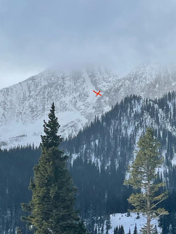
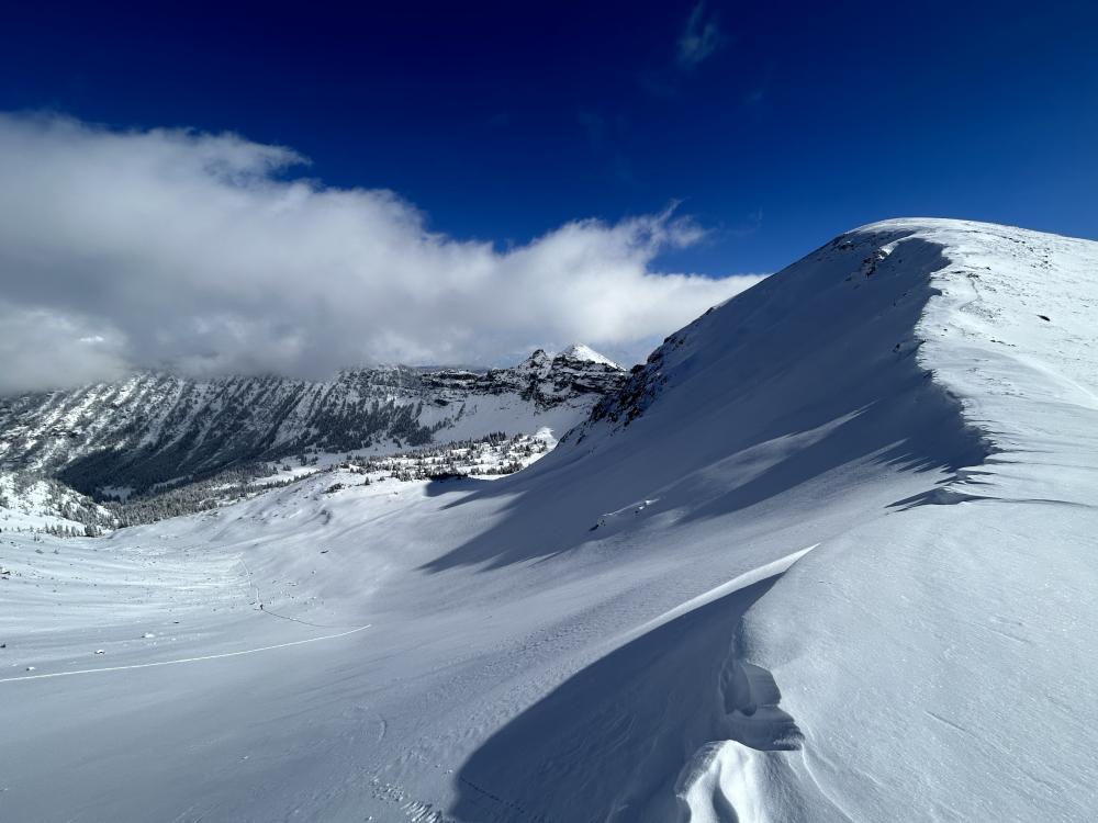
Northern Gallatin, 2023-11-14 Skiers reported triggering an avalanche on the east face of Mt. Blackmore on Sunday. Photo: Anonymous Link to Avalanche Details |
|
Cooke City, 2023-11-13 Bear tracks in the wind-eroded snow. Photo: B Fredlund |
|
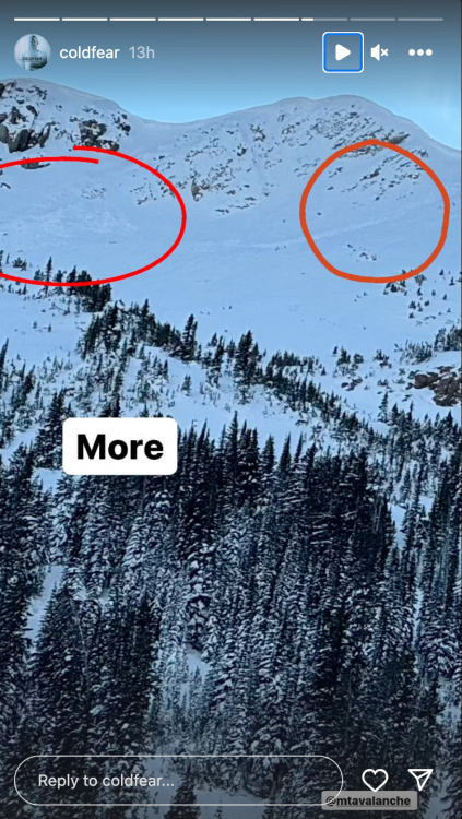
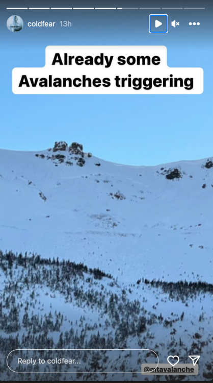
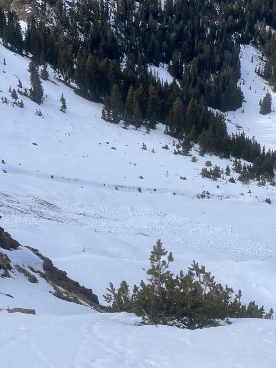
Cooke City, 2023-11-10 Avalanches on Henderson Mountain near Cooke City were reported via instagram on 11/9/2023. Estimating they occurred a day earlier. From message: "on Henderson in Cooke just above the lulu trail. It was surprising to see so much activity" Photo: A. Mulkey Link to Avalanche Details |
|
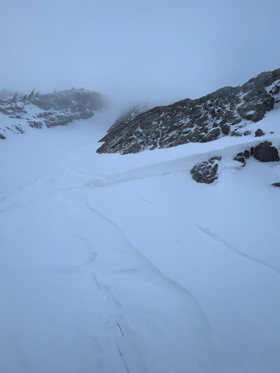
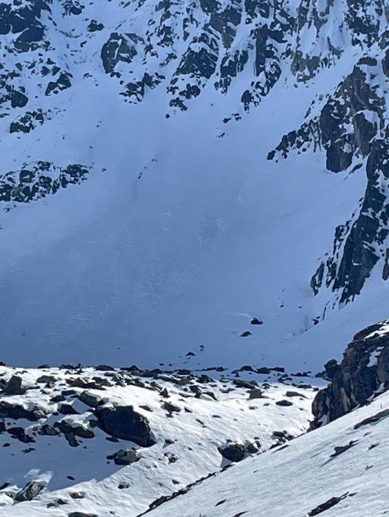
Bridger Range, 2023-11-08 Skier triggered windslab in the Great One off of Naya Nuki peak, skier was carried 15-20ft before arresting. Slide was triggered roughly halfway down the couloir where the right wall dips away exposing the snow to wind. Hard consolidated snow over facets, roughly 1-1.5 ft thick, ran about 50-100 ft before pouring over the cliff faces below. North- northeast aspect. Photo: J. Alford 11/8/2023 Link to Avalanche Details |
|
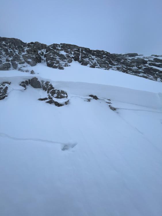
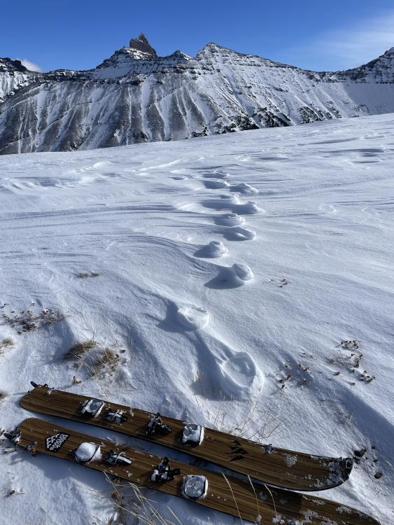
Bridger Range, 2023-11-07 A hiker at Bridger Bowl noticed a small, loose snow avalanche near the Apron. Noting that it was a, "Good reminder as to how little snow is required to have an avalanche!" Photo: A Crawford Link to Avalanche Details |
|
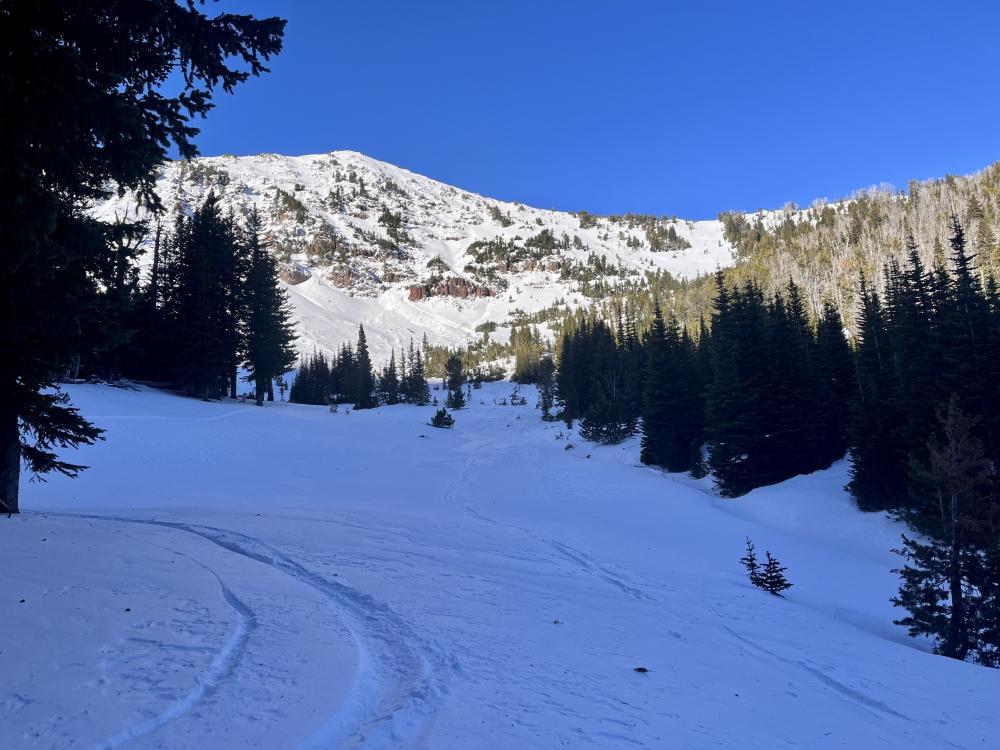
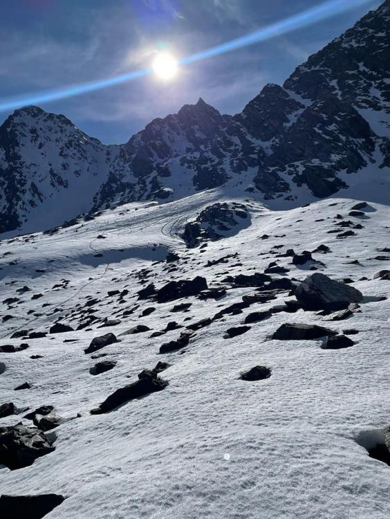
Northern Gallatin, 2023-11-03 From obs (10/29): "Went for a skin up to Hyalite Peak yesterday to check out snow conditions. We found about 8-12 inches of new snow sitting on a base at Hyalite Lake. We saw no signs of instability in the area. Small cornices were observed on the Hyalite saddle, and a hit or miss 1 inch wind slab directly below the ridge." Photo: T. Saulnier |
|
Out of Advisory Area, 2023-10-24 From IG: “Pine creek today, some small wind slabs and a full depth wet slide off black mountain” Link to Avalanche Details |
|
Out of Advisory Area, 2023-10-24 From IG: “Pine creek today (10/21), some small wind slabs and a full depth wet slide off black mountain” Link to Avalanche Details |
|
Northern Gallatin, 2023-10-24 From obs. "Was out alpine climbing today and observed the north face of Blackmore had slid already." Link to Avalanche Details |
|
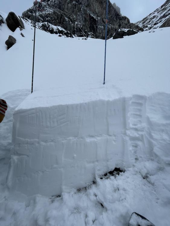
Out of Advisory Area, 2023-10-14 From obs (10/14/23): "Three clear storm layers and wind effect piling up larger drifts. Snow height at 9k ft averaged 85-90cm..." Photo: O. Robinson |
|
Bridger Range, 2023-10-03 Get your tickets and online bid for items HERE! |