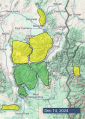
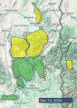
Advisory Archive
Since yesterday morning the Bridger Range received 8” of heavy new snow with 5-7” of lighter snow in Hyalite, Big Sky and Cooke City, and 2-3” elsewhere. Storm totals since Saturday night are:
10” snow/1.0-1.2” SWE - Bridger Range and Island Park
6-8” snow/0.4-0.8” SWE - Hyalite, Big Sky, S. Madison, West Yellowstone.
Yesterday wind was out of the west at 10-20 mph with gusts of 30-45 mph, and has decreased to 10-15 mph with gusts to 20-30 mph today. Temperatures are single digits to teens F this morning, and today will reach low 20s F. Snow is expected today, starting this morning near Island Park, West Yellowstone and Cooke City and this afternoon elsewhere. By tomorrow morning near Cooke City, Island Park and West Yellowstone could get 5-9” of snow with 3-6” elsewhere.


This morning, near Island Park and West Yellowstone have 4-6” of new snow, with 0” in Hyalite and 2-3” everywhere else. Wind has been out of the southwest and west at 10-20 mph with gusts of 30-45 mph. Temperatures are teens to 20s F.
Today temperatures will be in the teens and 20s F and drop to low teens F this afternoon. Wind will be out of the west and northwest at 10-20 mph with gusts to 35 mph. A period of heavy snow is expected this morning, favoring mountains near Bozeman and Big Sky with 5-8”, and 2-3” expected near Cooke City, West Yellowstone and Island Park. Snowfall will taper with light snowfall tonight in some places, and more snow possible tomorrow.

This morning, there is one inch of new snow around Cooke City and none elsewhere. Winds are 20-30 mph out of the southwest, with gusts of 40-50 mph (a bit lighter around Cooke City). Temperatures are in the teens and 20s F.
Snow will start falling this morning around Island Park and West Yellowstone, spreading across the advisory area tonight. By tomorrow morning, expect:
Island Park: 10-14” new snow
Lionhead: 6-10” new snow
Everywhere else: 3-5” new snow
Winds will remain strong and southwesterly, with temperatures rising into the 20s and low 30s F today.


There is at most a dusting of new snow. Temperatures are in the teens and 20s. Winds have mostly been 10-20 mph out of the south and west, with gusts of 25-35 mph. Except in Hyalite, where there were gusts up to 50 mph overnight.
Today, high temperatures will be in the 20s F. Skies will be sunny around Bozeman and Big Sky. Clouds will increase in southern areas, with light snow starting in Island Park.
Tonight, 1-3” of snow will fall in Island Park with little or none elsewhere.
Snow will spread further north tomorrow and tomorrow night, still favoring the Island Park area.
Overnight a trace of snow fell in some areas while others remained dry.
This morning, temperatures are mostly in the mid to upper teens F. Winds have generally been blowing from the W, a little from the NW and a little from the SW in places. Ridgetop wind speeds are averaging about 15 mph gusting 20-30 mph. They blew pretty strong on Tuesday moving lots of snow but haven’t increased since then.
Today will be mostly cloudy with high temperatures rising into the 20s F. Wind speeds will be similar today as they are this morning but will slowly shift direction and blow more from the SW.
A quick-moving storm is still on track to bring more snow on Sunday favoring areas near West Yellowstone and Island Park

Yesterday, strong winds blew from the W and NW. No snow fell but winds easily moved the snow that fell on Monday.
This morning, winds increased in most areas blowing 15-20 mph and gusting 25-40 from the W and SW. Winds in the Bridger Range remain similar at the ridge, but low elevation winds decreased significantly from yesterday. Temperatures in the Bridger Range are mostly in the 20s F, near Hyalite and Big Sky they are in the mid-teens F, and near Cooke City and West Yellowstone they are in the single digits F.
Today, clouds will increase throughout the day, and winds will slowly decrease. Temperatures may only rise by about five degrees from where they are this morning. A few snowflakes may dance in the air with no accumulations.
The rest of the week will have somewhat similar weather until a storm rolls over the area Sunday and Monday. Snowfall from this storm should favor mountains near West Yellowstone and Island Park.

This morning, mountain temperatures are in the single digits to teens F. Winds are blowing 15-25 mph from the west to northwest in the mountains around Bozeman and Big Sky, and 5 to 15 mph elsewhere.
24 Hour Snow Totals:
- Bridger and N. Gallatin Ranges: 2-3” (0.1” snow water equivalent - SWE)
- Big Sky, West Yellowstone, Island Park and Cooke City: Trace to 1” (0-0.1” SWE)
Today, high temperatures will be in the teens to 20s F with 5-15 mph winds from the west to southwest. Stronger winds will continue near Bozeman. The mountains will get a trace of snow by tomorrow morning.


This morning, mountain temperatures are in the single digits to teens F with 5-15 mph winds from the north to the west.
24-Hour Snow Totals:
- North Gallatin Range: 10” with 0.8 of snow water equivalent (SWE)
- Bridger and N. Madison Ranges: 3-4” (0.2-0.3” SWE)
- West Yellowstone, Island Park, and Cooke City: 0-1” (up to 0.1” SWE)
Today, temperatures will reach the teens to low 20s F with 10-15 mph winds from the northwest to the southwest. The mountains around Bozeman and Big Sky will receive an additional 1-4” of snow, with Hyalite Canyon remaining in the spotlight. The mountains around Cooke City, West Yellowstone and Island Park will get up to an inch.
0800 UPDATE: It is snowing hard in the Bridger Range. Since publishing the forecast 1 hour ago, 2-3" of light snow fell. Stay heads up for evolving conditions if intense snowfall continues.


Cold air is moving into our region this morning. At 6am, temperatures are teens to 20s F, and there is 1-2” of new snow near Cooke City, Big Sky, West Yellowstone and Island Park with no snow in the Bridger Range and Hyalite. Winds are strong at 10-30 mph with gusts of 40-75 mph out of the southwest-northwest. Today, temperatures will drop to the 20s and teens F with moderate to strong wind out of the west-northwest. More snow will fall this afternoon through tomorrow. By tomorrow morning the mountains near Bozeman could receive 6-12” of low density snow with 3-6” elsewhere.


This morning temperatures are high 20s to low 30s F. Today temperatures will reach 30s to low 40s F under partly sunny skies. Wind will continue out of the west at 10-25 mph. A cold front will arrive late tonight with temperatures dropping to teens and 20s F and westerly wind at 20-35 mph. Snowfall overnight could produce 1-3” by tomorrow morning with an additional 3-5” possible tomorrow night.